

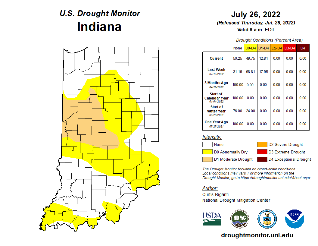
Rainfall over the past few weeks has helped to improve drought conditions across much of Indiana.
Rainfall over the past few weeks has helped to improve drought conditions across much of Indiana.
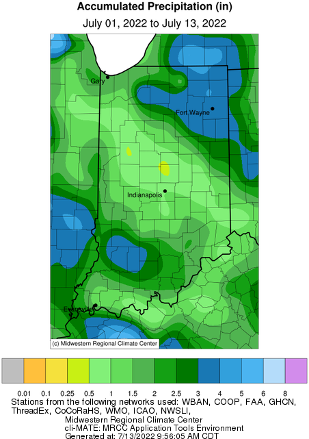
The June 2022 state average precipitation was 2.42 inches below the 1991-2020 normal, which ended up being the 14th driest on record.

The Farming for a Better Climate series explored a variety of climate-smart agricultural practices that aim to maintain, or even increase, farm profitability while also slowing climate change.
At one point in your life, you have probably been told to “turn off the lights” or “close the door.” Ultimately, the person footing the bills was trying to save money.
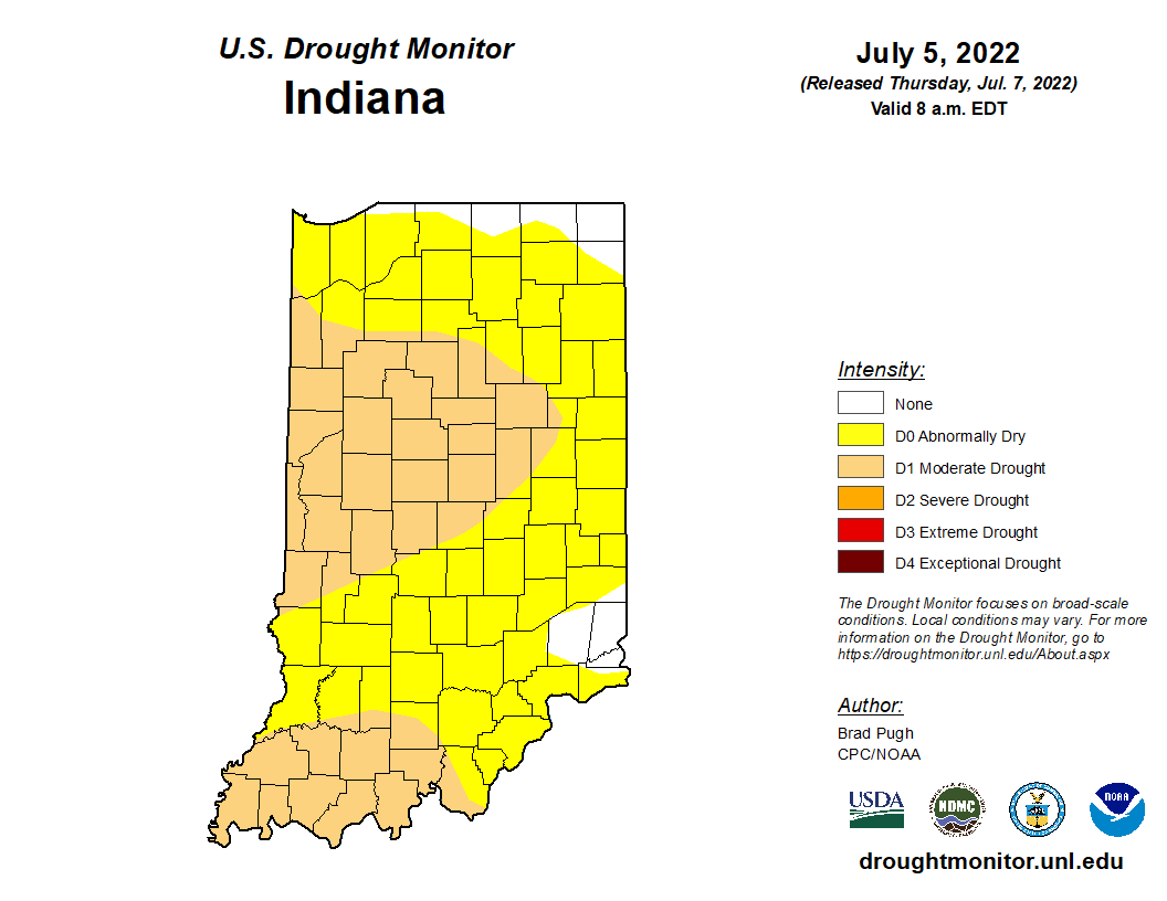
The latest release of the U.S. Drought Monitor has expanded and intensified drought status across Indiana (Figure 1).
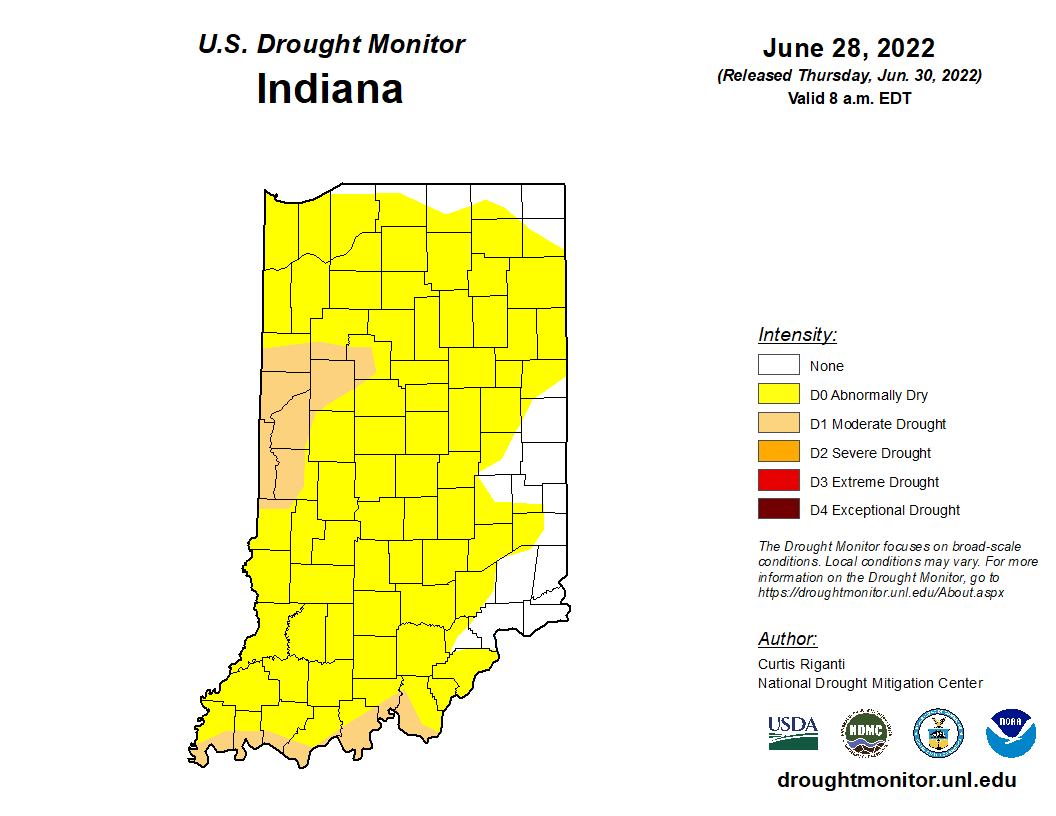
The most recent U.S. Drought Monitor now has over 87 percent of Indiana in some level of dryness and/or drought (Figure 1).
In pastoral agricultural days, and on some farms around the state today, cattle, pigs, turkeys, and chickens roamed the countryside, held in relative place using fencing or a centralized food source.
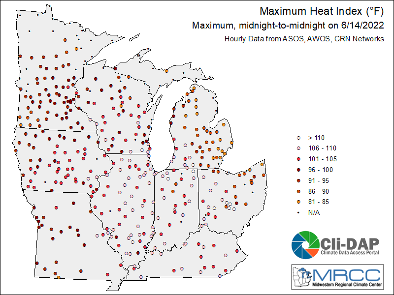
There is no shortage of weather to discuss this week! Heavy damage to buildings, trees, and powerlines was reported in northern Indiana as a result of the Derecho that occurred on June 13.
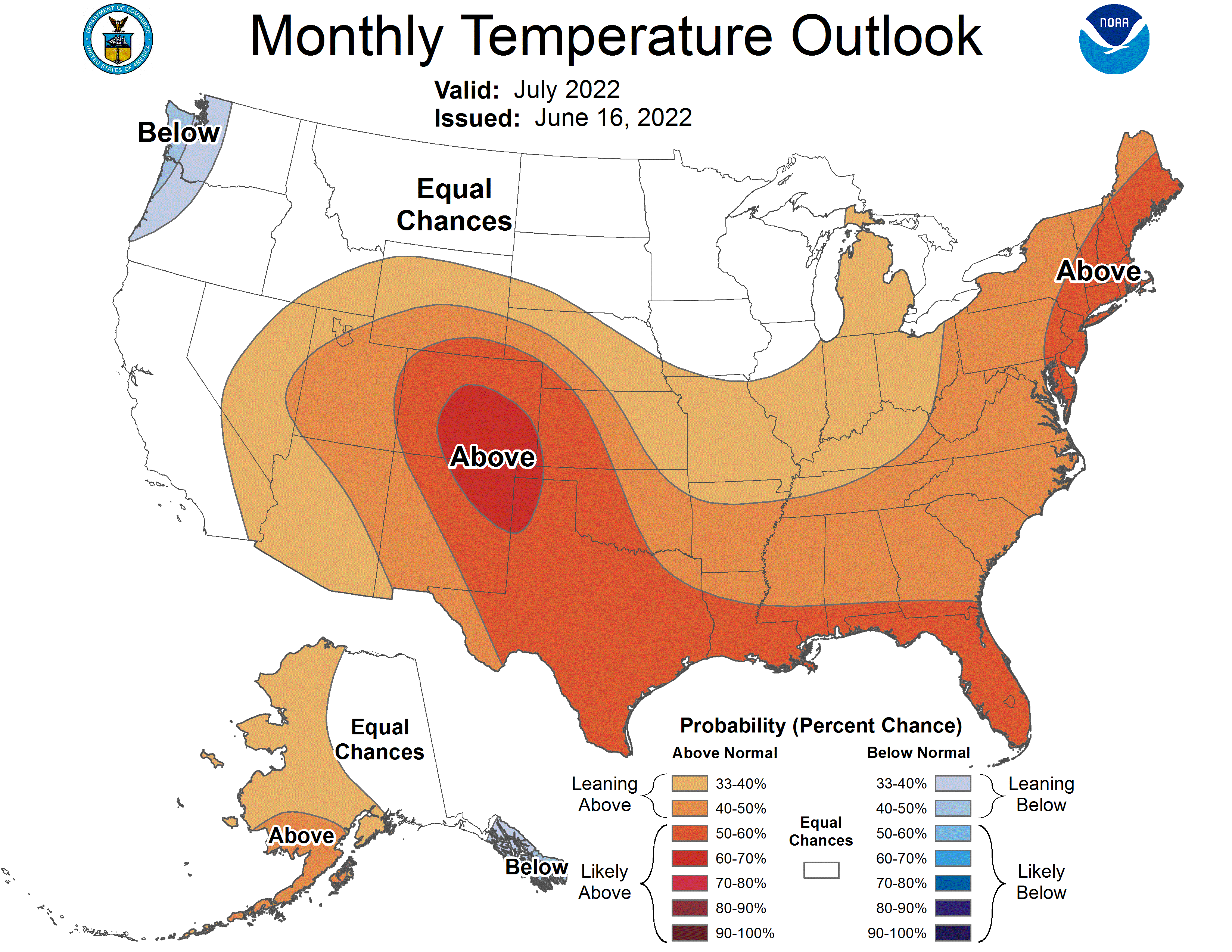
The climate outlooks are showing strong confidence that these hot temperatures will continue for a while.
In pastoral agricultural days, and on some farms around the state today, cattle, pigs, turkeys, and chickens roamed the countryside, held in relative place using fencing or a centralized food source.
© 2026 Purdue University | An equal access/equal opportunity university | Copyright Complaints | Maintained by Pest&Crop newsletter
If you have trouble accessing this page because of a disability, please contact Pest&Crop newsletter at luck@purdue.edu.
