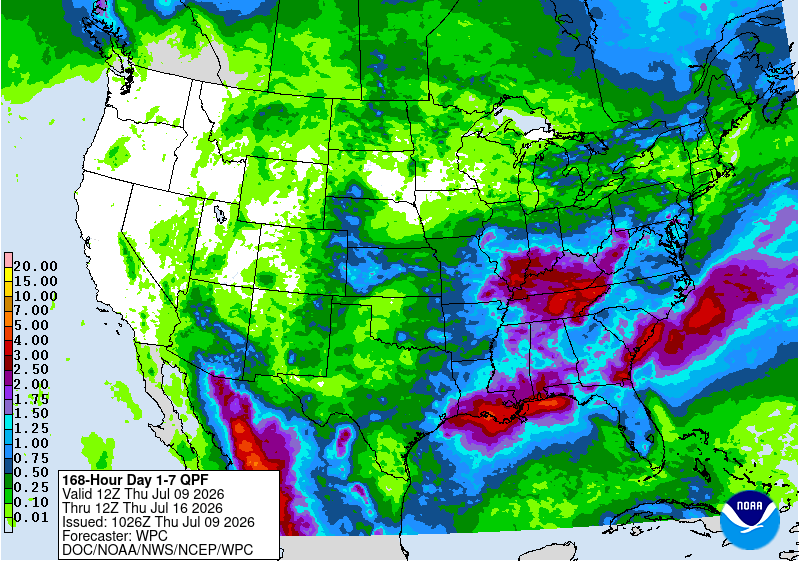
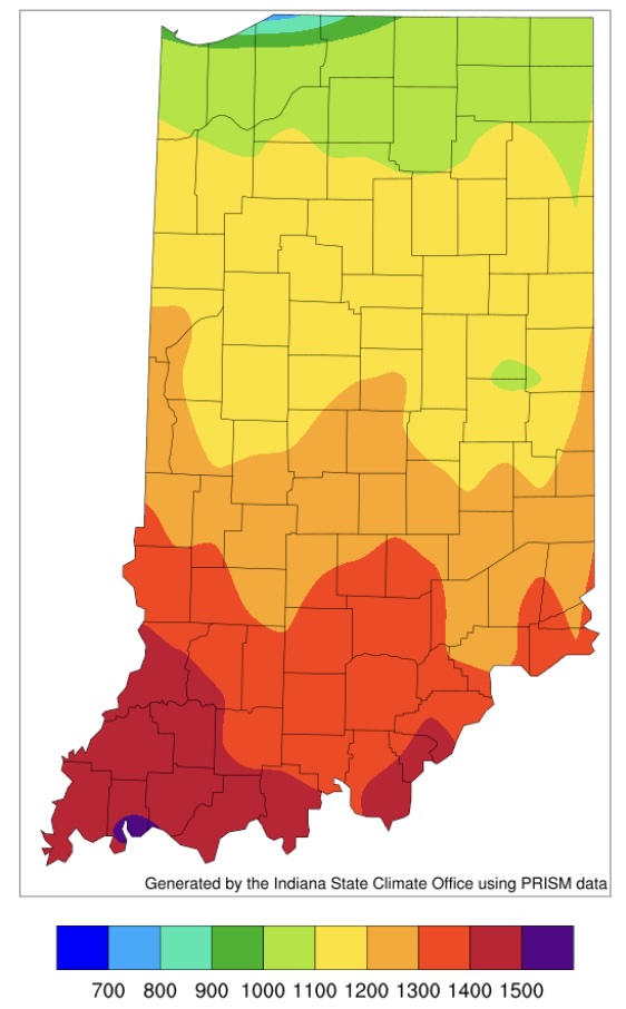
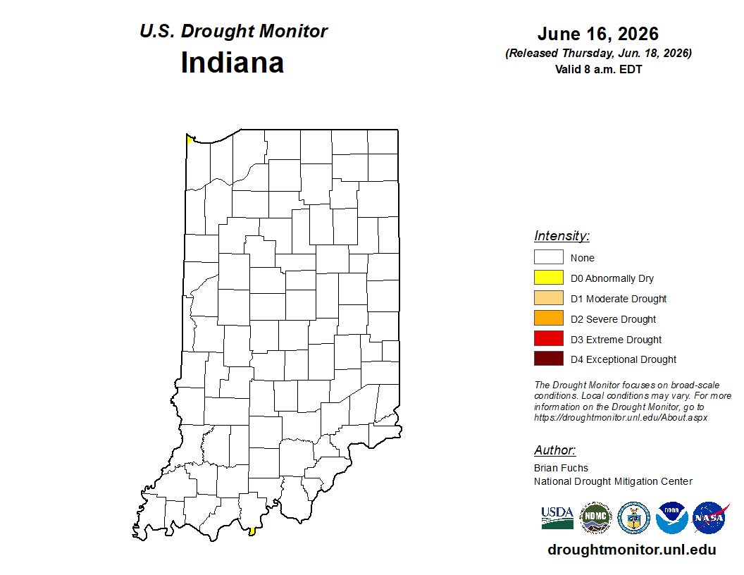
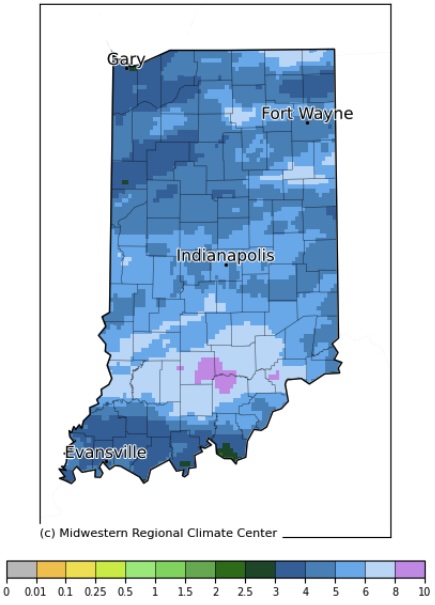
Regardless of when one defines the start of spring, so far it has been mostly on the cooler and wetter side.
Chance for above-normal precipitation in about 2 weeks, but for this time of the year, that doesn’t mean much.
As another dry week passes, we are left to wonder when the next significant rain event will occur. The 7-day precipitation forecast is indicating little-to-no precipitation until the end of next week where amounts are still likely to be below half an inch. Climate outlooks beyond this next week is favoring near-normal precipitation – which may not be enough to get most counties out of their current precipitation deficit. Temperatures seem to be wildly transitioning from above normal to below normal at a time of year when evapotranspiration rates are declining. This could help reduce the rate of drought impacts increasing, but Indiana is still likely to see some in the form of burn bans, mild dust storms, low lakes and streams, and stressed vegetation. With farm equipment entering fields, this could bring additional risk for unplanned ignitions. According to the U. S. Drought Monitor (USDM), abnormally dry (D0) conditions[Read More…]
As the days (and nights) have been getting cooler, I wanted to share with you a new online tool that the Midwestern Regional Climate Center (MRCC) has developed that provides an interactive way to learn more about the climatology of the first fall and last spring freeze dates across our region.
After another wet weekend and cooler temperatures to start this week, it may be surprising to hear that conditions will be changing back to warm and dry for the next several weeks.
After another wet weekend and cooler temperatures to start this week, it may be surprising to hear that conditions will be changing back to warm and dry for the next several weeks. Climate models are strongly favoring above-normal temperature throughout the rest of September with a slight favoring of below-normal precipitation. Abnormally dry conditions continue to persist in counties across northern Indiana, but the spatial extent is gradually shrinking (Figure 1). It is too soon to tell if the upcoming warm and dry outlooks will be strong enough to expand and intensify those drier areas or if a few periodic rain events will be enough to keep conditions relatively stable. Monthly (October) and seasonal (September-October-November) outlooks were released on 15 September 2022. For both of these time frames, the outlooks are favoring above-normal temperatures to continue with below-normal precipitation across Indiana (Figure 2). With each day that passes, we get[Read More…]
As has been the story throughout much of this summer, dry conditions have persisted in Indiana.
On this episode of the Purdue Crop Chat Podcast, Purdue Extension Soybean Specialist Shaun Casteel and Corn Specialist Dan Quinn welcome Indiana State Climatologist Beth Hall to discuss the weather extremes farmers have faced and might continue to face this season.
Since early June, Indiana has been seeing abnormally dry and moderate drought conditions gradually expand and intensify across the state.
Rainfall over the past few weeks has helped to improve drought conditions across much of Indiana.
© 2023 Purdue University | An equal access/equal opportunity university | Copyright Complaints | Maintained by Pest&Crop newsletter
If you have trouble accessing this page because of a disability, please contact Pest&Crop newsletter at luck@purdue.edu.