

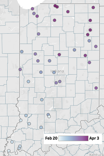
Temperatures dipped below freezing earlier this week as spring perennials started forcing their way out of their winter slumber.
Temperatures dipped below freezing earlier this week as spring perennials started forcing their way out of their winter slumber.
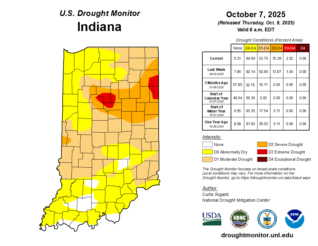
Prior to the rain event October 6-7, 2025, most of Indiana had only received between 0.5” – 2.5” of precipitation over the past 30 days.
Fall and drought have been nearly synonymous in recent years; 2025 is no different.

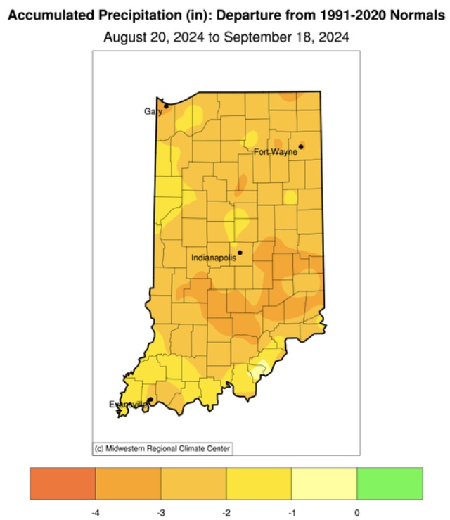
If you have any stakes in agriculture, you may have noticed a fairly rapid drying trend as summer has come to a close.
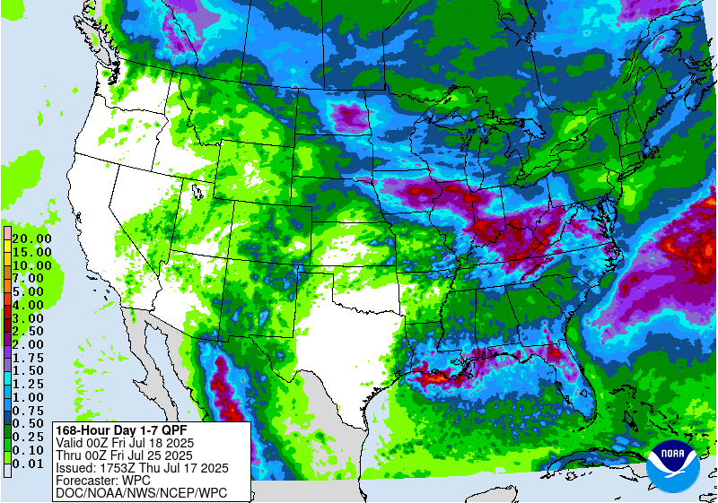
Precipitation forecasts for Indiana over the next 7 days (through late Thursday, July 24) are calling for close to 3 inches (Figure 1).
There is the common adage “April showers bring May flowers”. Apparently, Mother Nature utilized a rather liberal definition of “showers” last weekend and the end of last week by dumping over seven inches of rain in southern Indiana.
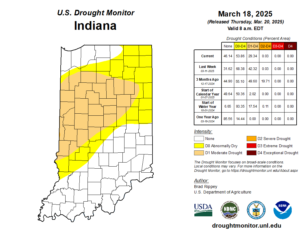
If one looks at the latest U.S. Drought Monitor map for Indiana (Figure 1), one might scratch their head – particularly as it has been raining and the chance for severe weather is in the forecast for this weekend.
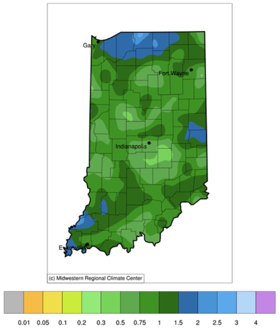
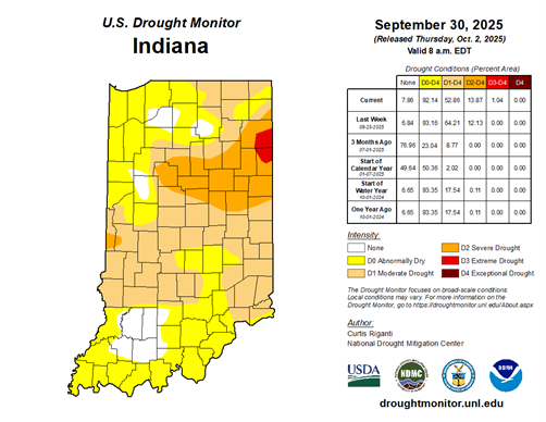
From September 19th through 25th, Indiana was fortunate to receive between a quarter inch to almost three inches of precipitation (Figure 1).
There was a brief period where forecast models were thinking that the remnants of Hurricane Francine might make its way far enough north to provide sufficient moisture to improve drought conditions across the Indiana.

Over the past several weeks, temperatures across Indiana have averaged within the normal range for this time of year. We may recall periods of extreme heat, but there were also periods that felt cooler with fall-like temperatures. Daytime maximum temperatures have averaged near normal whereas nighttime minimum temperatures have averaged slightly below normal. This has offered welcomed relief not only for livestock, pets, and humans, but has provide some much needed nighttime moisture recovery for vegetation, particularly as precipitation events have been few and far between. Abnormally dry and moderate drought conditions have gradually been expanding and intensifying almost everywhere (Figure 1). The only locations that have been mostly spared – or more likely, still benefiting for recent storm tracks – is from west-central Indiana into central Indiana (Benton and Warren counties toward Madison County). However, even those counties are starting to show stress and could soon be classified as[Read More…]
© 2026 Purdue University | An equal access/equal opportunity university | Copyright Complaints | Maintained by Pest&Crop newsletter
If you have trouble accessing this page because of a disability, please contact Pest&Crop newsletter at luck@purdue.edu.
