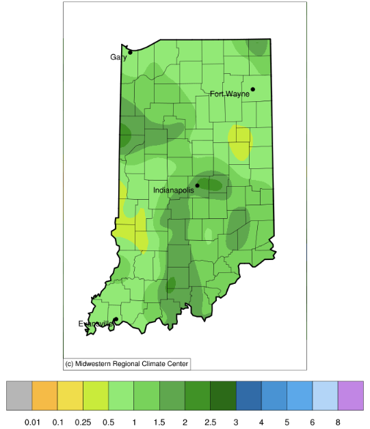
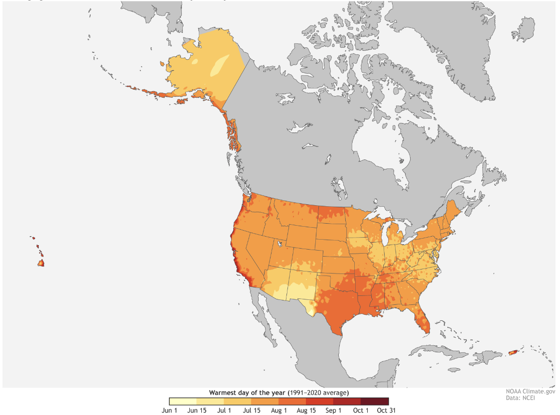
After another week of decent rains across the state (Figure 1), abnormally dry and drought conditions continue to improve according to the latest U.S. Drought Monitor (Figure 2). This has been promising news for both water supplies and agricultural production across the state. As we wonder how long this good fortune might last, we need to think in terms of both temperature and precipitation. Certainly, regular rain events help to keep the environment from getting too dry. However, excessively warm temperatures can increase the rate of dryness even if rain events pass through the area. Did you know we are in the heart of the climatological warmest weeks of the year? This isn’t true everywhere in the U.S. Figure 3 shows the average date when the warmest temperatures occurred from 1991-2020. In Indiana, this has typically occurred in the last half of July into early August. If this year mimics this climatological average, then the evapotranspiration rates should start to decrease. Unfortunately, climate outlooks for July 25th through August 2nd are heavily favoring above-normal temperatures with near normal precipitation amounts. Near the end of that period, there is a slight chance for above-normal precipitation over Indiana, but will that be too little, too late? It is quite possible that Indiana may experience drought conditions worsening slightly for a few weeks before conditions start to return to near normal or more favorable patterns. The monthly outlook for August (released July 20th) provides no guidance regarding temperature, but with probabilities slightly favoring above-normal precipitation in southern counties. The seasonal outlook for August through October is slightly favoring above-normal temperature with relatively weak probabilities for southern Indiana.
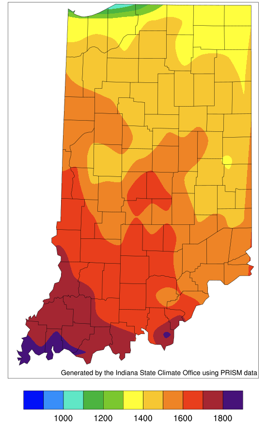
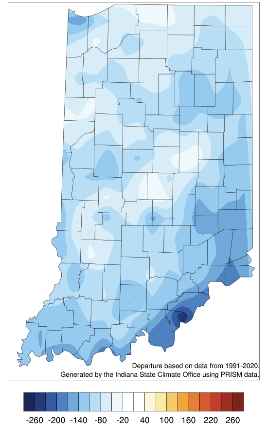
Temperature over the past 30 days has remained near normal across Indiana. This has led to accumulated modified growing degree days to run about 60 to 180 units behind the 1991-2020 average for this time of year (see Figures 4 and 5).
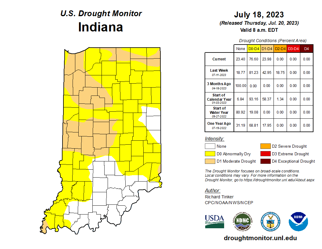
Figure 2. U.S. Drought Monitor status for Indiana based upon conditions through Tuesday, July 18, 2023.


