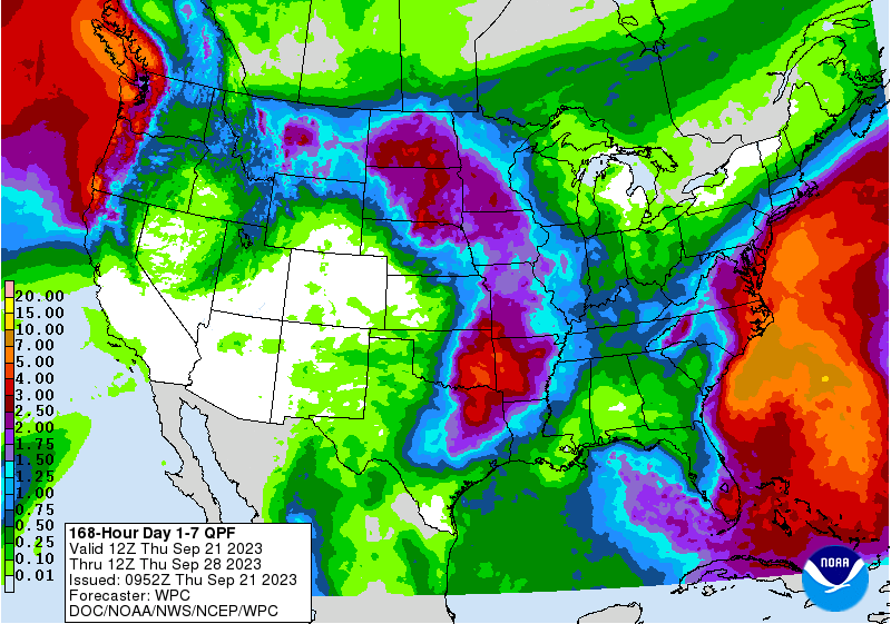
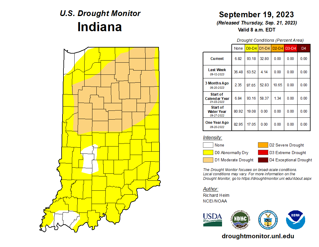
Our dry spell continues. Sure, there’s been a few passing showers, but Indiana is quickly seeing impacts magnify from the lack of rain. The latest U.S. Drought Monitor map shows the expansion of Abnormally Dry (D0) condition across most of the state (Figure 1). The very few counties not Abnormally Dry or in Moderate Drought (D1) are drying out but have yet to show the impacts the rest of the state has seen. This may change by next week with very little rain in the forecast between now and this coming Tuesday. Northeast Indiana has experienced the worst impacts so far with most of that region now designated in Moderate Drought (D1). Precipitation forecast over the next 7 days (through September 28th) has Indiana dry through most of the weekend with chances of rain across most of the state early next week. Amounts are currently forecasted to range between 0.5” to 1.5” (Figure 2). This will certainly help alleviate short-term impacts, but we may need more rain over the next few weeks to increase pond and creek levels to normal values for this time of year and see vegetation that is normally healthy in late September start to recover from this moisture deficit stress. Unfortunately, the 6-to-14-day precipitation outlook is favoring below-normal precipitation amounts over this period (through October 4th) with greater probabilities of drier-than-normal conditions near the end of that period.

Figure 2. Seven-day total precipitation forecasted for the period from September 21-28, 2023. The small amount forecasted for Indiana is likely to fall after September 24th.
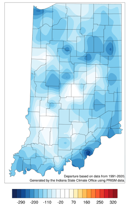
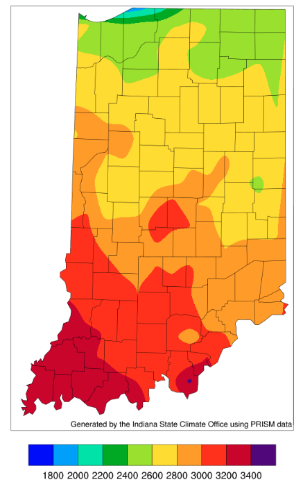
Temperatures have felt more fall-like this past week which means people are thinking more and more about mums and pulling out those Halloween decorations. I briefly considered putting out the Halloween lights at my house this past weekend, but my husband talked me out of it. Hey, at least I wasn’t wanting to put out Christmas decorations! These fall-like temperatures are favored to shift to above-normal temperatures for this time of year over the next 6 to 14 days. Like the precipitation outlooks, the higher-than-normal temperature probabilities are highest near the end of this upcoming 2-week period. As modified growing degree-day temperature accumulations continue to slow down, Figures 2 and 3 show that since April 15th, Indiana ranges between 2400 (northern Indiana) and 3400 (southern Indiana) units. This is slightly below normal across most of the state.

Figure 4. Modified growing degree day (50°F / 86°F) accumulation from April 15-September 20, 2023, represented as the departure from the 1991-2020 climatological average.


