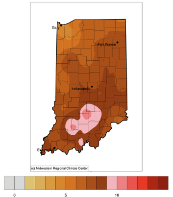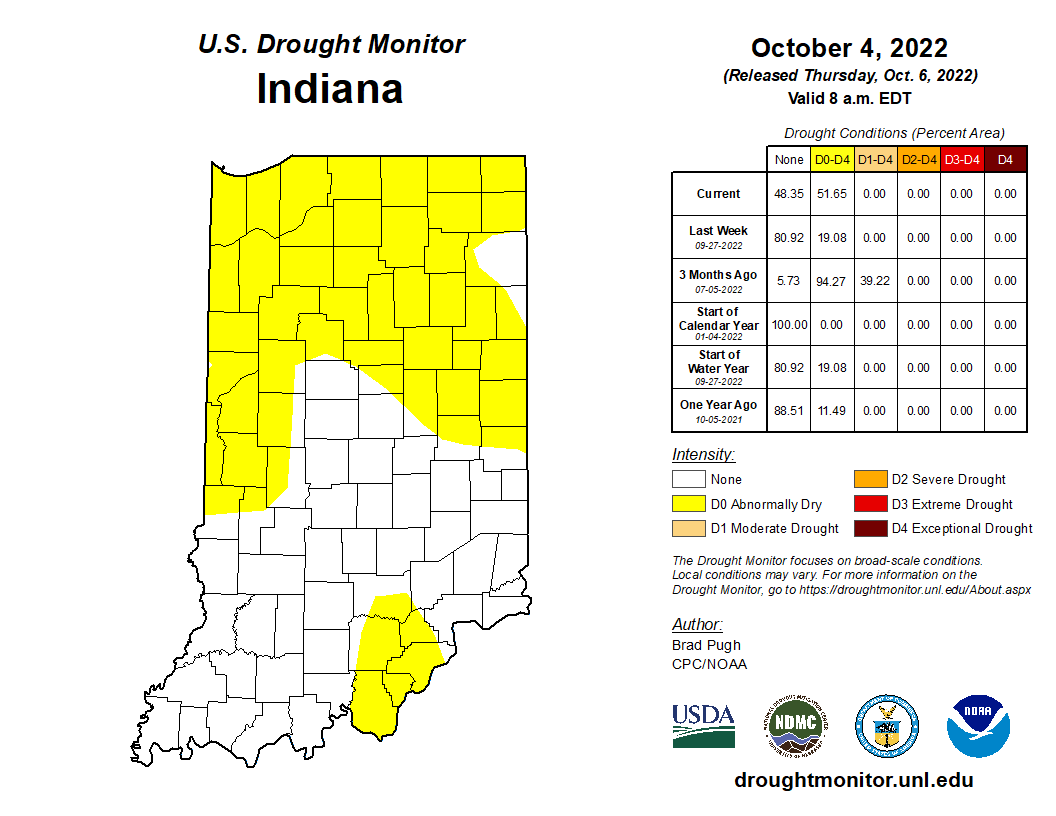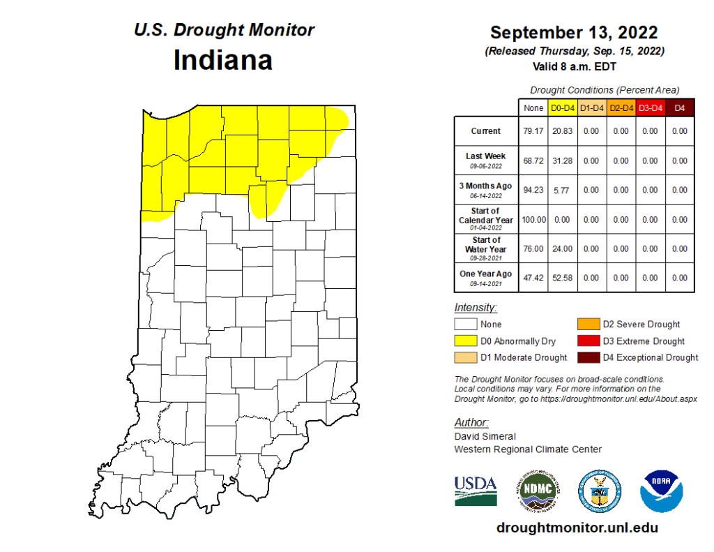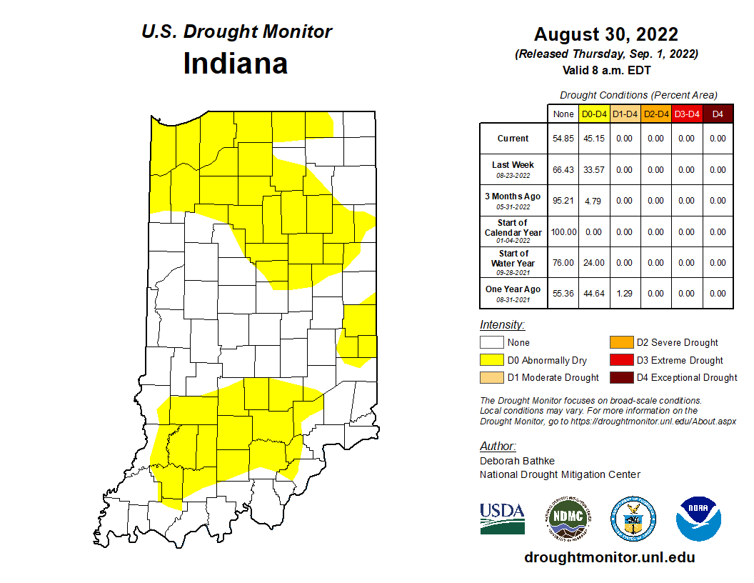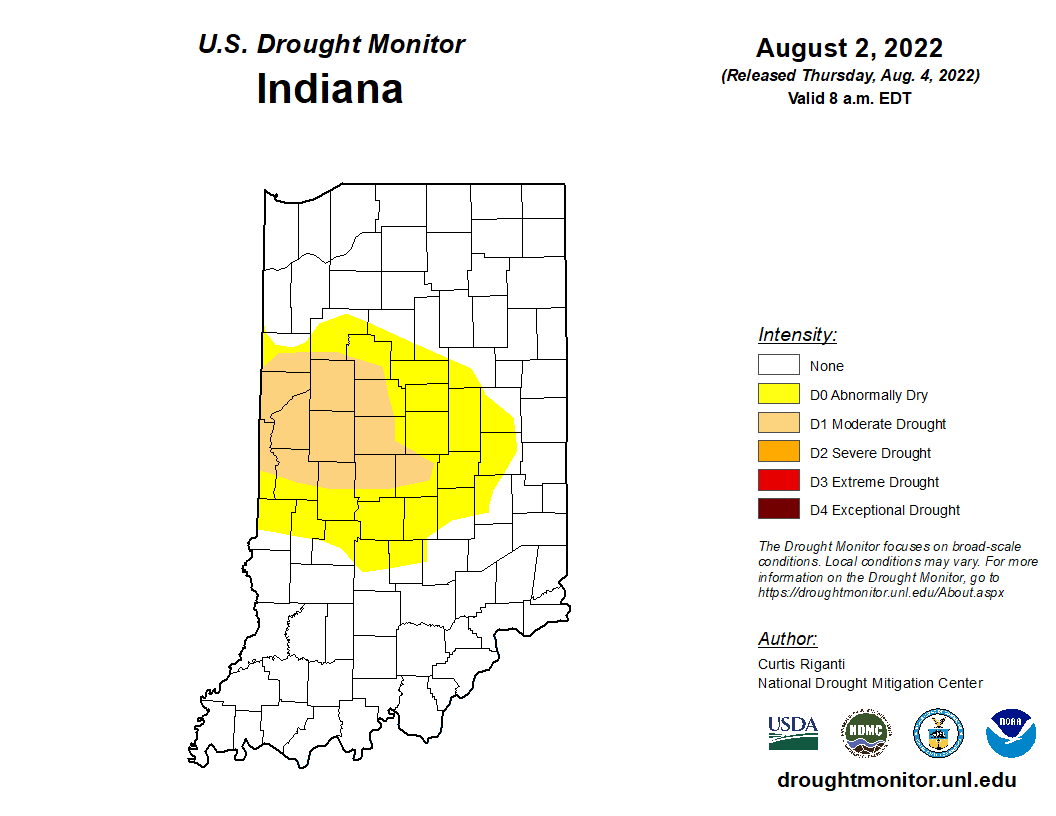
Drought and abnormally dry conditions continue to improve across most of Indiana (Figure 1).
Beth Hall
Recent precipitation events have allowed periodic rainfall to hit most places across Indiana.
After another week of decent rains across the state (Figure 1), abnormally dry and drought conditions continue to improve according to the latest U.S. Drought Monitor (Figure 2).
For the past seven weeks, abnormally dry conditions gradually spread and intensified across Indiana to eventually cover over 98% of the state.
While drought has been on many people’s minds lately, Indiana has had several rain events pass through that brought much needed moisture.
After several weeks of little-to-no rain, Indiana welcomed some much-needed precipitation over the last several days. While amounts ranged from 1-to-3 inches (except for a few counties in west-northwest Indiana (see Figure 1)), the state is still several inches from recovering from the deficit and relieving most impacts. The U.S. Drought Monitor this week (based upon data through the morning of Tuesday, June 13th) now has all of Indiana in some category of abnormal dryness or drought (Figure 2). The driest location is northwestern Indiana where severe drought (D2) is impacting several counties. Most of northern and some central Indiana counties are in moderate drought (D1) with southern Indiana Abnormally Dry (D0). After the additional precipitation that fell on June 13th along with what is forecasted (Figure 3) through next Thursday, Jun 22nd, there is a strong probability that drought will not worsen for much of the southern half of[Read More…]
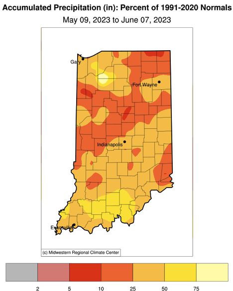
The last several weeks have seen very little precipitation across Indiana. Figure 1 illustrates how much was received compared to the climatological normal amount from May 9 through June 7. The entire state received amounts less than normal (where normal would be 100 percent on the map) with central and northeastern Indiana having received less than 25 percent of normal amounts. This has resulted in browning lawns, lowered ponds and streams, and most vegetation starting to look stressed. Why is this happening and how long will it last? While the El Niño – Southern Oscillation (ENSO) global teleconnection pattern is shifting from the La Niña phase (that has been around for the better part of three years, now) to the El Niño phase, it is difficult to attribute this dryness to ENSO. Historically, ENSO phases have had weaker correlations to temperature and precipitation in the Midwest – particularly[Read More…]
Regardless of when one defines the start of spring, so far it has been mostly on the cooler and wetter side.
Chance for above-normal precipitation in about 2 weeks, but for this time of the year, that doesn’t mean much.
As another dry week passes, we are left to wonder when the next significant rain event will occur. The 7-day precipitation forecast is indicating little-to-no precipitation until the end of next week where amounts are still likely to be below half an inch. Climate outlooks beyond this next week is favoring near-normal precipitation – which may not be enough to get most counties out of their current precipitation deficit. Temperatures seem to be wildly transitioning from above normal to below normal at a time of year when evapotranspiration rates are declining. This could help reduce the rate of drought impacts increasing, but Indiana is still likely to see some in the form of burn bans, mild dust storms, low lakes and streams, and stressed vegetation. With farm equipment entering fields, this could bring additional risk for unplanned ignitions. According to the U. S. Drought Monitor (USDM), abnormally dry (D0) conditions[Read More…]
© 2024 Purdue University | An equal access/equal opportunity university | Copyright Complaints | Maintained by Pest&Crop newsletter
If you have trouble accessing this page because of a disability, please contact Pest&Crop newsletter at luck@purdue.edu.