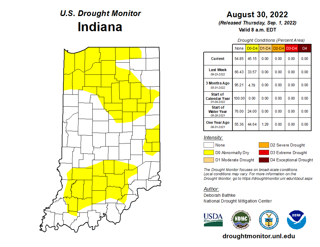
As has been the story throughout much of this summer, dry conditions have persisted in Indiana. According to the U.S. Drought Monitor (USDM), the spatial coverage of drought has ranged from below 10% across Indiana (late May – early June) to more than 94% (early July). Throughout much of that time, the areas impacted were categorized at the lowest USDM level of “Abnormally Dry”. However, from late June through early August, the second lowest USDM level (“Moderate Drought”) impacted central and west-central Indiana, peaking in spatial coverage in mid-July. As we welcome September and start to see cooler temperatures, evapotranspiration rates should lower. However, forecasts are predicting below-normal precipitation over the next few weeks that may encourage at least “Abnormally Dry” conditions to persist and expand across the state. Figure 1 shows the most recent USDM map for Indiana, released 1 September 2022.
The first day of September marks the first day of meteorological autumn. While temperatures are still likely to feel hot at times, we should start to see cooler periods nudge their way into our state from time to time. Before we start to fantasize too much about these cooler temperatures, let us reflect on our meteorological summer from a climatological perspective. Remarkably, temperatures throughout the summer were within 1-2 degrees from normal – most often on the warmer side. Precipitation is a slightly different story. The seasonal (June-July-August) precipitation ranged from above normal in the southwestern (SW) and northeastern (NE) parts of Indiana with the central part of the state drier than normal (Figure 2). However, this is mostly due to June 2022 (particularly the latter half of the month) being significantly drier than normal, causing the rest of the summer to try and catch up from this deficit. July storm events across the SW and NE corners of the state helped eliminate most drought concerns for those regions, and August brought some much-needed rain to southern and western Indiana. When these three months are combined, we see those faint reminders of the rain activity (or lack, therefore) that occurred throughout the season.
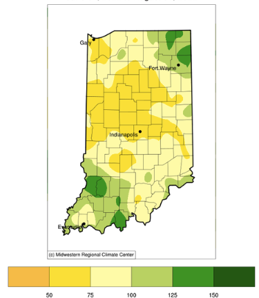
Figure 2. Precipitation represented as the percent of the 1991-2020 normal period for the June-July-August 3-month period.
This time of year, the Indiana State Climate Office starts to get questions about the predicted timing of the first hard freeze in Indiana. We are still a few weeks away from being able to offer any guidance with confidence. If this were to be a normal fall season, climatologically that first hard freeze has occurred between October 20th and November 10th. This range is likely not too helpful, so stay tuned for future articles that may provide better insight about these dates and how this year may be different.
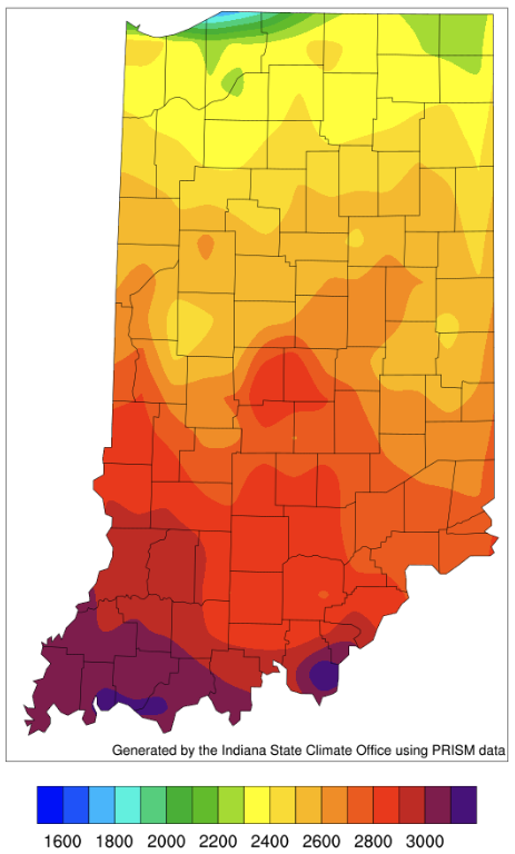
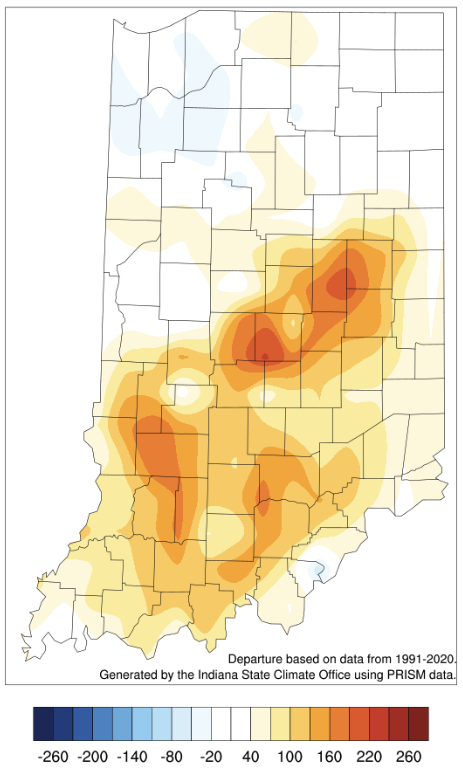
Accumulated modified growing degree days (MGDDs) now span from slightly above 2200 units in the north to over 3100 units in the south (Figure 3). These accumulations are greater than the average compared to the 1991-2020 period for most of the central and southern counties (Figure 4).


