

Indiana has seen several rounds of severe weather, and many are likely ready for a break.
Indiana has seen several rounds of severe weather, and many are likely ready for a break.
After another rainy start to the week, some of you may be ready for a few dry days to get out in the garden or field to start planting.
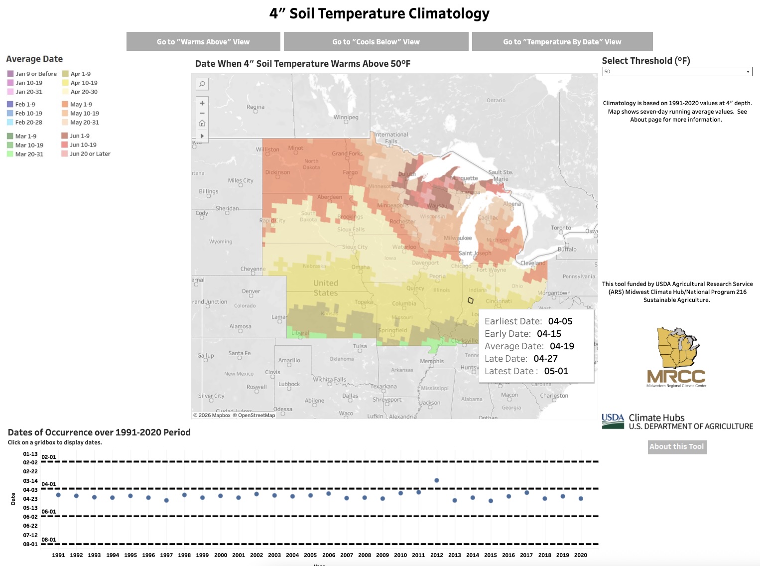
Soil temperatures are often a guide for various timing decisions in agriculture.
The last week has caused many to struggle with whether to turn the heat on inside. Mornings have been quite chilly, and I am guessing several readers may have also struggled with the decision to wear a jacket as they started their workday. These are tough decisions, no doubt. Several data sources have suggested we have had at least 2 weeks of consecutive below-average daily mean temperatures. While not a record, this is certainly noticeable! Perhaps we are hoping those tomato plants will produce just a few more tomatoes. Is it mum season, already? The good news – for those not quite ready to say goodbye to warm days, not needing coats, and garden delights – is warm temperatures are expected to return. Daily high temperatures are already in the 80s and Indiana is likely to see temperatures in the mid-90s by next week. There is significant confidence that this[Read More…]
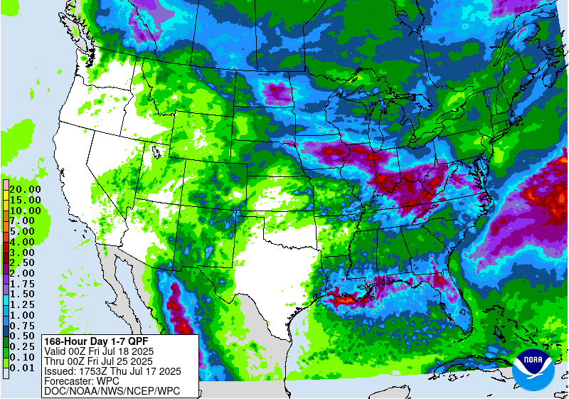
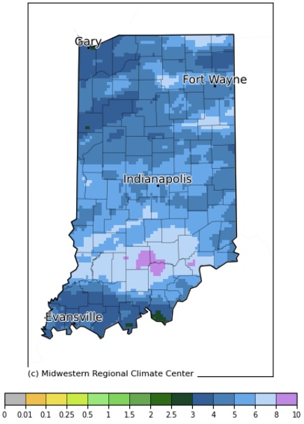
Precipitation forecasts for Indiana over the next 7 days (through late Thursday, July 24) are calling for close to 3 inches (Figure 1).

Precipitation in May has varied tremendously, but most of the state has generally been on the dry side.

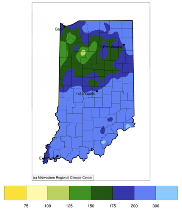
Southern Indiana took the lion’s share of precipitation in April with some locations getting over twice the amount of rain than normal for that month.
Southern Indiana took the lion’s share of precipitation in April with some locations getting over twice the amount of rain than normal for that month.
There is the common adage “April showers bring May flowers”. Apparently, Mother Nature utilized a rather liberal definition of “showers” last weekend and the end of last week by dumping over seven inches of rain in southern Indiana.
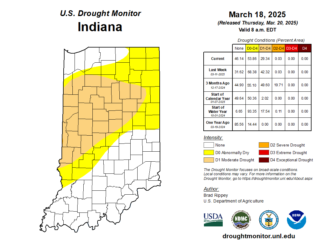
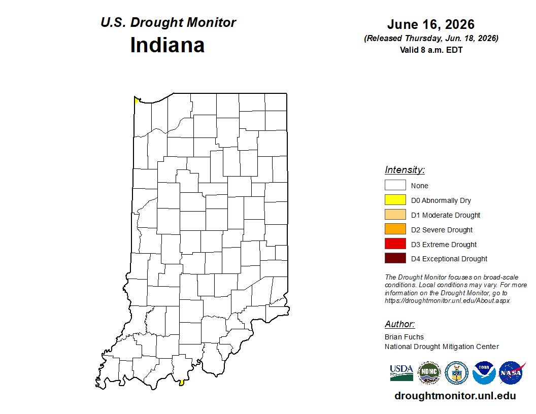
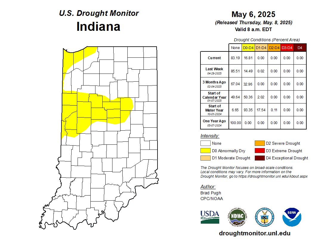
If one looks at the latest U.S. Drought Monitor map for Indiana (Figure 1), one might scratch their head – particularly as it has been raining and the chance for severe weather is in the forecast for this weekend.
© 2026 Purdue University | An equal access/equal opportunity university | Copyright Complaints | Maintained by Pest&Crop newsletter
If you have trouble accessing this page because of a disability, please contact Pest&Crop newsletter at luck@purdue.edu.
