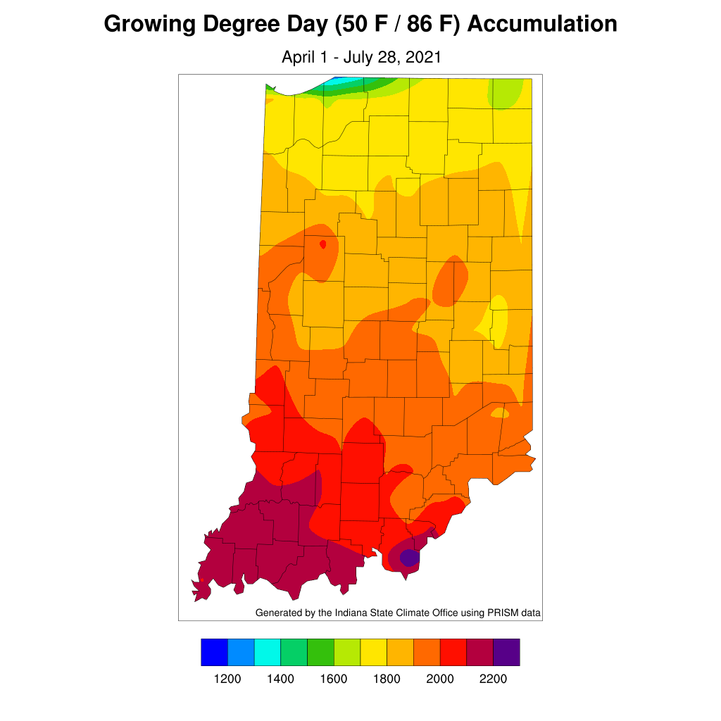
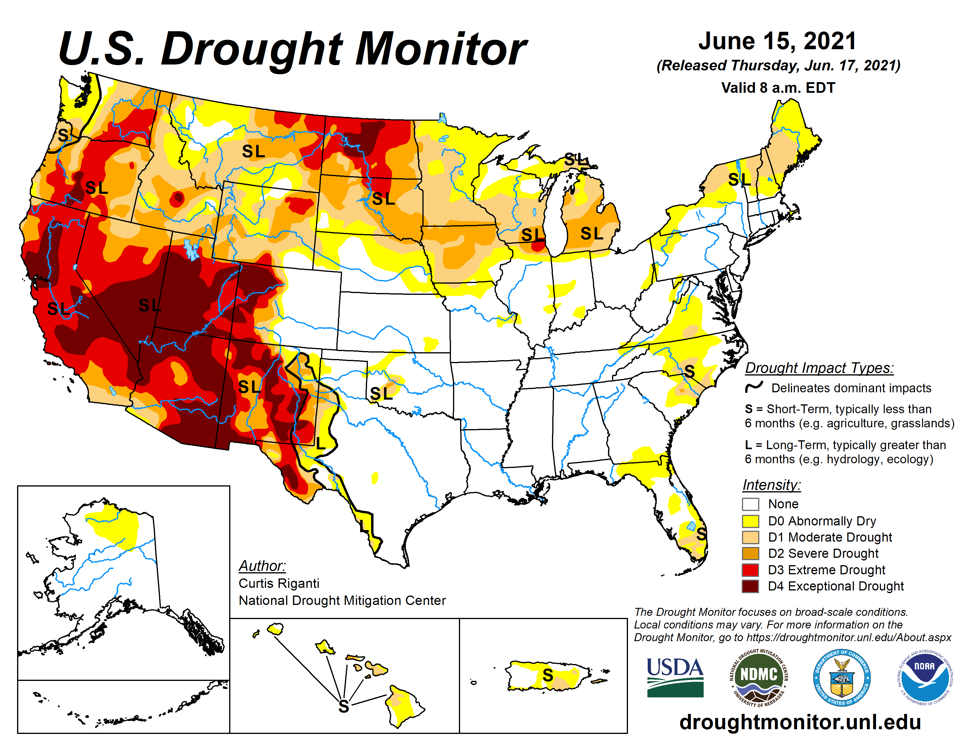
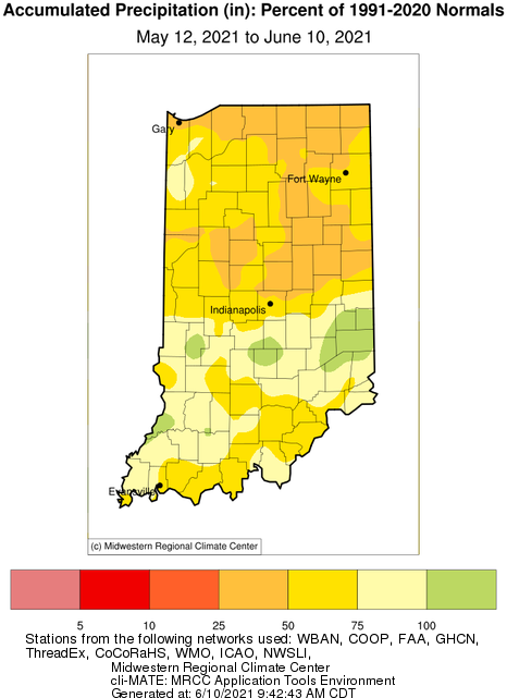
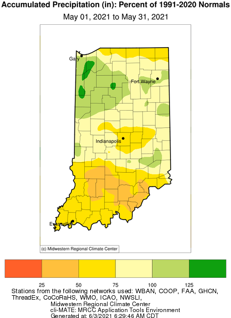
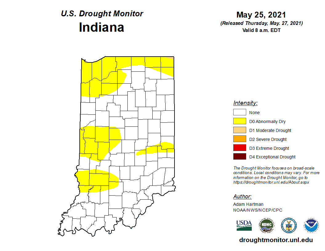
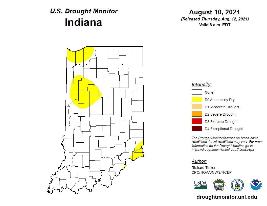
Another period of rain passed through the state earlier this week, providing limited rain to the northeast and southern counties.
172 articles tagged "Indiana Weather & Climate Report".
The brief rain event earlier this week brought some precipitation to the state. However, the drier regions of the north could use more rain soon!
The brutal heat wave has passed, but there are still plenty of warm days ahead. Climate outlooks (over the next few weeks) are suggesting confidence of above-normal precipitation across Indiana.
While the remnants of Hurricane Barry brought some much-needed precipitation to the state, the next few weeks look to be on the dry side.
It seems someone left the oven on, again! Temperatures, so far, for July have been several degrees above normal (Figure 1) and with relatively calm winds and little precipitation, the warm temperatures during the day can feel brutal.
When I was very young, I remember my father talking about “knee high by the Fourth of July”.
Outlook into early next week looks favorable for a dry weekend, but chances for precipitation around the state pop back up around Tuesday.
Some weeks I wonder if I could just re-use the previous week’s weather and climate article! The story seems to be the same: It’s been wet and more rain is expected.
After a welcomed break in the rain for most of the state over the last 7-10 days, that window will close again by this weekend. In fact, the 7-day precipitation forecast (Figure 1) is predicting 2”-4” across Indiana by next Thursday (June 20th). Beyond that date, the climate outlook is showing strong confidence that above-normal precipitation amounts will continue through the following week (June 25th) and into early July. Be prepared for pooling water and potential flash flooding! How unusual has this spring been for Indiana? Believe it or not, this past March-May came in as the 11th wettest spring (15.52”) with respect to the 1895 through 2019 (125 years) time period! The record spring was in 2011 when 19.58” fell across the state (Figure 2). What is interesting to consider is in 2011, after the record-breaking March-June precipitation, the rain all but stopped falling for July through October (Figure[Read More…]
As we close the doors on May for the year, one of the biggest stories throughout the month was the precipitation. The entire state was above normal. Northwestern Indiana was 3.41” above normal and southeastern Indiana was 0.18” above normal for the month (Figure 1). Temperatures were near normal in the northern and above normal in the central and southern tiers of the state. Some stations in Central Indiana recorded rainfall on 24 out of 31 days.