

The southern half of Indiana seems to be drying out where the central and northeast parts of the state have experienced above normal precipitation, with amounts in some places exceeding 1” more than normal over the past 2 weeks (Figure 1).
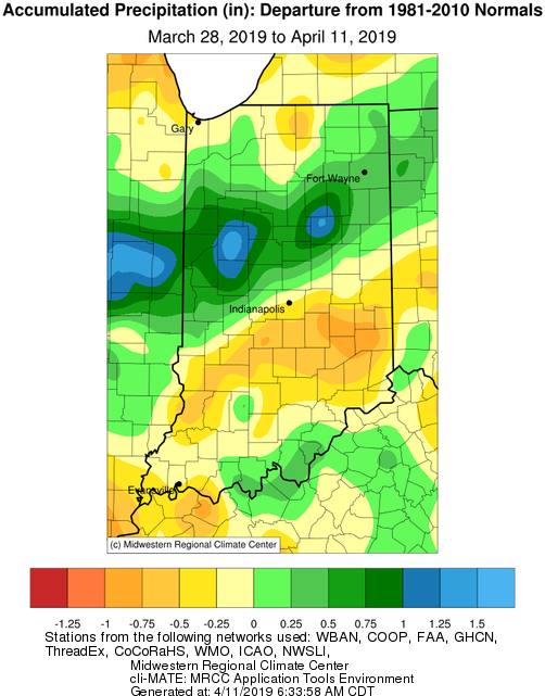
Figure 1. Precipitation departure from normal over the past 2 weeks.
Warm days are wanting to occur, but they seem to be intermittently dispersed with cooler days – a common indication of spring. seem to be relatively few and far between, causing a slow start to growing degree-day (GDD) accumulations. As of April 9th, GDD units across the state range from 40 units in the north up to 80 units in the south (Figure 2).
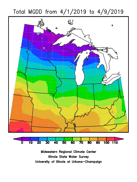
Figure 2. Modified growing degree-day accumulation starting April 1, 2019.
Hard freezes (<= 28°F are still in recent memory, with the most recent hard freeze occurring just last week (April 1-3). For April 11-18, precipitation forecasts are predicting 1.75”-4.0” of rain, with the higher amounts expected in the southwestern part of the state. There is still a 25-50% chance of a 32°F freeze occurring in southern counties and over a 75%-90% chance of a freeze occurring in the northern half of the state (Figure 3).
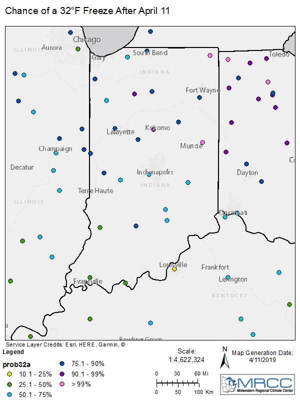
Figure 3. Modified growing degree-day accumulation starting April 1, 2019.
