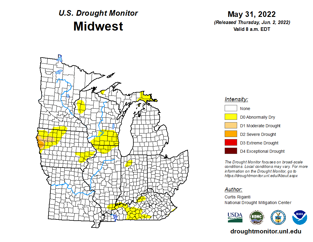
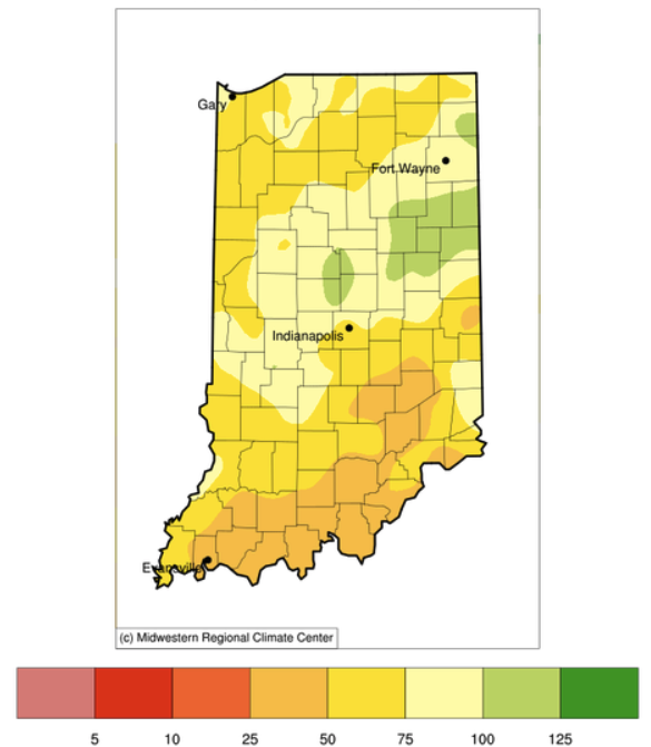
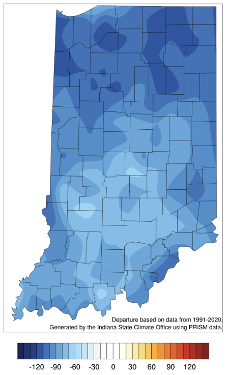
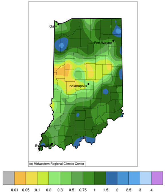
149 articles tagged "Indiana Weather & Climate Report".


thumbnail image

After a welcomed break in the rain for most of the state over the last 7-10 days, that window will close again by this weekend.  In fact, the 7-day precipitation forecast (Figure 1) is predicting 2”-4” across Indiana by next Thursday (June 20th).   Beyond that date, the climate outlook is showing strong confidence that above-normal precipitation amounts will continue through the following week (June 25th) and into early July.  Be prepared for pooling water and potential flash flooding! How unusual has this spring been for Indiana?  Believe it or not, this past March-May came in as the 11th wettest spring (15.52”) with respect to the 1895 through 2019 (125 years) time period!  The record spring was in 2011 when 19.58” fell across the state (Figure 2).  What is interesting to consider is in 2011, after the record-breaking March-June precipitation, the rain all but stopped falling for July through October (Figure[Read More…]


thumbnail image

As we close the doors on May for the year, one of the biggest stories throughout the month was the precipitation. The entire state was above normal. Northwestern Indiana was 3.41” above normal and southeastern Indiana was 0.18” above normal for the month (Figure 1). Temperatures were near normal in the northern and above normal in the central and southern tiers of the state. Some stations in Central Indiana recorded rainfall on 24 out of 31 days.


thumbnail image

So far for the month of May, temperatures across the state vary by nearly 2˚F above normal in the southeast and almost 3˚F below normal in the extreme northwest. Similarly, the same trends can be seen in the Modified Growing Degree Days as they are based on temperature (Fig 1).   The main story continues to be the precipitation for most of the state.  Since January 1, precipitation is between 3 to 9 inches above normal in spots. Adding observed near normal to slightly above normal precipitation for the month in some areas is really delaying folks in the agriculture industry (Fig 2). Looking at the short term outlook from the Climate Prediction Center (Fig 3 & 4), much of the state has above normal chances for seeing above normal temperatures and precipitation over the 6 to 10 day and 8 to 14 day outlooks. Our active weather pattern doesn’t[Read More…]


thumbnail image

Near term, Sunday looks like the next most likely precipitation event around the state.  The active pattern seems to continue, with chances of rain continuing about every 3-4 days.  Meanwhile, temperatures begin to trend more summer-like, with 80 degree days coming statewide, and likelihood for above average temperatures in the 6-10 day outlook high (see map, cpc.ncep.noaa.gov). Important to note:  high temperatures and excessive moisture favor many different kinds of disease and insect development.  Scout any crops that have been planted for disease development or infestation and act accordingly.  Contact your local Purdue Extension office for help in identifying problems or economic thresholds for treatment.    


Pest&Crop newsletter - Department of Entomology Purdue University 901 Mitch Daniels Blvd West Lafayette, IN 47907

© 2024 Purdue University | An equal access/equal opportunity university | Copyright Complaints | Maintained by Pest&Crop newsletter

If you have trouble accessing this page because of a disability, please contact Pest&Crop newsletter at luck@purdue.edu.