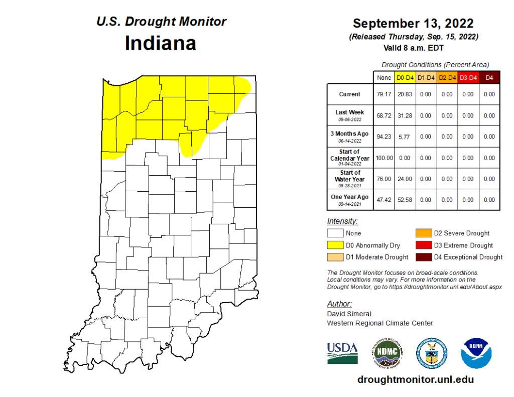
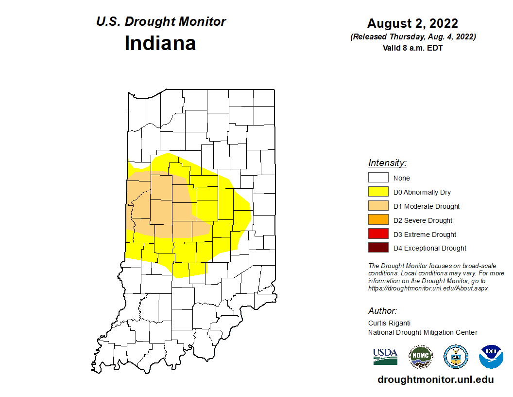
After another wet weekend and cooler temperatures to start this week, it may be surprising to hear that conditions will be changing back to warm and dry for the next several weeks. Climate models are strongly favoring above-normal temperature throughout the rest of September with a slight favoring of below-normal precipitation. Abnormally dry conditions continue to persist in counties across northern Indiana, but the spatial extent is gradually shrinking (Figure 1). It is too soon to tell if the upcoming warm and dry outlooks will be strong enough to expand and intensify those drier areas or if a few periodic rain events will be enough to keep conditions relatively stable. Monthly (October) and seasonal (September-October-November) outlooks were released on 15 September 2022. For both of these time frames, the outlooks are favoring above-normal temperatures to continue with below-normal precipitation across Indiana (Figure 2). With each day that passes, we get[Read More…]