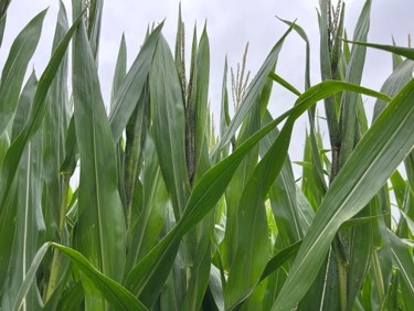
Calls and observations from both north-central and eastern Indiana indicate populations of aphids that are so high they are covering the upper leaves of plants.
Calls and observations from both north-central and eastern Indiana indicate populations of aphids that are so high they are covering the upper leaves of plants.
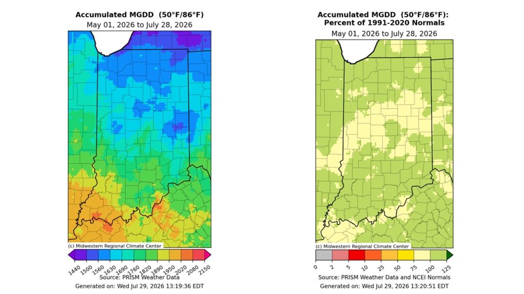
By late July, Indiana had settled into a typical midsummer pattern. Warm, humid days with warm overnight temperatures were common, and scattered thunderstorms left a patchwork of rainfall across the state.
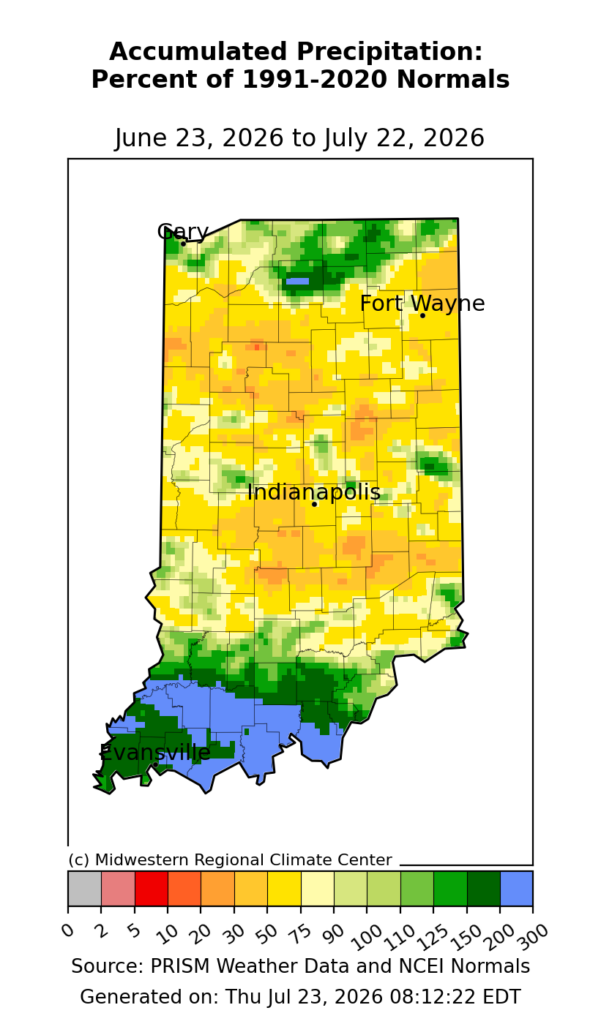
Aside from southern and far northern Indiana, the rest of the state has generally received below normal precipitation over the past 30 days (Figure 1). While only a few localized areas show percentages below the 30 percent-of-normal level (one of the factors considered to recommend the Abnormally Dry (D0) classification to the U.S. Drought Monitor authors), other factors are suggesting something may be developing. A challenge has been the very spotty nature of heavy precipitation events in the broad region that has caused localized flooded areas nearby areas that seem to keep missing out. The Indiana state drought monitoring team has also been looking at other factors such as evapotranspiration, soil moisture, stream and lake levels, and groundwater levels. Several of those factors did suggest the area was already abnormally dry so without significant additional precipitation most of Indiana is likely to enter the D0 category soon. Rumors will start[Read More…]
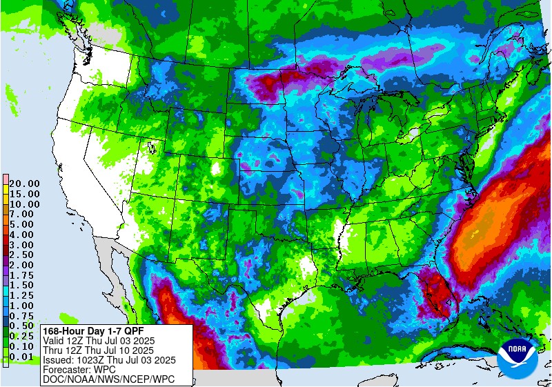
One heat wave down, more to come. It is summer, though, so aside from expecting plenty of hot days, the things to be more concerned about is reference (or potential) evapotranspiration (ET) significantly exceeding precipitation that would ultimately cause drought-related impacts. The National Weather Service provides a 7-day forecasted reference ET product as well as a 7-day forecast for total precipitation amounts. From these resources, it looks like across Indiana, approximately 1.5” of water is expected to be lost over the next 7 days and anywhere from 0.10” to up to 1.5” of precipitation will be received (Figure 1). This implies a water deficit for most areas – which is not unusual throughout Indiana summers. The concern comes when that deficit becomes much greater than normal. Concerning drought, the U.S. Drought Monitor continues to place northwestern Indiana in the Abnormally Dry (D0) category with two isolated areas within that zone[Read More…]
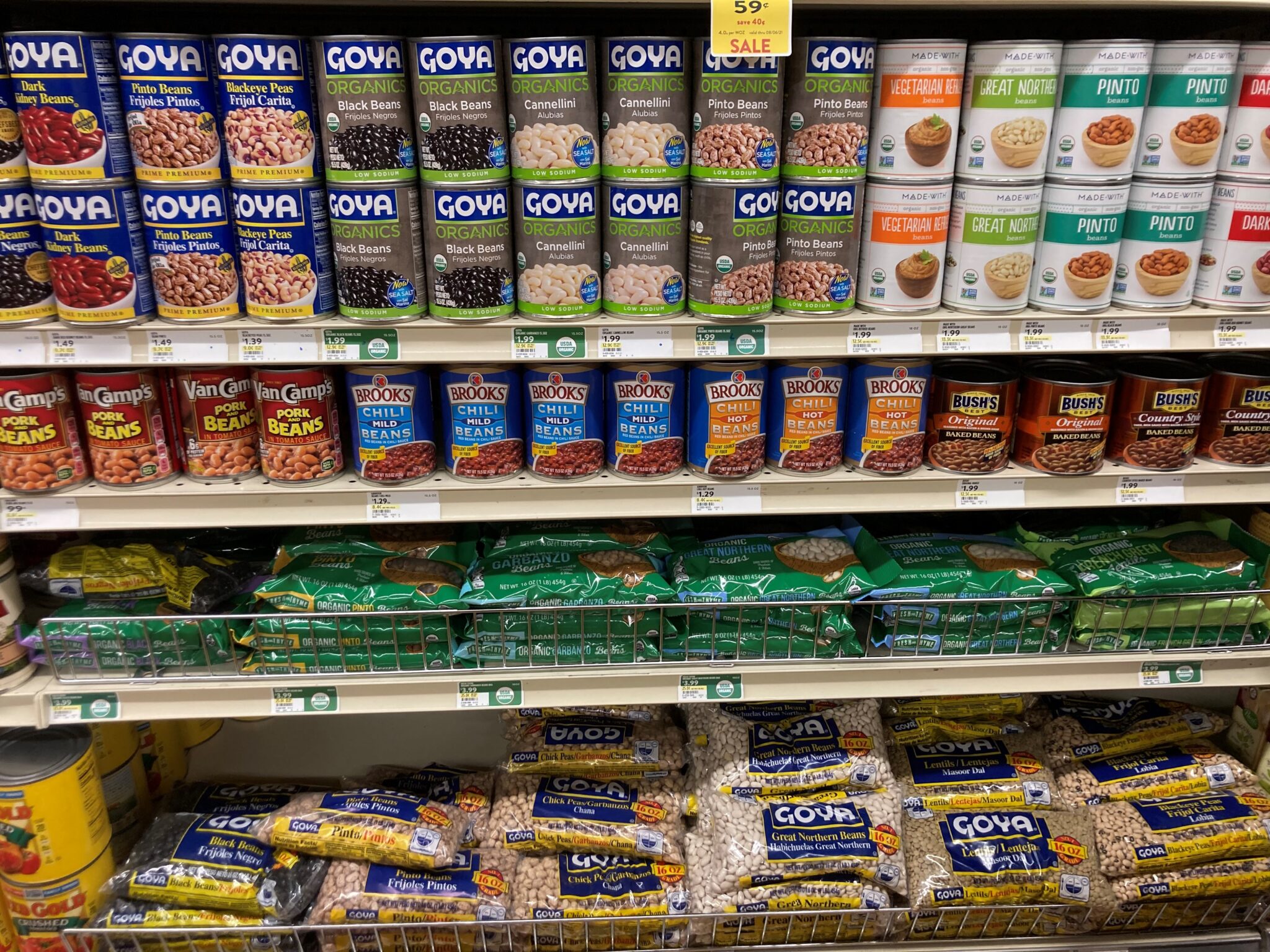
I hope you take more time evaluating what forage species and variety of that species should be purchased than the time taken to buy a vegetable at the grocery store.
Recent storms which crossed Indiana brought welcome rains to current dry conditions, yet were not without additional challenges, which includes hail damage.
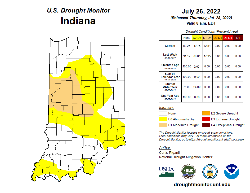
Rainfall over the past few weeks has helped to improve drought conditions across much of Indiana.
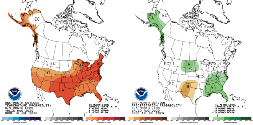
On July 16th, the national Climate Prediction Center released the climate outlooks for August (Figure 1) and the August-September-October (Figure 2) period.
© 2026 Purdue University | An equal access/equal opportunity university | Copyright Complaints | Maintained by Pest&Crop newsletter
If you have trouble accessing this page because of a disability, please contact Pest&Crop newsletter at luck@purdue.edu.