

In last week’s article, cooler and wetter conditions were noted for the first half of September with some uncertainty for the latter half of the month. Updated climate outlooks are continuing to indicate increased confidence for below-normal temperatures with weaker, yet significant, confidence for above-normal precipitation. The September monthly outlook provides no guidance for precipitation – possibly implying that these wetter-than-normal conditions in the first half of the month may not persist through the second half of the month. However, below-normal temperatures are still significantly probable throughout the month. This could be due to an incoming cold wave that is expected to bring much below-normal temperatures from the northern Plains into western Illinois September 10-11, 2020. Continue to keep an eye on this forecast in case overnight lows drop too close to freezing. At this time, an early frost or freeze for Indiana seems highly unlikely for next week, but this year has certainly challenged even the most tolerant among us!
Accumulated modified growing degree days (GDDs) continue trying to catch up with previous years (Figures 1 and 2). It will be interesting to see if the warmer temperature for the rest of August will push this year’s GDDs ahead of the pack. It is a race I am sure all of us are on the edges of our seats in anticipation of the outcome.
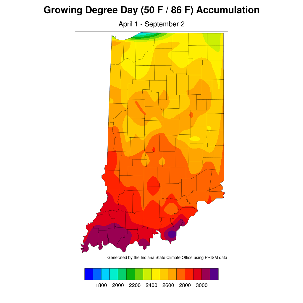
Figure 1. Modified accumulated growing degree-day units for April 1 – September 2, 2020.
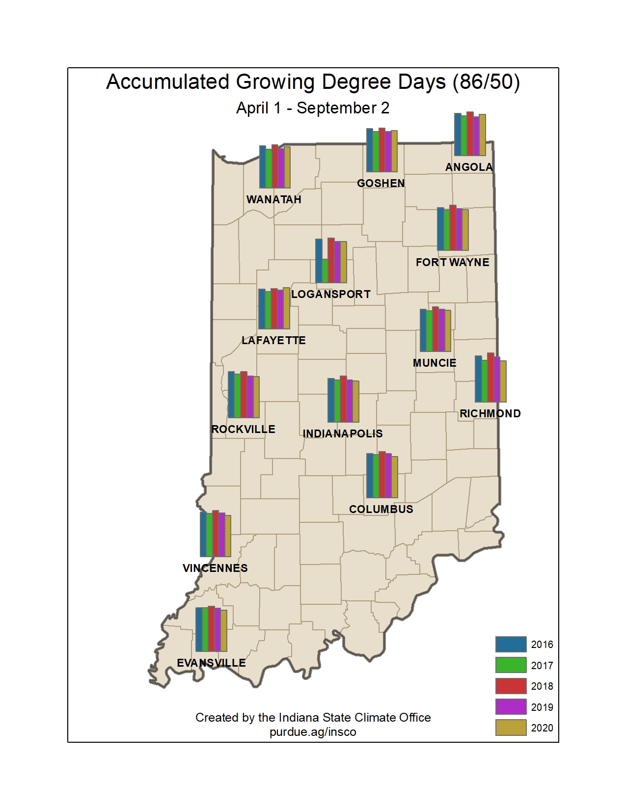
Figure 2. Comparison of accumulated modified growing degree days for April 1 through September 2 for 2016 through 2020.
