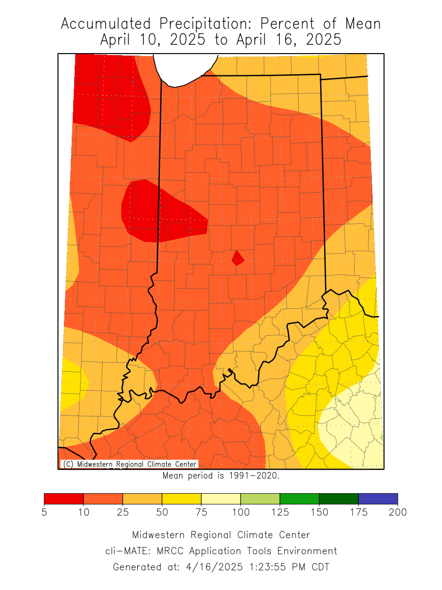
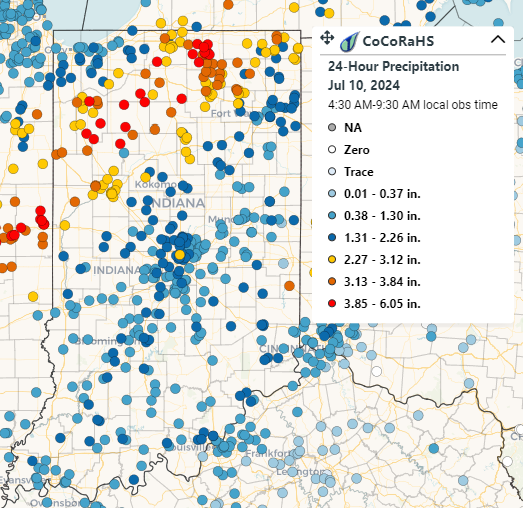
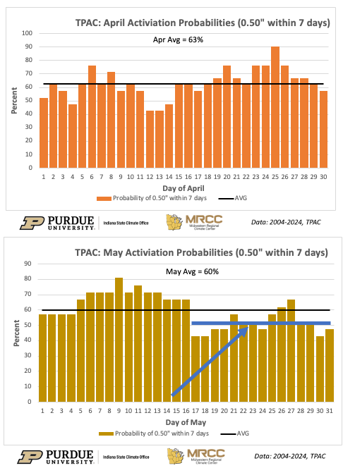
![thumbnail image](https://extension.entm.purdue.edu/newsletters/pestandcrop/wp-content/uploads/sites/2/2023/07/Figure1.jpg)
Timely rains have returned over the past few weeks and have helped crop conditions across the state.
Below-normal temperatures continued through the first 21 days of June as the state average temperature was 68.3°F, which was 1.8°F below the 1991-2020 climatological normal. Temperature departures were 1-5°F below normal across the state, with larger departures in eastern and southern Indiana (Figure 1, Left). Maximum temperatures were near normal for the entire state, and minimum temperatures ran 1-9°F below normal (Figure 1, Right). Dry air and limited overnight cloud cover are to blame. Several locations measured minimum temperatures in the 40s at some point this month, but Franklin County recorded a chilly 36°F on June 9th. This station also tied with Shelby County for the second highest temperature recorded so far this month, 95°F, which occurred on June 3. Dubois County hit 97°F on June 4th. There were more than 20 daily low temperature records broken or tied during the second week of June. Over the last week, maximum[Read More…]
Temperatures warmed into the 80s by the end of Memorial Day weekend, but low dew point temperatures made the heat bearable.
Cool mornings and warm afternoons have made conditions pleasant across the state.
The weather has been absolutely beautiful over the past few days. Temperatures have finally rebounded, vegetation is green again, and agricultural crops are beginning to emerge from the freshly planted fields. Despite the warming temperatures, we still have not dug ourselves out of the below-normal start to May. Through the first ten days of the month, Indiana averaged 0.7◦F below normal (Figure 1). The largest departures occurred in climate divisions 6 and 9, which were 1.6◦F and 1.9◦F below normal, respectively. Angola, located in Steuben County, was the coldest location with an average temperature of 50.9◦F (4.0◦F below normal). Evansville was the warmest with an average temperature of 63.4◦F, which was 2.0◦F below normal. Accumulated Modified Growing Degree Days (April 1 – May 10) continued to run within 60 MGDDs of normal throughout the state (Figure 2). Statewide, MGDDs have accumulated between 160 and 420 units since April 1. Four-inch[Read More…]
It is May, the sun is shining, of course the wind is blowing, and the weather forecast is calling for warmer temperatures.
Despite the cooler weather we’ve experienced the last couple of weeks, temperatures from April 1st through 26th averaged 2.3°F above normal for the entire state (Figure 1).
Through the first 18 days of April, temperatures ran 5.5◦F above normal statewide (Figure 1).
Much like March, April has gotten off to a warm start.
Indiana experienced near-normal temperatures for March as the state averaged 40.9◦F, despite the record warmth at the beginning of the month (Figure 1).
© 2025 Purdue University | An equal access/equal opportunity university | Copyright Complaints | Maintained by Pest&Crop newsletter
If you have trouble accessing this page because of a disability, please contact Pest&Crop newsletter at luck@purdue.edu.