

As September begins, we officially welcome meteorological fall. While the autumnal equinox isn’t until September 22, the past few mornings have already brought a crisp, fall-like feel to the air.
As September begins, we officially welcome meteorological fall. While the autumnal equinox isn’t until September 22, the past few mornings have already brought a crisp, fall-like feel to the air.
Summer just had to throw us a going away party in the form of extreme heat!

Pattern changes, like the one we’ve experienced in the middle of the month, are quite typical for August.
August is in full swing, and schools are back in session, but let’s remember that it’s still summer, meteorologically-speaking!
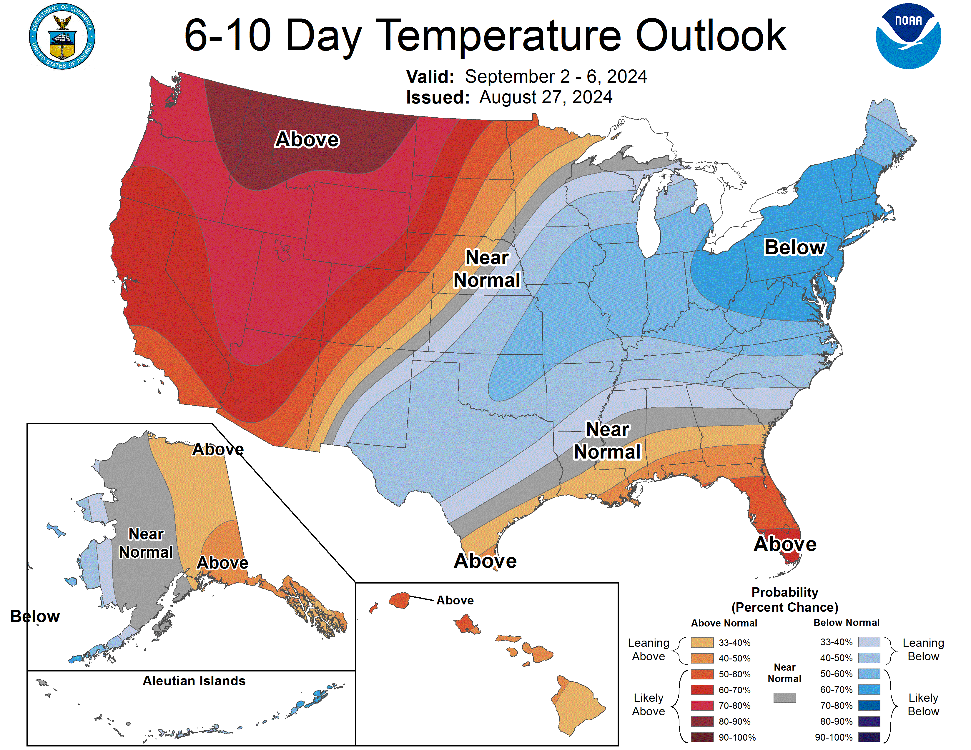
After a period of hot and humid weather where heat indices reached triple digits in some locations, we welcome cooler than normal temperatures for the next several days. It is still summer, though, so sweaters, mittens, and scarves will not be necessary! There were a few temperature records broken over the August 5-6, 2024, period, but surprisingly none otherwise across Indiana. What a nice reminder that we are usually hot and humid this time of year! In fact, the July 2024 average daily temperature (as well as the average daily maximum and minimum temperatures) were very close to normal. Does this mean global climate change is not real? Absolutely not! The key word there is “global” and while the average temperatures for the month were near normal, the variability and extremes illustrate how much the atmosphere has been agitated. Which brings us to precipitation. July’s precipitation was well above normal[Read More…]
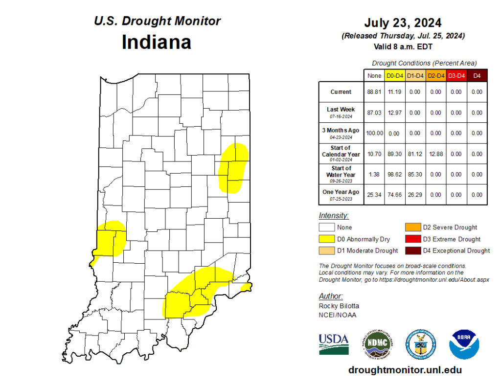
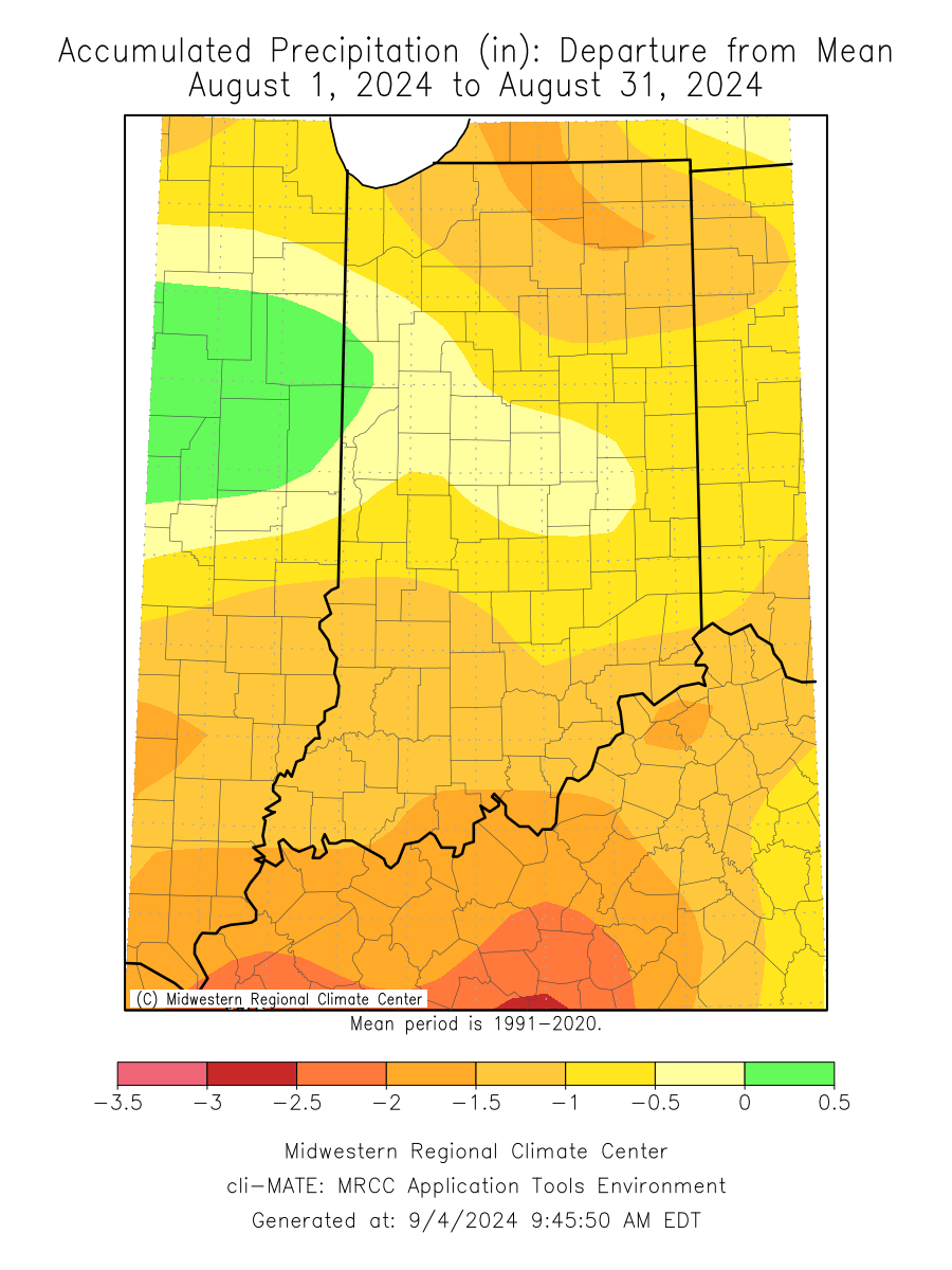
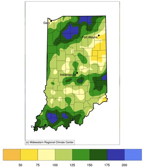
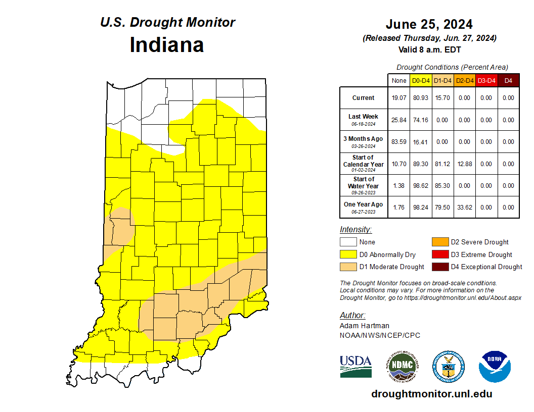
Several weeks ago, Indiana received enough rain to eliminate drought across the state, leaving behind just a few counties in Abnormally Dry (D0) status. Fortunately, this week has been relatively quiet, allowing many areas to alleviate flooding issues. The U.S. Drought Monitor kept those Abnormally Dry areas nearly the same this week (Figure 1), so how might things change? Will this recent dry period re-introduce Moderate Drought (D1) and/or expand those Abnormally Dry areas? Or will more rain keep Indiana in a more normal situation where precipitation passes through every few days, separated by typical Midwest hot and humid conditions? First, it is important to review what has been happening across our state. Over the past two weeks, Figure 2 shows that most of Indiana has receive above-normal precipitation except for southeastern and southern Indiana. However, even those locations are within one inch of normal amounts (based on the 1991-2020[Read More…]
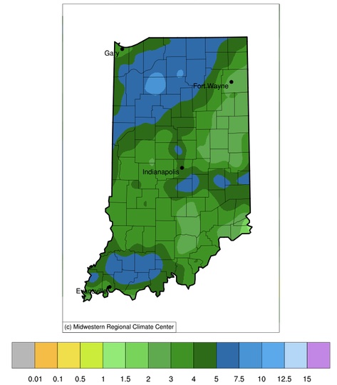
Since the start of July, most of Indiana has received at least 2 inches with up to 8 inches of precipitation (Figure 1).
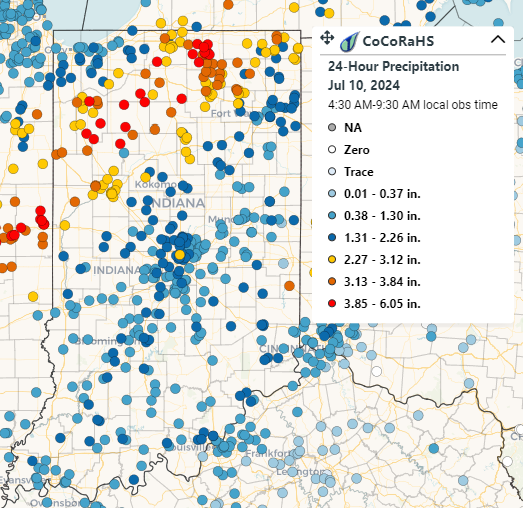
The remnants of Hurricane Beryl brought much-needed rain to the state, although some areas experienced excessive totals.
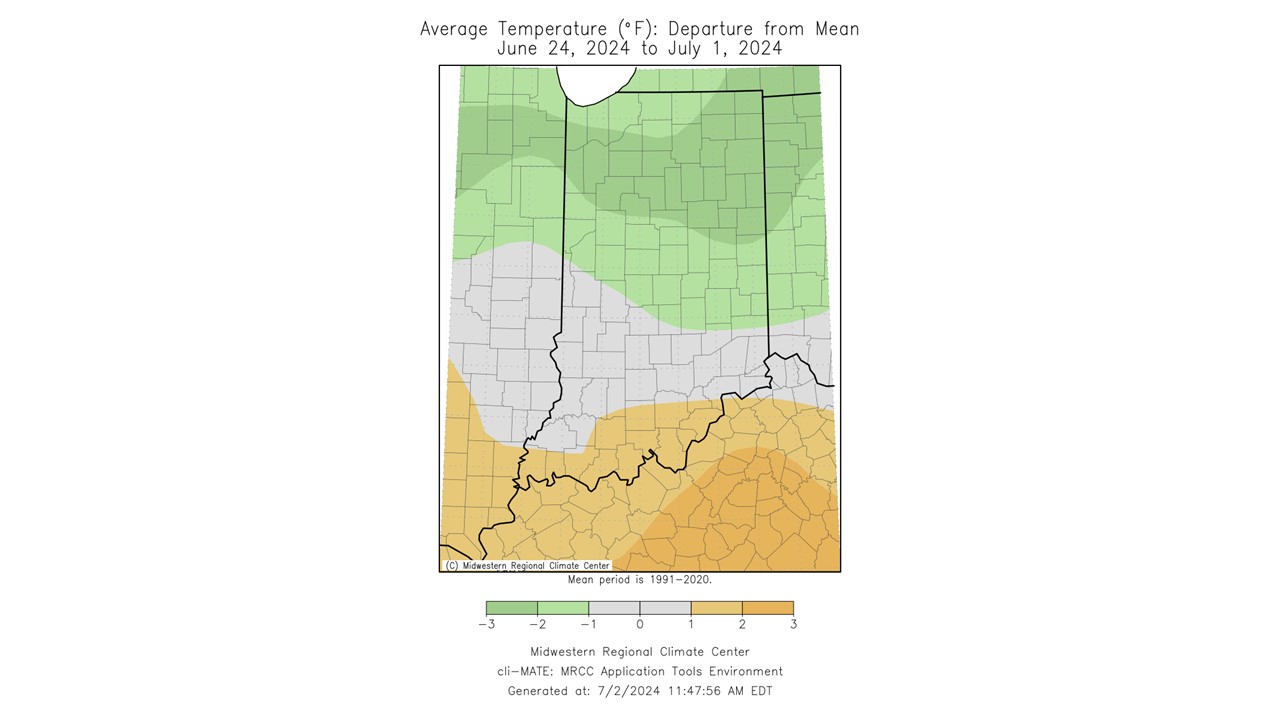
Temperatures were much more pleasant over the past seven days (June 24-July 1) compared to the heat experienced in mid-late June.
Last week, temperatures were higher than normal, and the lack of precipitation was causing lawns to turn brown, creek and lake levels to drop, and some crops to start showing stress.
© 2026 Purdue University | An equal access/equal opportunity university | Copyright Complaints | Maintained by Pest&Crop newsletter
If you have trouble accessing this page because of a disability, please contact Pest&Crop newsletter at luck@purdue.edu.
