

Last week was marked by cooler temperatures and lots of rain.
Last week was marked by cooler temperatures and lots of rain.
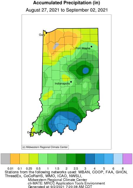
While Hurricane Ida and her remnants have wreaked havoc down south and in the mid-Atlantic states, she was relatively kind and generous when it came to Indiana. Some southern counties received between 4 and 5 inches from Ida (Figure 1).
The roller coaster ride of Indiana weather continues.
Two weekends ago, Indiana was facing freezing temperatures that broke numerous records across the state.
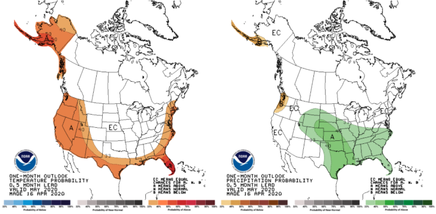
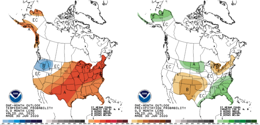
The Climate Prediction Center’s outlook for May is dominated by uncertainty regarding both temperature and precipitation (Figure 1).
Staying true to global climate trends these days, March 2020 finished warmer and wetter than the 1981-2010 climate normal period.
Even the climate models are confused by this year’s weather. When the August monthly outlook was released (July 31st; national Climate Prediction Center) it showed significant confidence that August would have below-normal temperatures and below-normal precipitation.
The brutal heat wave has passed, but there are still plenty of warm days ahead. Climate outlooks (over the next few weeks) are suggesting confidence of above-normal precipitation across Indiana.
Some weeks I wonder if I could just re-use the previous week’s weather and climate article! The story seems to be the same: It’s been wet and more rain is expected.
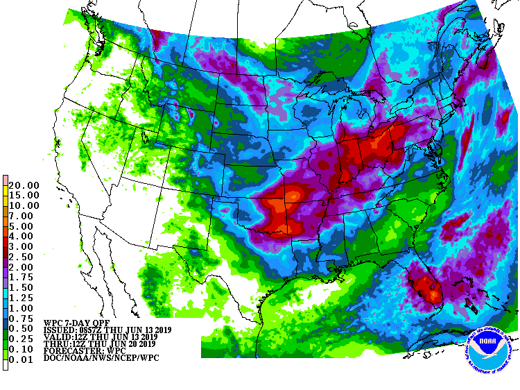
After a welcomed break in the rain for most of the state over the last 7-10 days, that window will close again by this weekend. In fact, the 7-day precipitation forecast (Figure 1) is predicting 2”-4” across Indiana by next Thursday (June 20th). Beyond that date, the climate outlook is showing strong confidence that above-normal precipitation amounts will continue through the following week (June 25th) and into early July. Be prepared for pooling water and potential flash flooding! How unusual has this spring been for Indiana? Believe it or not, this past March-May came in as the 11th wettest spring (15.52”) with respect to the 1895 through 2019 (125 years) time period! The record spring was in 2011 when 19.58” fell across the state (Figure 2). What is interesting to consider is in 2011, after the record-breaking March-June precipitation, the rain all but stopped falling for July through October (Figure[Read More…]
© 2026 Purdue University | An equal access/equal opportunity university | Copyright Complaints | Maintained by Pest&Crop newsletter
If you have trouble accessing this page because of a disability, please contact Pest&Crop newsletter at luck@purdue.edu.
