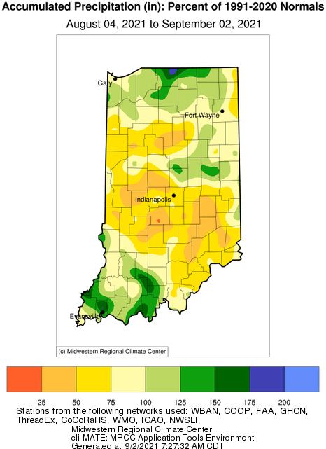
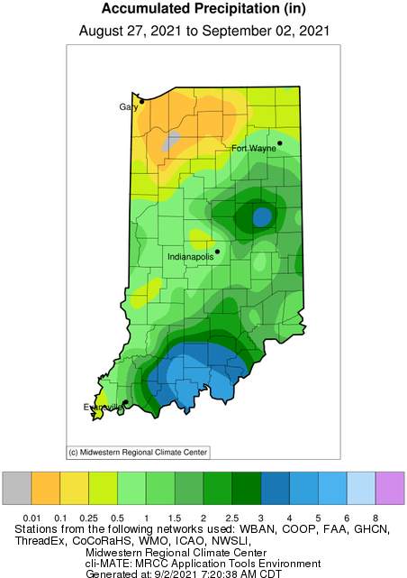
While Hurricane Ida and her remnants have wreaked havoc down south and in the mid-Atlantic states, she was relatively kind and generous when it came to Indiana. Some southern counties received between 4 and 5 inches from Ida (Figure 1). In east central Indiana, similar amounts were felt (e.g., Delaware County), but due more to isolate thunderstorms around August 29th. Will this help alleviate the abnormally dry and moderate drought conditions that have been lingering around the state? Figure 2 puts the last 30 days of precipitation into climatological perspective showing that even with those recent rain events, a considerable amount of the state (particularly those with drought concerns) has only received 50% to 75% of what is typical for this time of year with respect to precipitation amounts.

Figure 2. Precipitation from August 4 to September 2, 2021 presented as a percentage to the 1991-2020 climatological normal.
Heat index values have been high lately due to high humidity and calmer winds. However, the forecasts are predicting dew point temperatures in the 50s*, which should make conditions feel less muggy. For the next several weeks, climate outlooks are favoring below-normal temperatures and precipitation. By mid-September, outlooks are suggesting temperatures should return to normal or may lean towards above-normal conditions with precipitation still remaining fairly dry. It seems fall conditions are trying to push summer behind us!
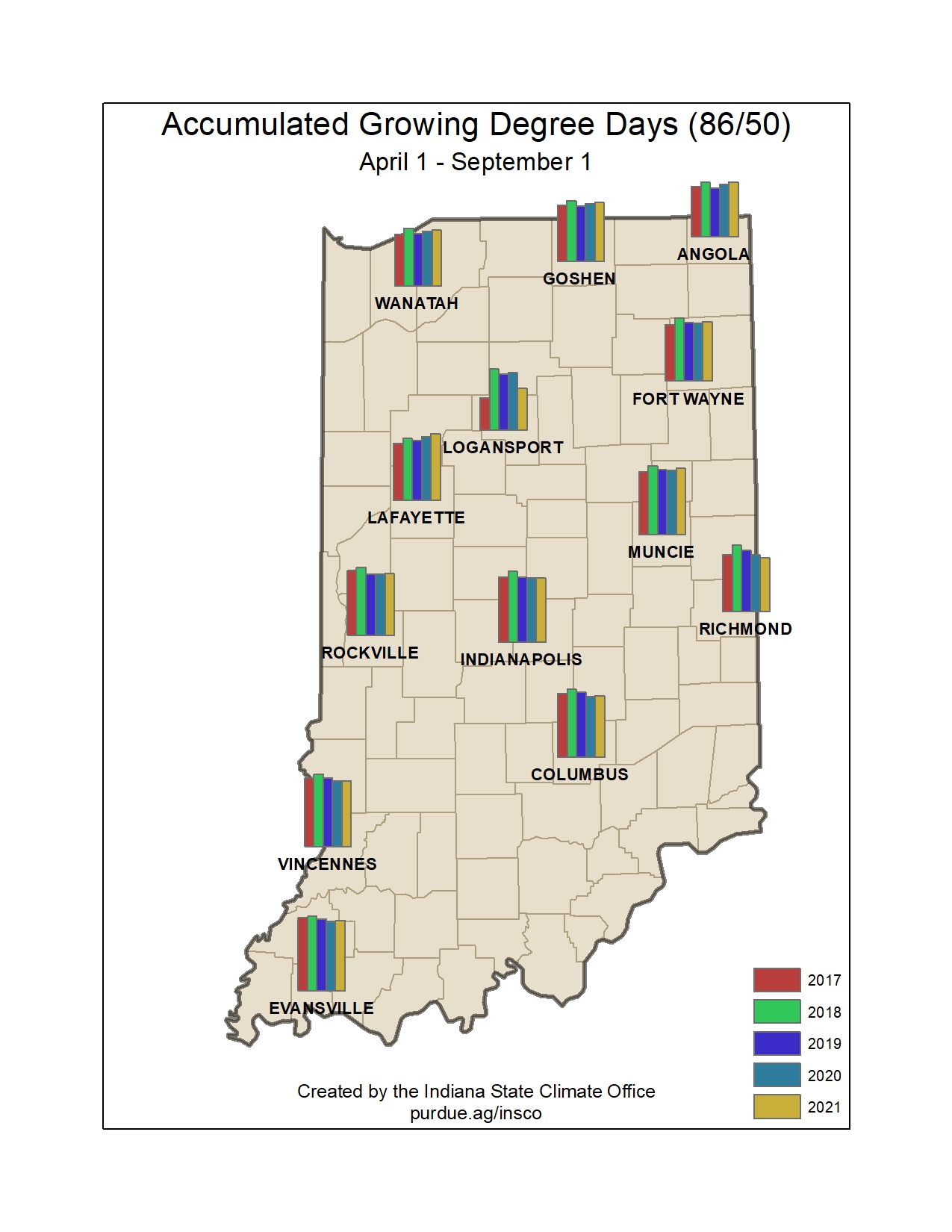
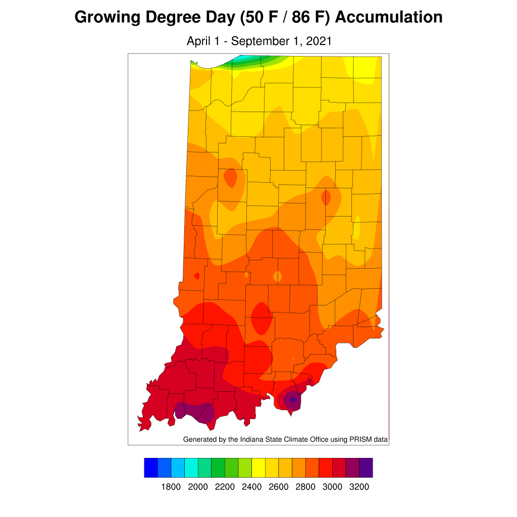
Modified growing degree-day accumulations are now ranging from around 2400 units in northern Indiana to above 3000 units in southern Indiana (Figure 3). While southern Indiana seems to still be lagging behind the climatological average for this period (April 1 through September 2), the northern part of the state is now around 100 to 150 units ahead of average (Figure 4). Figure 5 shows the comparison of this year’s modified growing degree-day accumulations compared to recent years.
*The lower the dew point temperature, and further away it is from the actual temperature, the drier the air.

Figure 4. The accumulated modified growing degree day departure from the 1991-2020 average for April 1 through September 1, 2021.

Figure 5. Comparison of 2021 modified growing degree day accumulations from April 1 – September 1 to the past four years.


