

Just when we thought we were done wearing sweaters and using our furnaces, Mother Nature decided to throw us a curve ball.
Just when we thought we were done wearing sweaters and using our furnaces, Mother Nature decided to throw us a curve ball.
March wrapped up as one of Indiana’s wettest (44th wettest out of 126 years) and warmest (16th warmest).
Current temperatures and rainfall report.
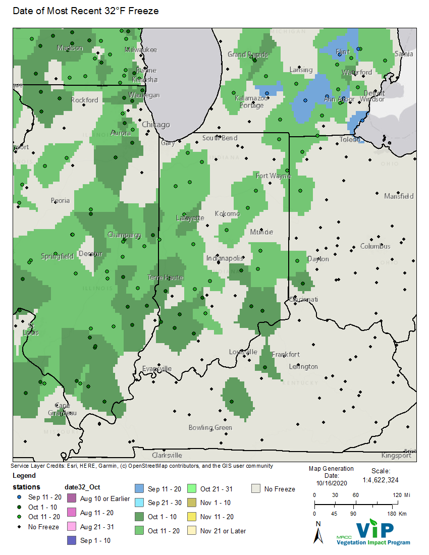
Overnight low temperatures the morning of October 16th reached into the low 30s (Fahrenheit), bringing an end to the growing season for a lot of vegetation across Indiana (Figure 1).
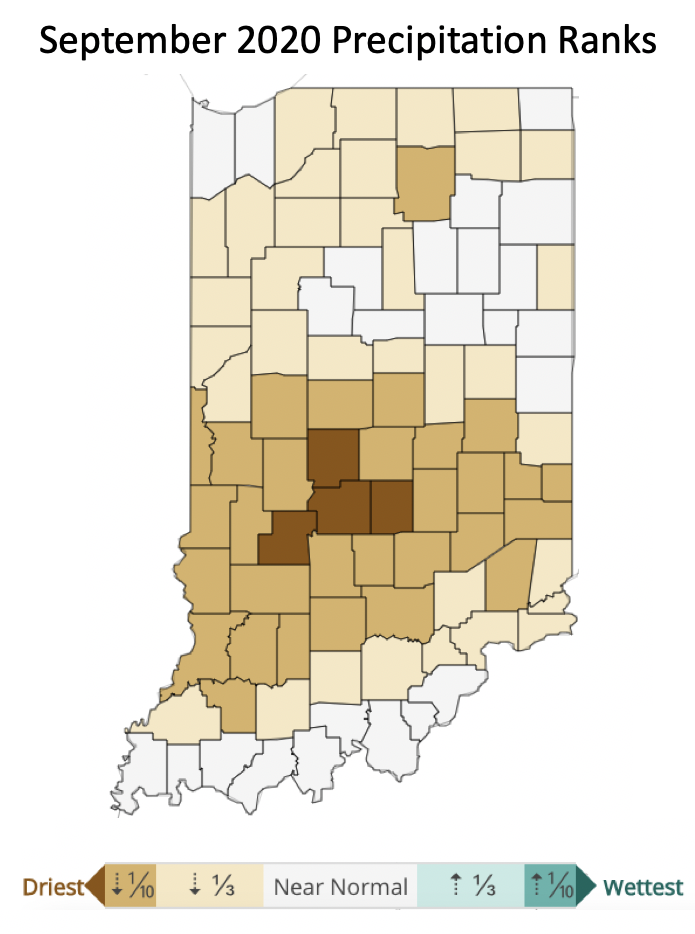
September was dry across Indiana with some counties being the driest on record since 1895 (Figure 1).
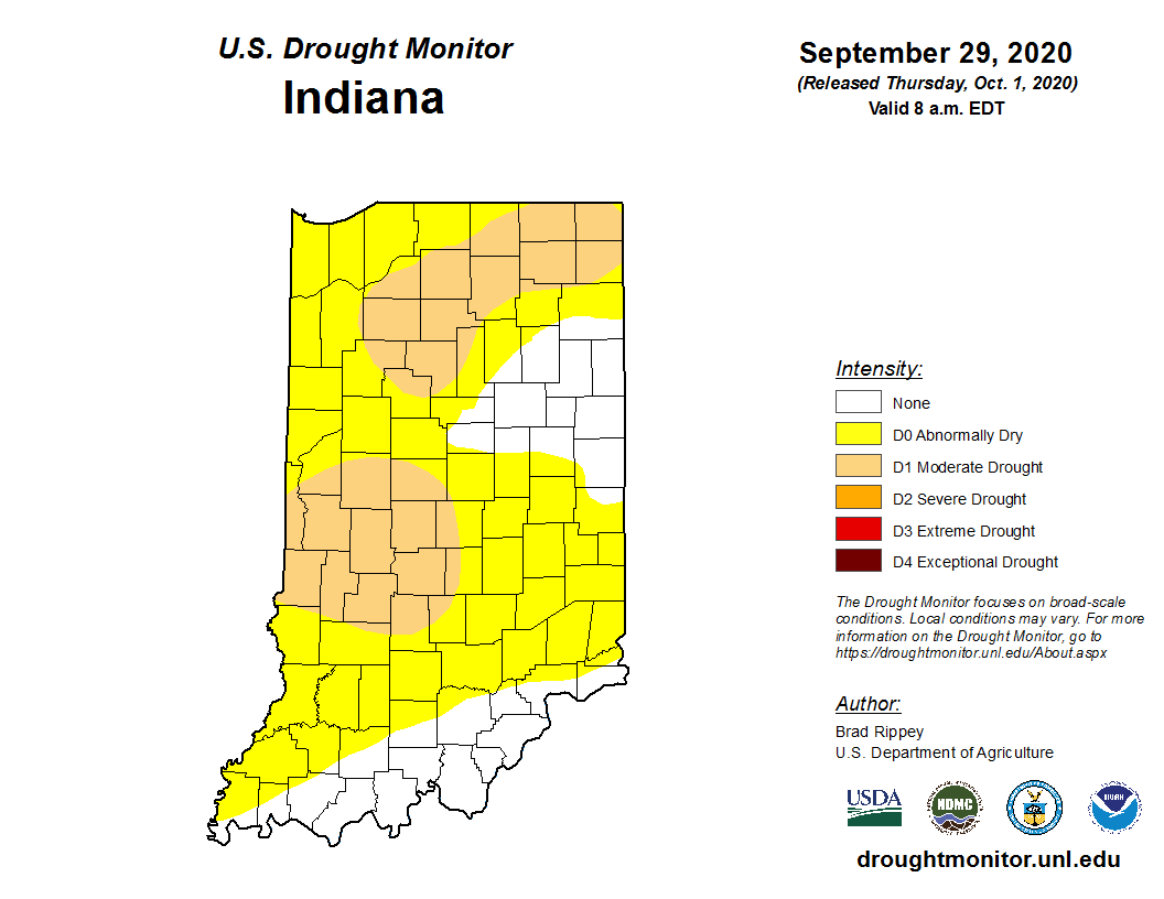
Abnormally dry/drought conditions continue across most of Indiana.
The climate outlooks from the national Climate Prediction Center are indicating significant confidence for below-normal precipitation through the first week of October and the monthly precipitation outlook for October is indicating slight confidence for below-normal precipitation throughout the month.
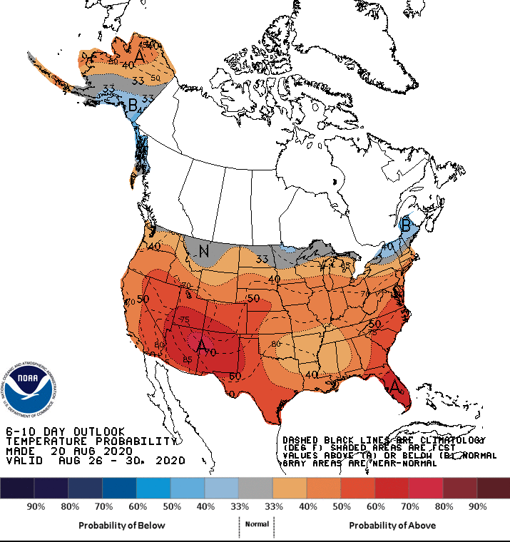
In last week’s article, cooler and wetter conditions were noted for the first half of September with some uncertainty for the latter half of the month.
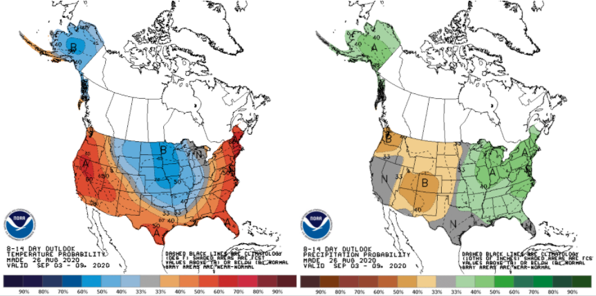
After the last several weeks of predominantly dry conditions, the national climate outlooks are finally showing confidence that temperatures should start shifting to cooler than normal and precipitation will be wetter than normal (Figure 1).
This past week has been so enjoyable temperature- and humidity-wise that it was easy to hope that it was going to stay this way for several more weeks.
© 2026 Purdue University | An equal access/equal opportunity university | Copyright Complaints | Maintained by Pest&Crop newsletter
If you have trouble accessing this page because of a disability, please contact Pest&Crop newsletter at luck@purdue.edu.
