

Weather Update: Moisture And Temperature
Weather Update: Moisture And Temperature

As we welcome July, Indiana seems to be in a very wet phase. Or, at least part of the state has been.
For those keeping track, last week’s article (“How likely will drought develop or worsen in Indiana”) and the article two weeks ago (“Nature’s faucets predicted to be turning off for the rest of the month”) had an overlapping theme – Indiana is behind in precipitation amounts from the climatological normals and the climate outlooks are not too confident that above-normal precipitation will catch the state up from its deficits.
The news of the disastrous drought and extreme heat in the western United States (US) have local folks wondering if Indiana might be next.
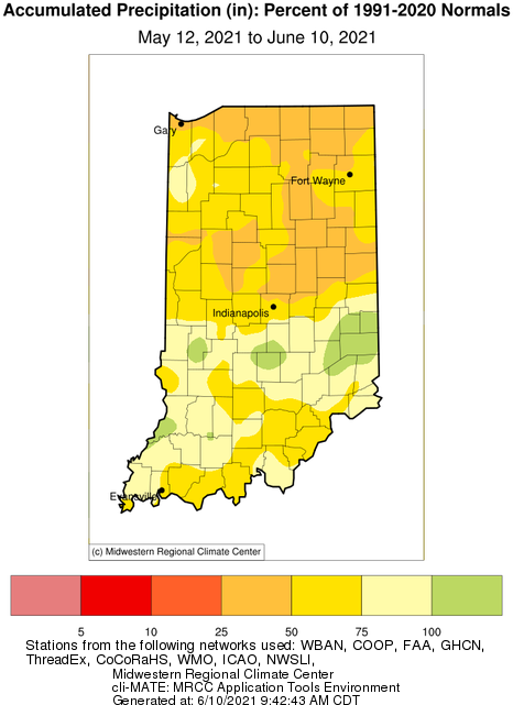
While rain showers and scattered thunderstorms have fallen across Indiana the last few weeks, conditions still remain dry for most areas.
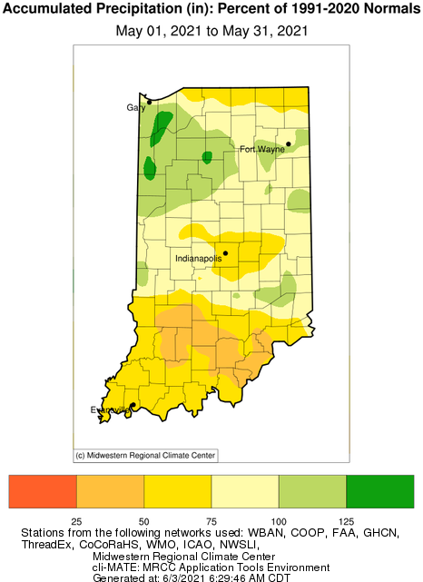
The month of May in Indiana was 2°F-4°F below normal across the state, based upon the new 1991-2020 climatological normals that were released last month.
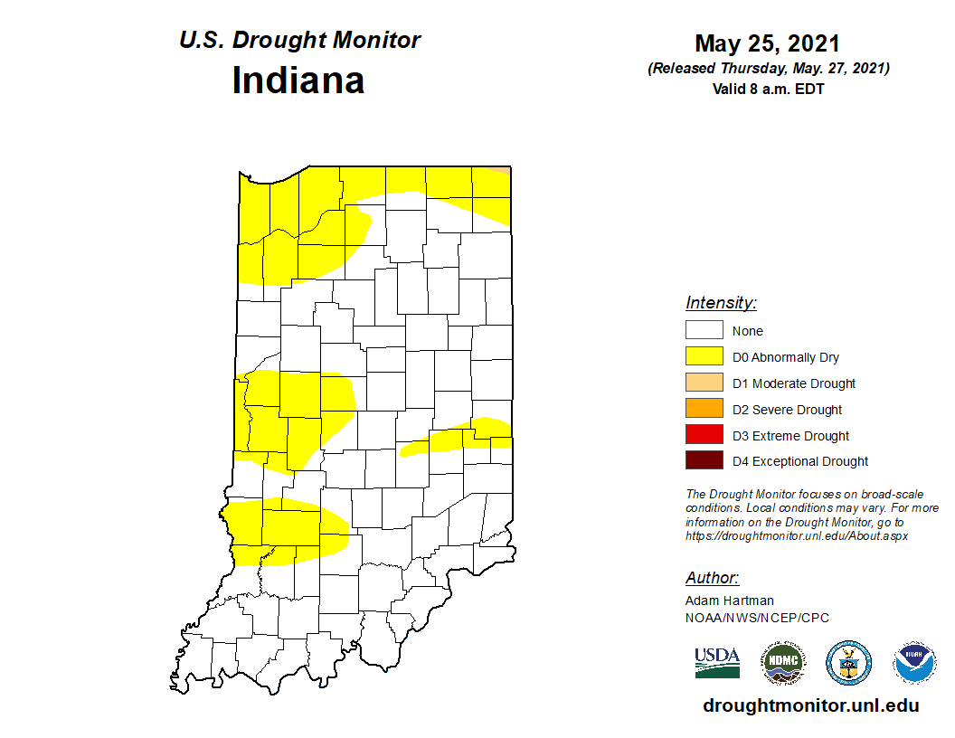
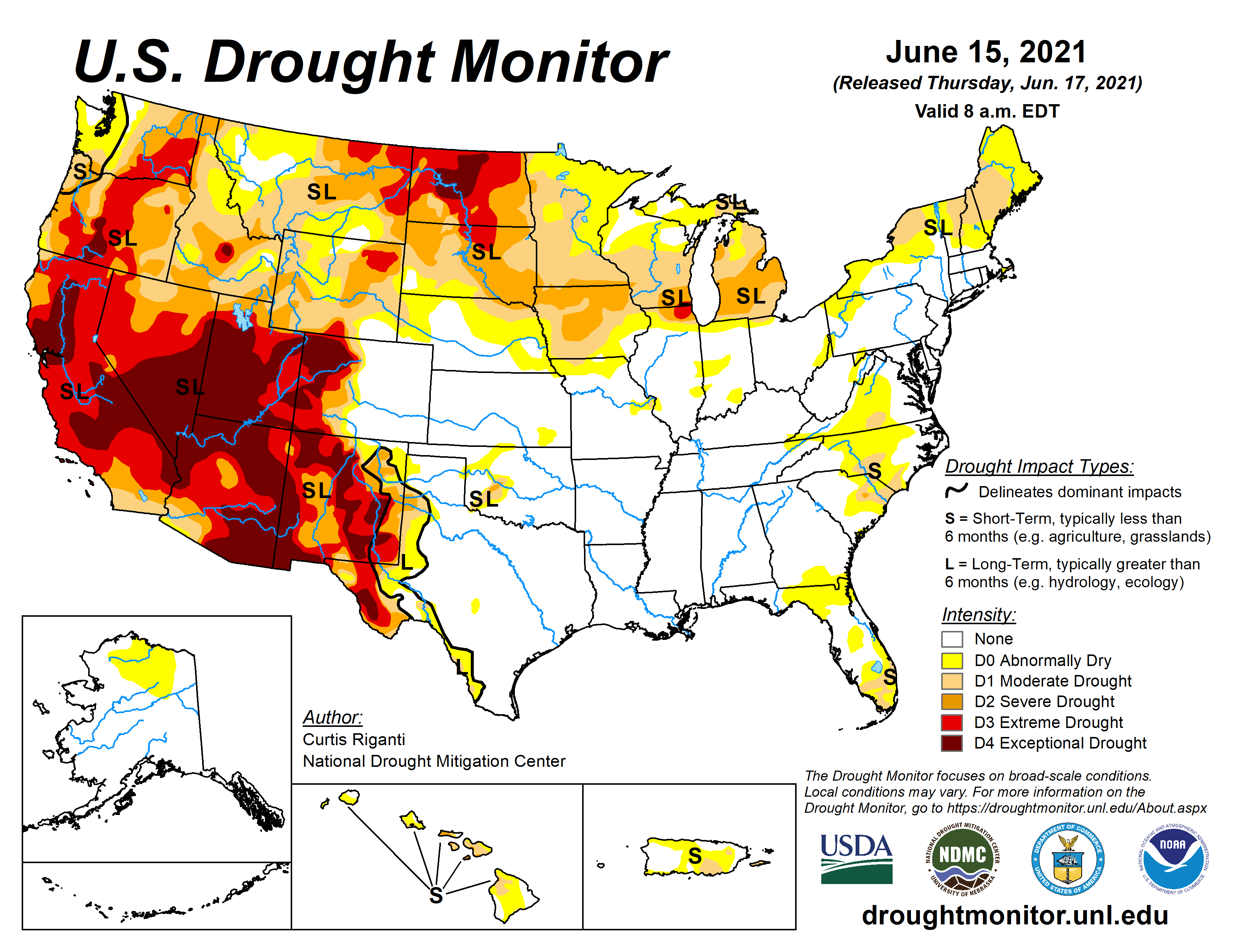
Abnormally dry conditions are continuing to linger across Indiana as temperatures, and therefore evapotranspiration, increase (Figure 1).
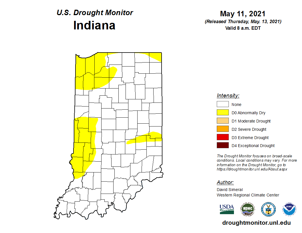
Abnormally dry conditions are still lingering in parts of Indiana (Figure 1) with interest growing on how much the warmer weather might exacerbate the situation.
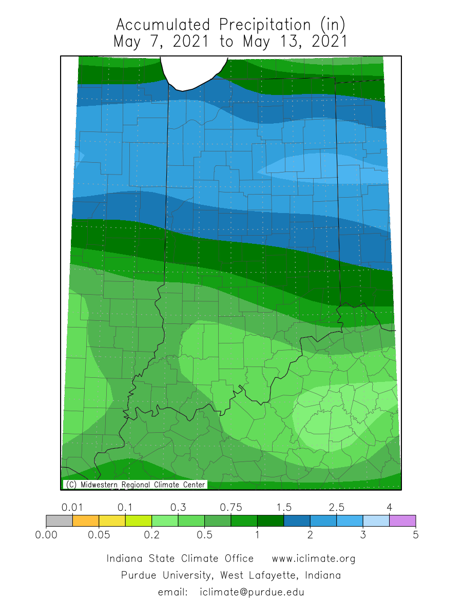
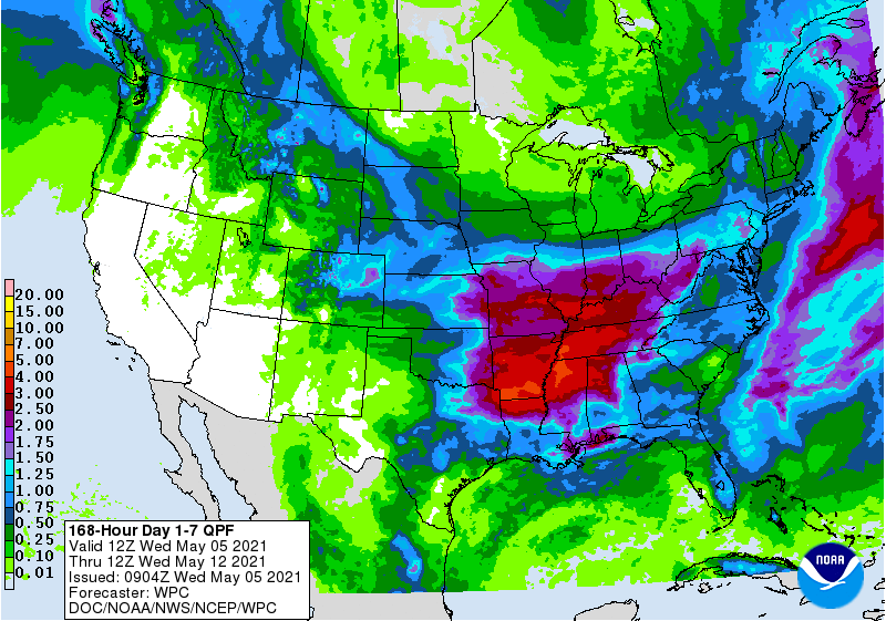
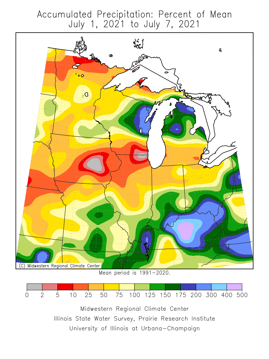
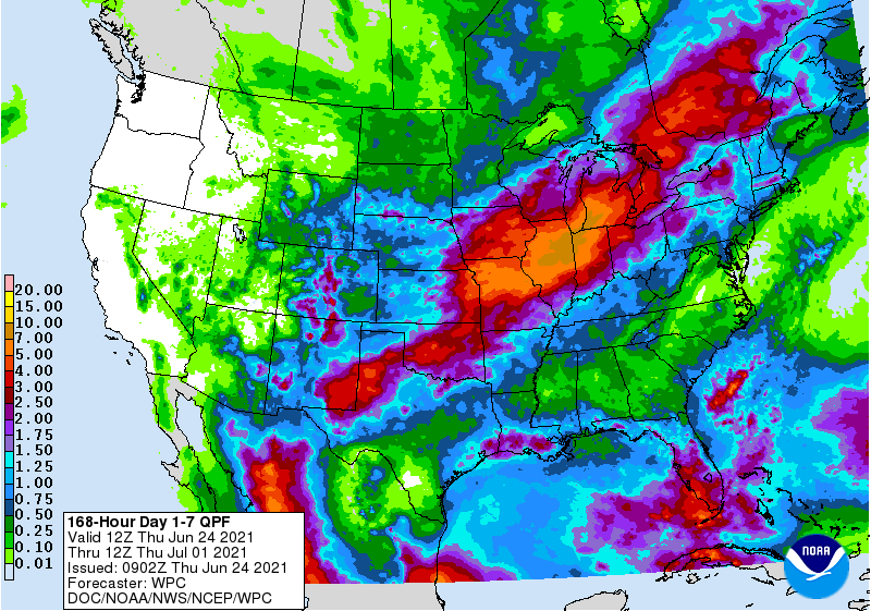
It seems the weather pattern may have shifted toward wetter conditions. Over the past week, Indiana has received over an inch of rain and the 7-day forecast is predicting at least another inch (Figure 1) in the central and southern parts of the state.
© 2026 Purdue University | An equal access/equal opportunity university | Copyright Complaints | Maintained by Pest&Crop newsletter
If you have trouble accessing this page because of a disability, please contact Pest&Crop newsletter at luck@purdue.edu.
