

While rain showers and scattered thunderstorms have fallen across Indiana the last few weeks, conditions still remain dry for most areas. Over the last 30 days, the precipitation has been between 25% to 75% of what is normal for the northern part of the state with the southern part of state seeing a mixture of above- and below-normal amounts for that time period (Figure 1). This means abnormally dry conditions are still lingering in various pockets across the state, including the northern counties, west-central counties, and even a few southeast counties near the Ohio River (Figure 2). There is still a long growing season ahead of us and June is typically the wettest month of the April through October period. Groundwater supplies are still limited and low in many places in northern Indiana, so be cognizant when determining water usage.
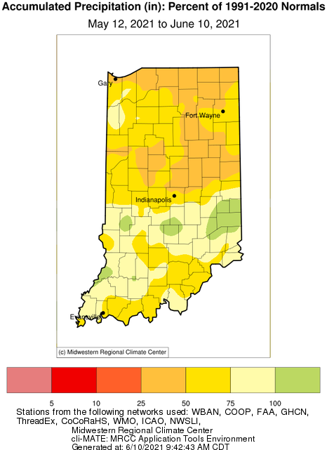
Figure 1. Accumulated precipitation from May 12 through June 10, 2021 represented as a percent of the climatological normal amounts for the 1991-2020 period.
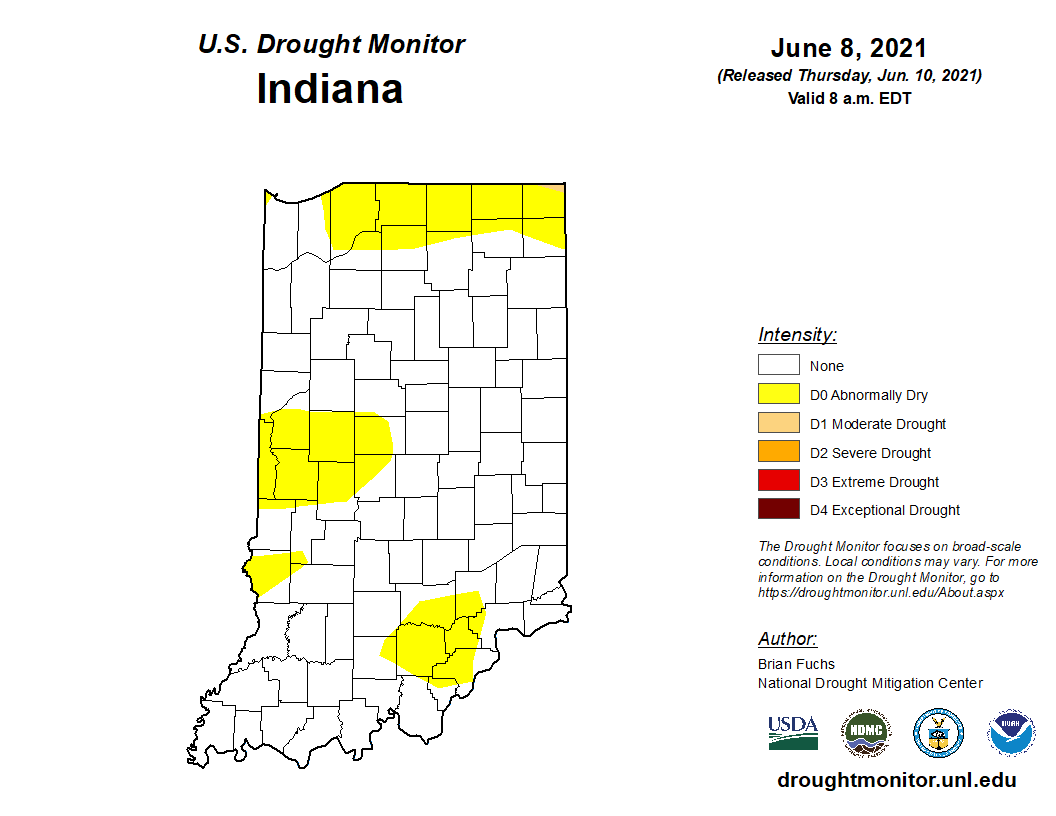
Figure 2. US Drought Monitor state for Indiana as of June 8, 2021.
Temperatures for the rest of June are expected to be rather typical for this time of year, which is hopefully good. This should keep evapotranspiration rates down. Modified growing degree-day (MGDD) accumulations are trying to catch up to amounts seen in recent years. This upcoming weekend will be warm, which will increase the rate of those accumulations. Figures 3 and 4 show the MGDD accumulation since April 1 and how this year compares to recent years. There are no significant weather or climate hazards expected over the next few weeks.
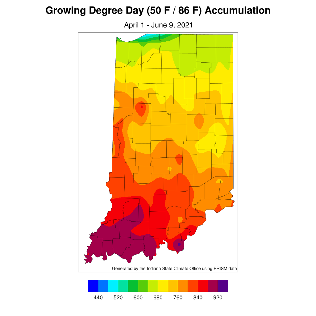
Figure 3. Modified growing degree day accumulations from April 1 to June 9, 2021.
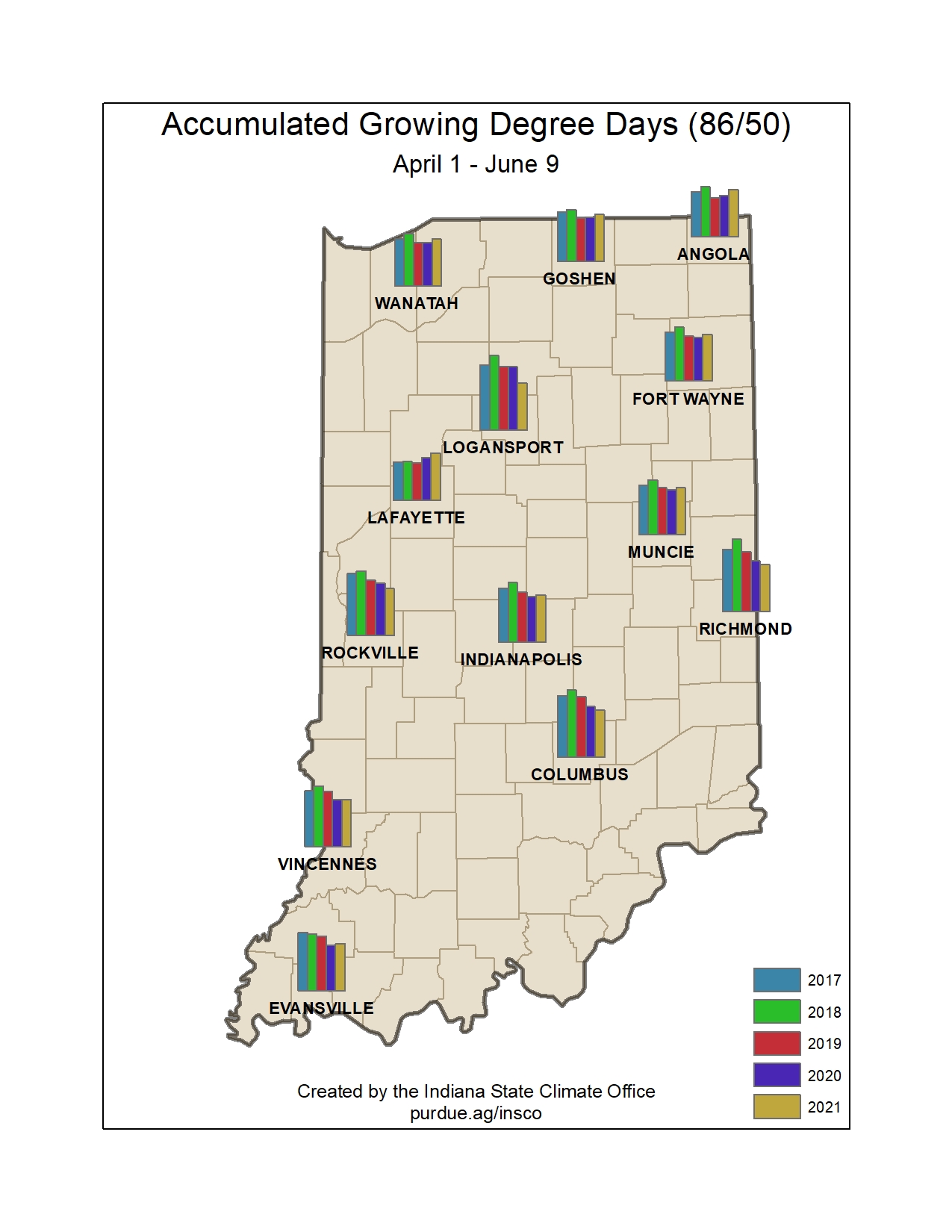
Figure 4. Comparison of 2021 modified growing degree day accumulations from April 1 – June 9 to the past four years.
