

It is May, the sun is shining, of course the wind is blowing, and the weather forecast is calling for warmer temperatures.
It is May, the sun is shining, of course the wind is blowing, and the weather forecast is calling for warmer temperatures.
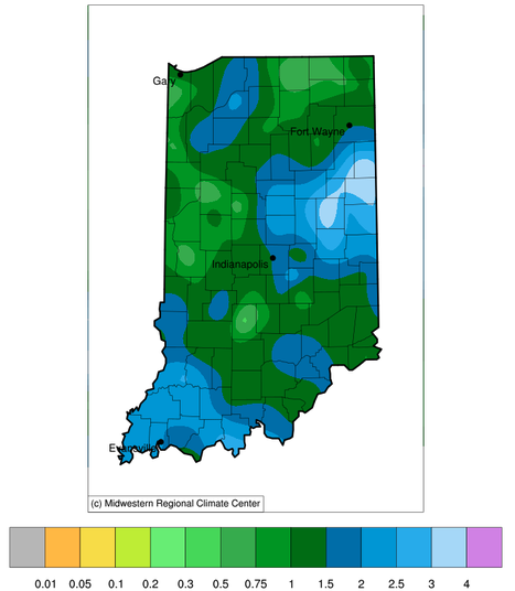
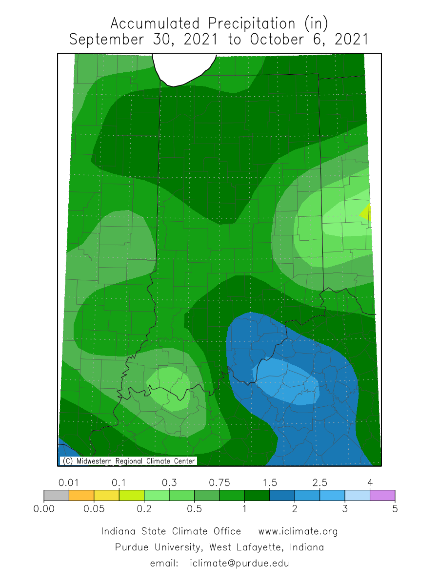
This past weekend brought some much-needed rain to the Hoosier state.
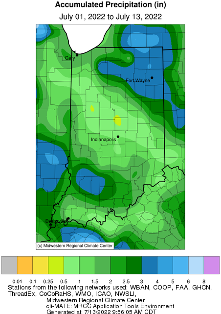
The June 2022 state average precipitation was 2.42 inches below the 1991-2020 normal, which ended up being the 14th driest on record.
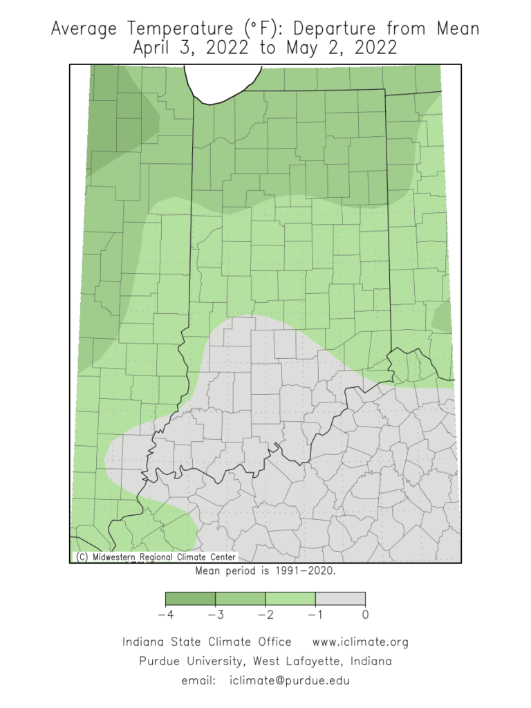
Over the last 30 days (April 3 – May 2), average temperatures ran below normal for most of the state (Figure 1).
It seems to be a big challenge these days to find two or more consecutive days without precipitation.
Weather
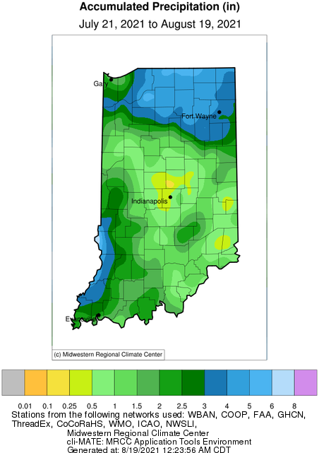
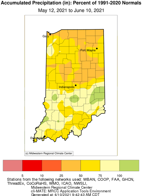
Precipitation and storm tracks this year seem to be stagnating in patterns that have caused some parts of Indiana to feel as if they are drowning and other parts to feel like they are in a drought. Indiana is not a particularly large state, so it is impressive to see the extremes across such a short area. Sometimes, these extremes can be explained from just one or two storm events that pass through, but recently it seems to be a series of events that set up this polarized pattern of precipitation winners and losers. Figure 1 shows the 30-day accumulated precipitation presented as the percent of mean climatology for Indiana from July 21 to August 19. Central Indiana has been experiencing dry conditions with some locations only have received 25%-50% of what they would normally receive during that time period. In contrast, northeastern and southwestern Indiana have experienced a surplus[Read More…]
The national Climate Prediction Center updates their monthly climate outlooks in the middle and last day of each month.
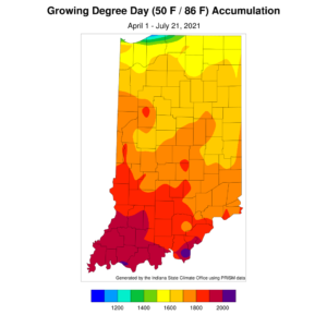
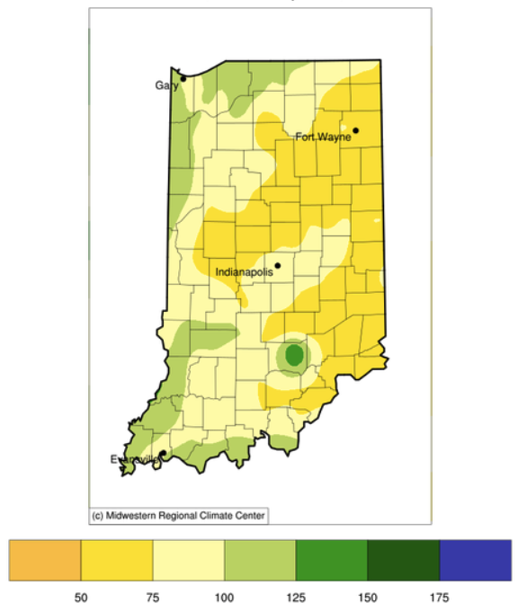
After several weeks of above-normal precipitation across much of Indiana, we are now entering a relative dry period. The national Climate Prediction Center is indicating enhanced chances for below-normal precipitation amounts over the next several weeks. Temperatures are also expected to be above normal over this period which will cause increased rates of evapotranspiration. This may induce the onset and establishment of a flash drought – defined as a rapid intensification of drought conditions and impacts sustained for a relatively short amount of time (e.g., less than a year). The key is to start planning and preparing for this now, even if a flash drought does not end up developing, so that one is being proactive rather than reactive to drought impacts. Modified growing degree days range from about 1500 units (northern Indiana) to 200 units (southern Indiana) (Figure 1). With temperatures being relatively mild lately, this has kept accumulated[Read More…]
While rain showers and scattered thunderstorms have fallen across Indiana the last few weeks, conditions still remain dry for most areas.
© 2026 Purdue University | An equal access/equal opportunity university | Copyright Complaints | Maintained by Pest&Crop newsletter
If you have trouble accessing this page because of a disability, please contact Pest&Crop newsletter at luck@purdue.edu.
