

Expect increased possibilities of above normal precipitation through the mid-September, particular in northern regions of the state
Expect increased possibilities of above normal precipitation through the mid-September, particular in northern regions of the state
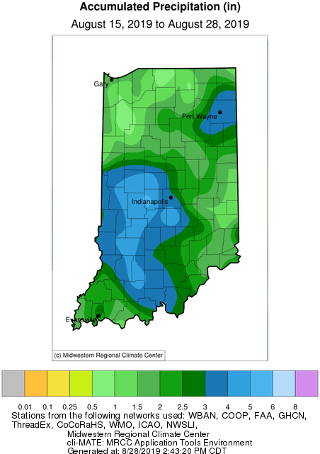
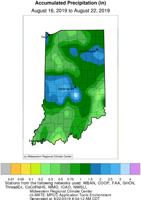
The big story this week was the much-needed rain throughout most of Indiana that fell on Monday (August 19th).
Sporadic rain events are barely bringing relief to sections of Indiana .
The brief rain event earlier this week brought some precipitation to the state. However, the drier regions of the north could use more rain soon!
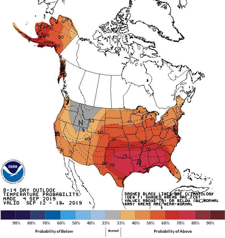
The brutal heat wave has passed, but there are still plenty of warm days ahead. Climate outlooks (over the next few weeks) are suggesting confidence of above-normal precipitation across Indiana.
While the remnants of Hurricane Barry brought some much-needed precipitation to the state, the next few weeks look to be on the dry side.
When I was very young, I remember my father talking about “knee high by the Fourth of July”.
Outlook into early next week looks favorable for a dry weekend, but chances for precipitation around the state pop back up around Tuesday.
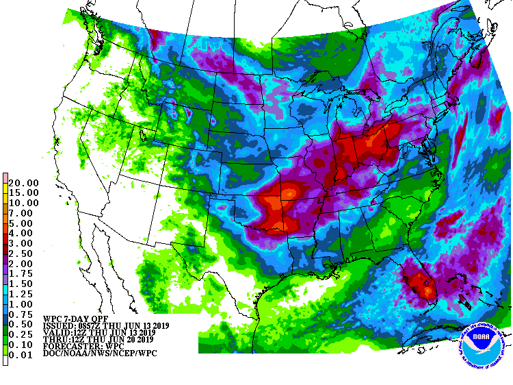
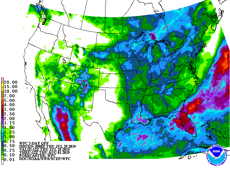
After a welcomed break in the rain for most of the state over the last 7-10 days, that window will close again by this weekend. In fact, the 7-day precipitation forecast (Figure 1) is predicting 2”-4” across Indiana by next Thursday (June 20th). Beyond that date, the climate outlook is showing strong confidence that above-normal precipitation amounts will continue through the following week (June 25th) and into early July. Be prepared for pooling water and potential flash flooding! How unusual has this spring been for Indiana? Believe it or not, this past March-May came in as the 11th wettest spring (15.52”) with respect to the 1895 through 2019 (125 years) time period! The record spring was in 2011 when 19.58” fell across the state (Figure 2). What is interesting to consider is in 2011, after the record-breaking March-June precipitation, the rain all but stopped falling for July through October (Figure[Read More…]
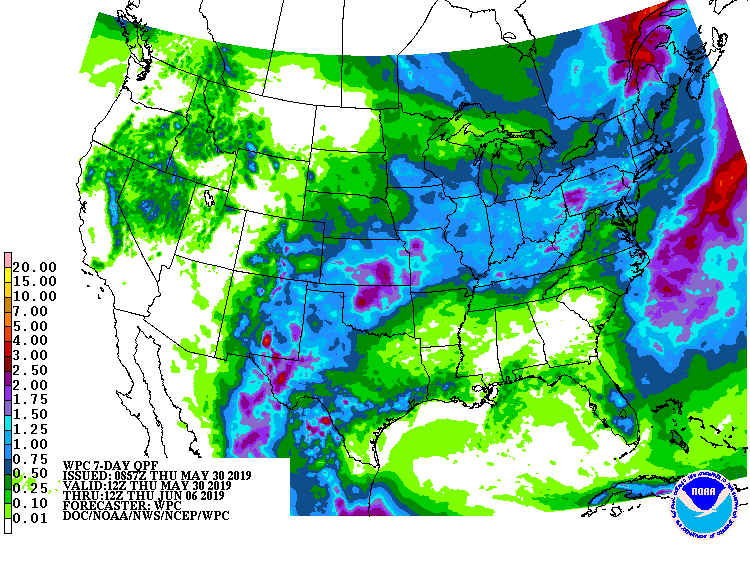
The story of excessive rain and soil moisture continues and the 7-day precipitation forecast suggests this wet pattern will continue (Fig. 1). When looking at the precipitation percent of mean for May 1-30, 2019, the southern half of the state received near normal amounts.
© 2026 Purdue University | An equal access/equal opportunity university | Copyright Complaints | Maintained by Pest&Crop newsletter
If you have trouble accessing this page because of a disability, please contact Pest&Crop newsletter at luck@purdue.edu.
