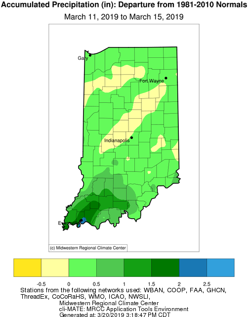
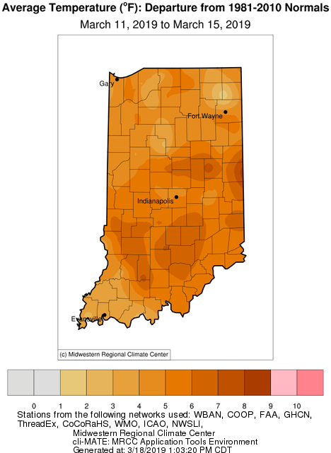
Last week, spring-like temperatures teased most of the Hoosier State with temperatures 5°F-8°F above normal (see Figure). While this encouraged more folks to get outside and enjoy the warmer weather, the week ended with a return to colder, windier conditions. Storms brought excess rainfall to the southwestern part of the state with near-normal precipitation elsewhere. By the end of this week, there are strong indications that temperatures will start to warm again with precipitation forecasts neither too wet nor too dry. Next week’s outlooks have increased confidence in above-normal precipitation, but without extreme amounts for large-scale flooding. Growing degree-days (base 50°F) have yet to significantly accumulate and there are still significant risks for several more freeze events based upon climatology. For more information on climate outlooks, visit the National Oceanic and Atmospheric Administration’s Climate Prediction Center (https://www.cpc.ncep.noaa.gov/).


