

The story of excessive rain and soil moisture continues and the 7-day precipitation forecast suggests this wet pattern will continue (Fig. 1). When looking at the precipitation percent of mean for May 1-30, 2019, the southern half of the state received near normal amounts. However, the northern half has experiences well over normal amounts with some areas receiving double the average amount (Fig. 2). Regardless, the April rains and lack of significant warm temperatures have kept the ground close to saturation so even normal precipitation is causing flooding (Fig. 3). The climate outlook for June is too uncertain for the National Center for Environmental Prediction to provide significant probability of either above- or below-normal precipitation. However, the 3-month climate outlook (valid for June – August) is predicting a significant chance of above-normal precipitation.
Modified growing degree-days (MGDDs) since April 1 have accumulated to 400-800 units (from north to south) across the state, which is approximately 90 units less than average in the northern parts of the state and 90 units greater than average in the southern parts. Similar to the precipitation outlook, the temperature outlook for June showed no statistical confidence that Indiana will be either warmer or cooler than normal.
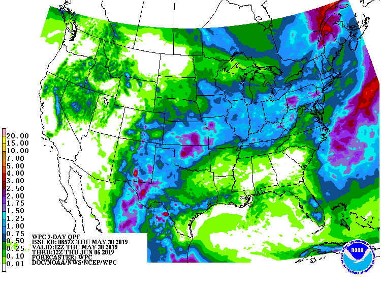
Fig. 1. 7-day precipitation forecast representing May 30 – June 6, 2019. Source: NOAA Weather Prediction Center
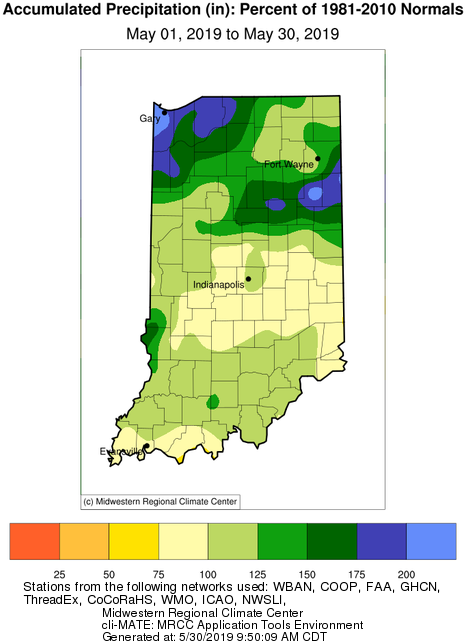
Fig. 2. Accumulated precipitation percent of mean for May 1-29, 2019 compared to 1981-2010 normals.
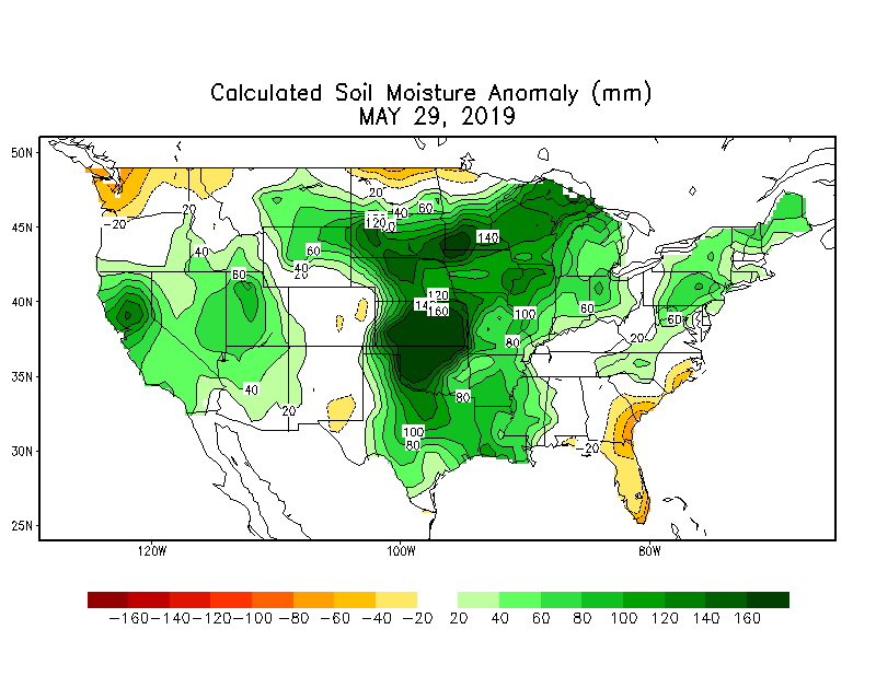
Fig. 3. Soil moisture anomaly (in millimeters) for 28 May 2019. Source: NOAA Climate Prediction Center.
