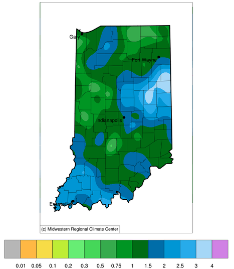
This past weekend brought some much-needed rain to the Hoosier state.

This past weekend brought some much-needed rain to the Hoosier state.
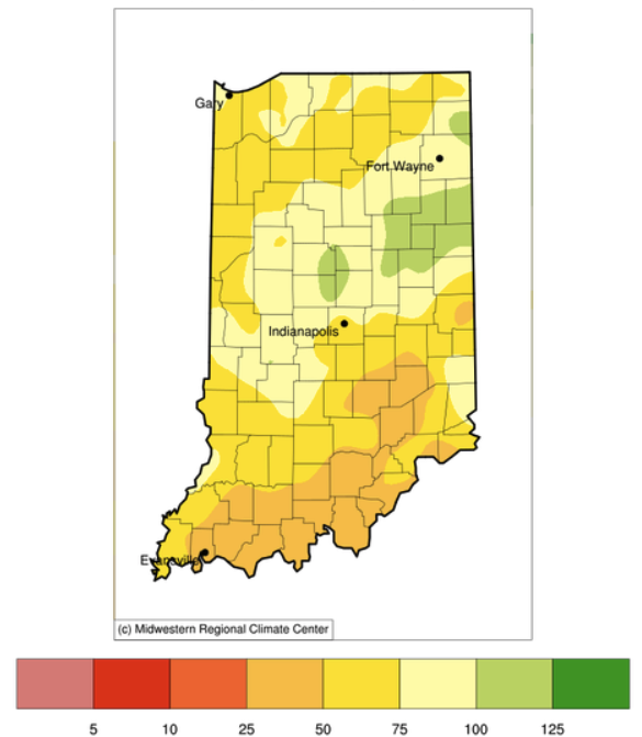
Indiana has been receiving less precipitation than normal, particularly over the last 30 days (Figure 1).
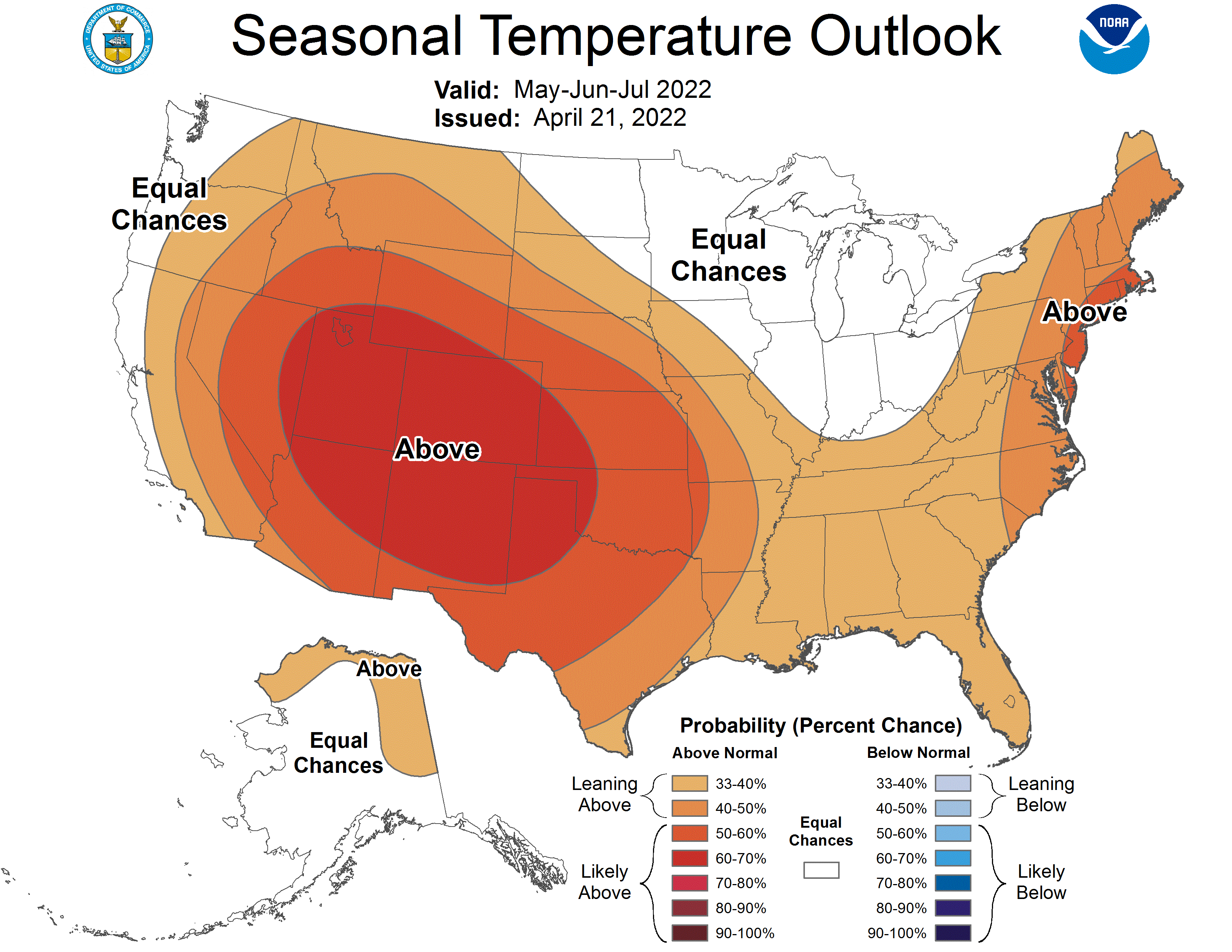
On the third Thursday of every month, the national Climate Prediction Center releases their 3-month climate outlook for temperature and precipitation.
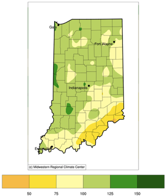
Indiana adds one more week to its months-long streak of having no drought across the state. In fact, from March 1st through April 14th (45 days), 35 of those days (78%) had precipitation in South Bend (31 days), Indianapolis (26 days), and/or Evansville (25 days).
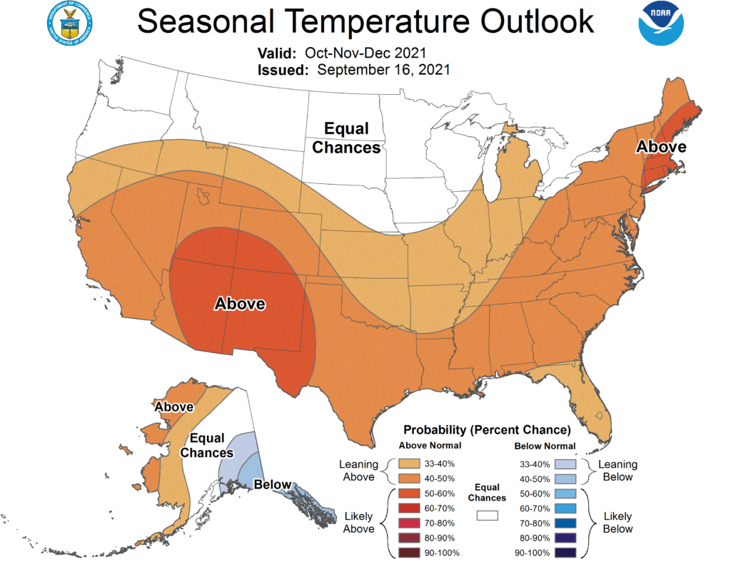
The most recent climate outlooks for the October through December period is slightly favoring above-normal temperatures (Figure 1) with equal chances for above-normal, below-normal, or normal precipitation across Indiana (Figure 2). The climate outlooks for October are more strongly favoring above-normal temperatures across the state with precipitation being only slightly favored for the northeastern part of the state.
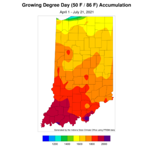
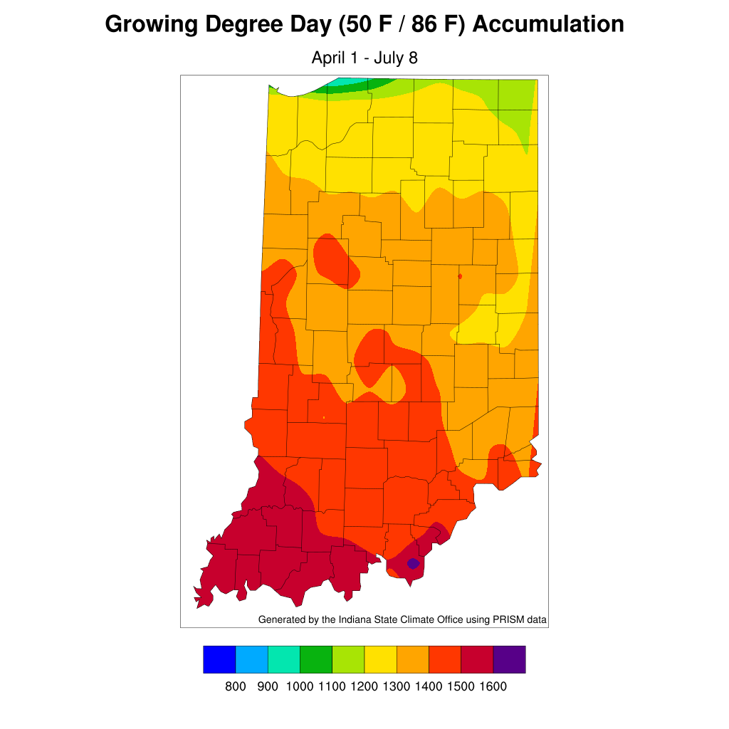
After several weeks of above-normal precipitation across much of Indiana, we are now entering a relative dry period. The national Climate Prediction Center is indicating enhanced chances for below-normal precipitation amounts over the next several weeks. Temperatures are also expected to be above normal over this period which will cause increased rates of evapotranspiration. This may induce the onset and establishment of a flash drought – defined as a rapid intensification of drought conditions and impacts sustained for a relatively short amount of time (e.g., less than a year). The key is to start planning and preparing for this now, even if a flash drought does not end up developing, so that one is being proactive rather than reactive to drought impacts. Modified growing degree days range from about 1500 units (northern Indiana) to 200 units (southern Indiana) (Figure 1). With temperatures being relatively mild lately, this has kept accumulated[Read More…]
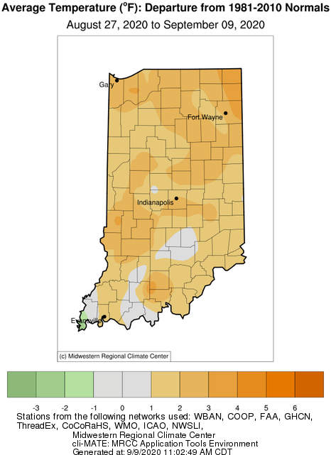
For those keeping track of my articles over the last few weeks, the outlooks of wetter and cooler than normal conditions have been the theme. The cooler temperatures never really came to fruition. In fact, most of Indiana was 1°F to 3°F above normal over the past two weeks (Figure 1)! Regarding the wetter-than-normal precipitation outlook, northern counties, northeastern Indiana, as well as along the Ohio River received above normal precipitation. However, the rest of the state experienced 1” to 2” less-than-normal precipitation over the past 2-week period (Figure 2). Even the above-normal precipitation in the northern and northeastern counties have had little impact relieving the developing drought conditions!
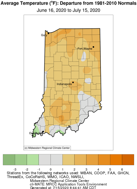
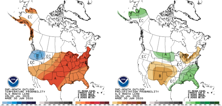
The past 30 days have been met with warmer than normal temperatures in the northern counties and drier than normal conditions throughout most of the state. This warm and dry environment is conducive to developing drought – particularly with the increased evapotranspiration rates. While climate outlooks are calling for increased confidence of above-normal precipitation throughout the rest of July, these events are likely to remain spotty with inconsistent coverage across the state.
The forecasts and climate outlooks are still calling for hot and dry (though humid) conditions for the rest of July.
The roller coaster ride of Indiana weather continues.
© 2026 Purdue University | An equal access/equal opportunity university | Copyright Complaints | Maintained by Pest&Crop newsletter
If you have trouble accessing this page because of a disability, please contact Pest&Crop newsletter at luck@purdue.edu.