

It seems to be a big challenge these days to find two or more consecutive days without precipitation.

It seems to be a big challenge these days to find two or more consecutive days without precipitation.
On the third Thursday of every month, the national Climate Prediction Center releases their 3-month climate outlook for temperature and precipitation.
Indiana adds one more week to its months-long streak of having no drought across the state. In fact, from March 1st through April 14th (45 days), 35 of those days (78%) had precipitation in South Bend (31 days), Indianapolis (26 days), and/or Evansville (25 days).

The Indiana State Climate Office (IN-SCO) hosted a climate services summit in early June 2021.
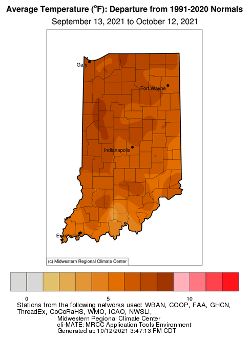
The last several weeks have certainly been warmer than normal.
Weather
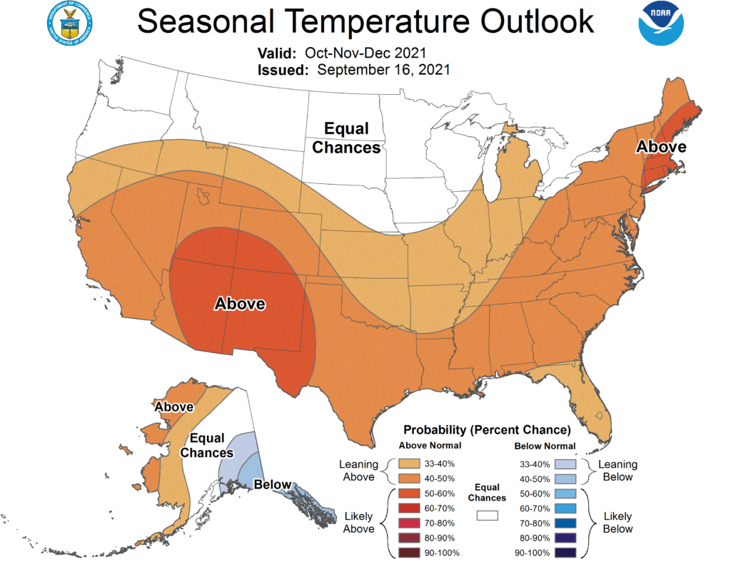
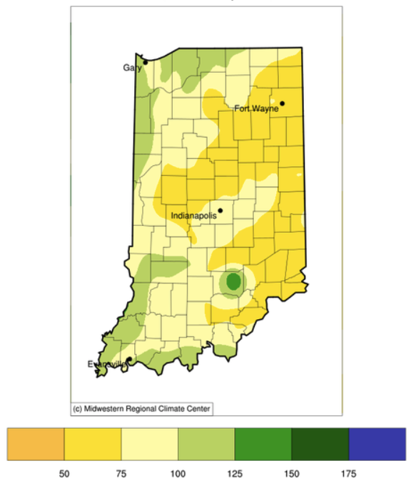
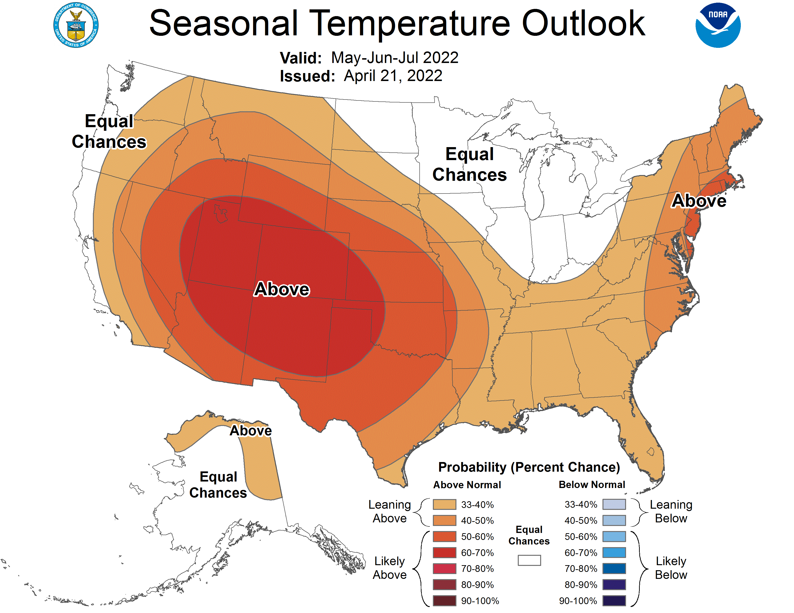
The most recent climate outlooks for the October through December period is slightly favoring above-normal temperatures (Figure 1) with equal chances for above-normal, below-normal, or normal precipitation across Indiana (Figure 2). The climate outlooks for October are more strongly favoring above-normal temperatures across the state with precipitation being only slightly favored for the northeastern part of the state.
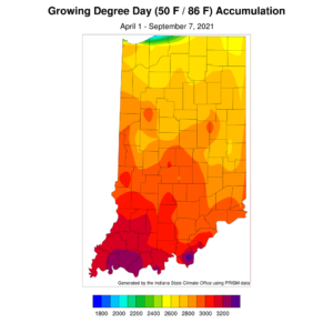
Enjoy these cooler, drier September days while you can. Climate outlooks from the national Climate Prediction Center are strongly favoring above-normal temperatures for the 6-to-10-day period of September 14th through 18th. Precipitation outlooks are slightly favoring above-normal conditions, but will then shift to drier-than-normal conditions. This should mean fewer muggy days with lower heat index values. The average September temperatures across Indiana – based upon the 1991-2020 period – range in the 60s with daytime highs between 75°F and 80°F. Therefore, even if the climate outlook holds true, above-normal temperatures in September should be more tolerable than in July or August. Modified growing degree-day (MGDD) accumulations since April 1 currently range from slightly above around 2500 units in northern Indiana to slightly over 3200 units in southern Indiana (Figure 1). This is around 80 to 140 units above normal in the northern part of the state and 50-100 units below[Read More…]
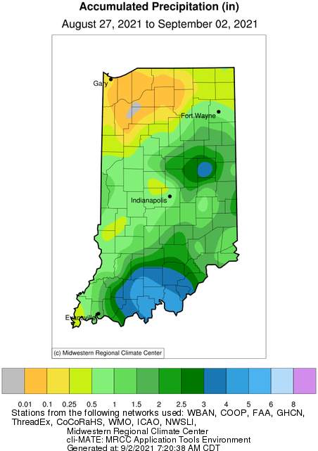
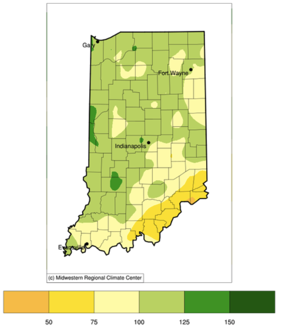
While Hurricane Ida and her remnants have wreaked havoc down south and in the mid-Atlantic states, she was relatively kind and generous when it came to Indiana. Some southern counties received between 4 and 5 inches from Ida (Figure 1).

Precipitation and storm tracks this year seem to be stagnating in patterns that have caused some parts of Indiana to feel as if they are drowning and other parts to feel like they are in a drought.
© 2026 Purdue University | An equal access/equal opportunity university | Copyright Complaints | Maintained by Pest&Crop newsletter
If you have trouble accessing this page because of a disability, please contact Pest&Crop newsletter at luck@purdue.edu.
