

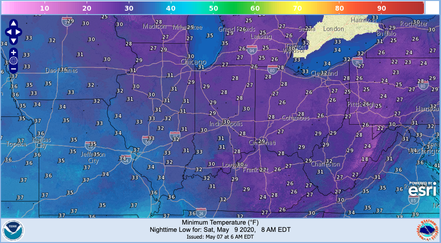
Two weekends ago, Indiana was facing freezing temperatures that broke numerous records across the state.
Two weekends ago, Indiana was facing freezing temperatures that broke numerous records across the state.
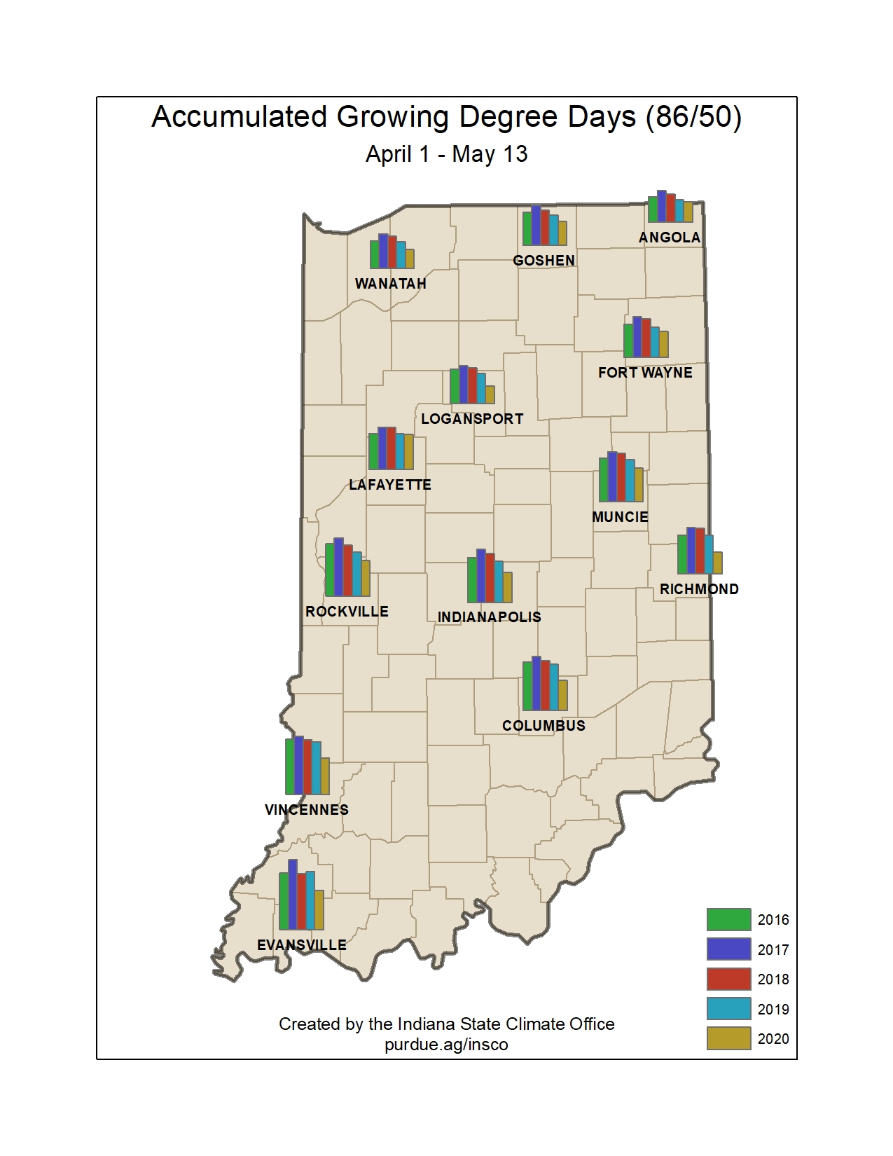
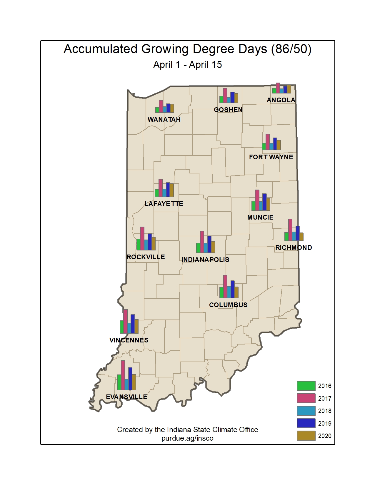
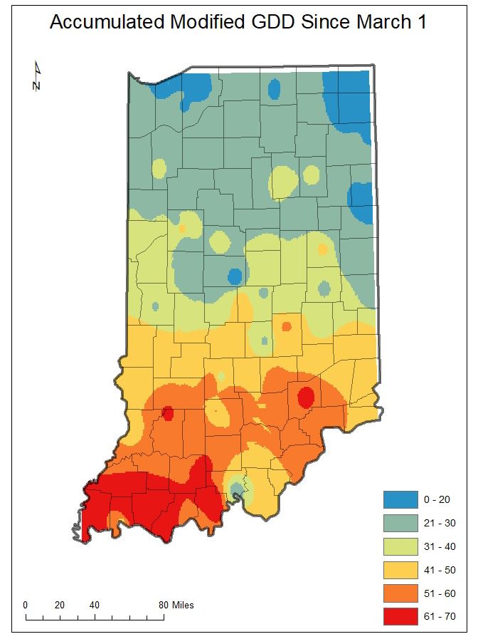
Growing degree day (GDD) accumulations (Figures 1 and 2) have been off to a slow start this season due to unseasonably cool temperatures.
The earth’s position and movement around the sun welcomed the spring equinox on March 19th, and meteorologists in the northern hemisphere welcomed spring on March 1st.
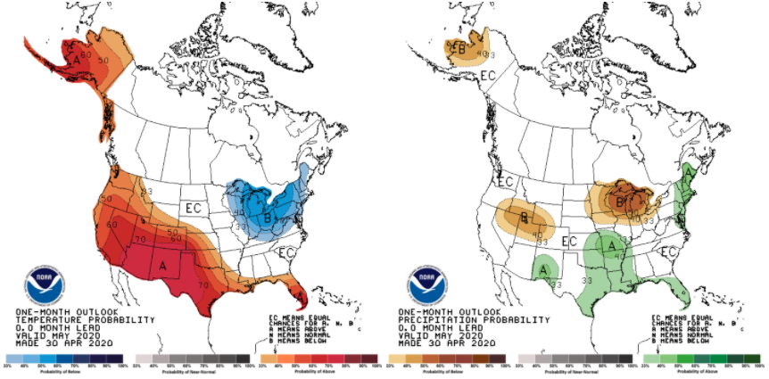
On April 30, 2020, the national Climate Prediction Center released its monthly outlook for May (Figure 1).
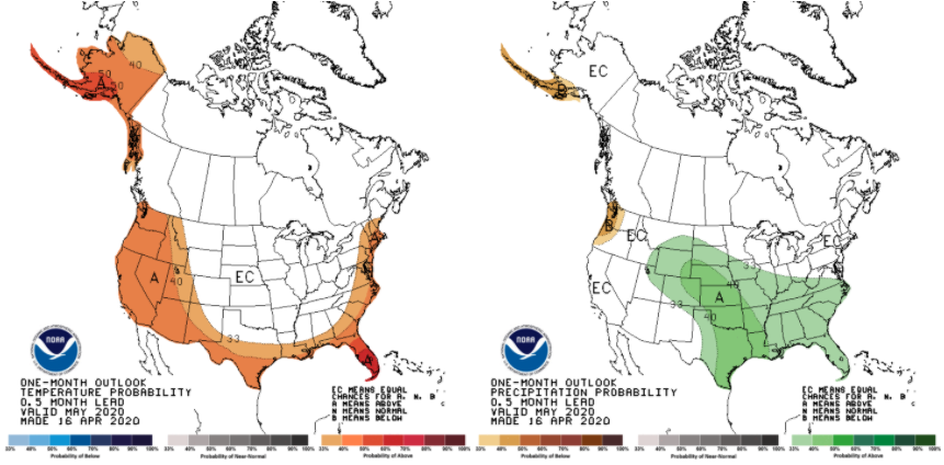
The Climate Prediction Center’s outlook for May is dominated by uncertainty regarding both temperature and precipitation (Figure 1).
This week brought freezing temperatures across much of Indiana – an unpleasant change from the previous weeks that were encouraging us to think about short sleeves and flip-flops!
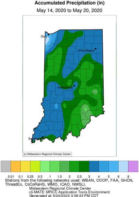
Over the past 30 days, southern Indiana has received above-average precipitation which has caused some flooding and well-saturated fields.
Fall is finally here and temperatures are starting to decline. It has been a typical fall, though with above normal temperatures one day with noticeably cooler temperatures the next.
Warmer and wetter than normal. That’s the climate outlook through the end of this month.
The initial cool wave of September is likely over as we welcome warmer temperatures for the next several weeks.
© 2026 Purdue University | An equal access/equal opportunity university | Copyright Complaints | Maintained by Pest&Crop newsletter
If you have trouble accessing this page because of a disability, please contact Pest&Crop newsletter at luck@purdue.edu.
