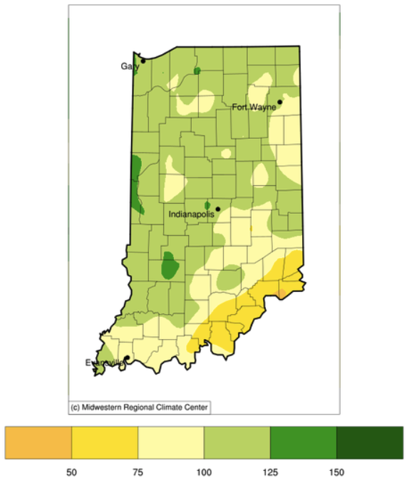
It seems the weather pattern may have shifted toward wetter conditions. Over the past week, Indiana has received over an inch of rain and the 7-day forecast is predicting at least another inch (Figure 1) in the central and southern parts of the state.
March wrapped up as one of Indiana’s wettest (44th wettest out of 126 years) and warmest (16th warmest).
Current temperatures and rainfall report.
Overnight low temperatures the morning of October 16th reached into the low 30s (Fahrenheit), bringing an end to the growing season for a lot of vegetation across Indiana (Figure 1).
September was dry across Indiana with some counties being the driest on record since 1895 (Figure 1).
On July 16th, the national Climate Prediction Center released the climate outlooks for August (Figure 1) and the August-September-October (Figure 2) period.
For the first time in what seems like months, the 8-to-14-day climate outlook is not showing significant confidence for above-normal temperatures in Indiana (Figure 1).
Prior to this week, there was growing concern of developing drought across Indiana.
Indiana has been very dry the last several weeks (Figure 1) and conditions are starting to show in lawns and fields.
© 2025 Purdue University | An equal access/equal opportunity university | Copyright Complaints | Maintained by Pest&Crop newsletter
If you have trouble accessing this page because of a disability, please contact Pest&Crop newsletter at luck@purdue.edu.