

This week brought freezing temperatures across much of Indiana – an unpleasant change from the previous weeks that were encouraging us to think about short sleeves and flip-flops!
This week brought freezing temperatures across much of Indiana – an unpleasant change from the previous weeks that were encouraging us to think about short sleeves and flip-flops!
Staying true to global climate trends these days, March 2020 finished warmer and wetter than the 1981-2010 climate normal period.
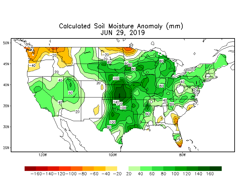
Over the past 30 days, southern Indiana has received above-average precipitation which has caused some flooding and well-saturated fields.
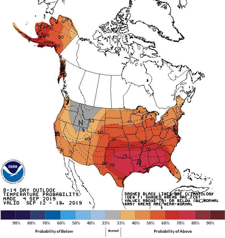
Expect increased possibilities of above normal precipitation through the mid-September, particular in northern regions of the state
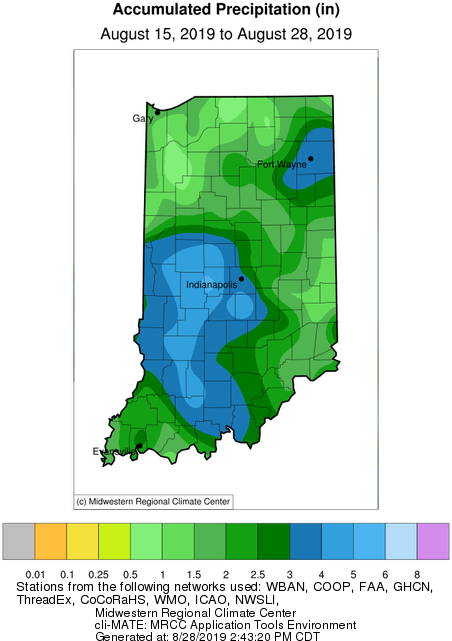
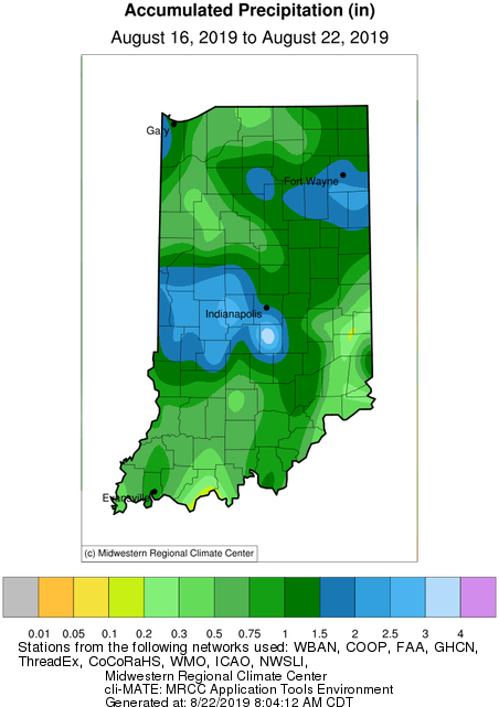
The big story this week was the much-needed rain throughout most of Indiana that fell on Monday (August 19th).
Sporadic rain events are barely bringing relief to sections of Indiana .
The brief rain event earlier this week brought some precipitation to the state. However, the drier regions of the north could use more rain soon!
The brutal heat wave has passed, but there are still plenty of warm days ahead. Climate outlooks (over the next few weeks) are suggesting confidence of above-normal precipitation across Indiana.
While the remnants of Hurricane Barry brought some much-needed precipitation to the state, the next few weeks look to be on the dry side.
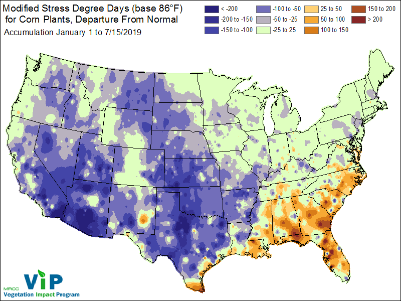
When I was very young, I remember my father talking about “knee high by the Fourth of July”.
© 2026 Purdue University | An equal access/equal opportunity university | Copyright Complaints | Maintained by Pest&Crop newsletter
If you have trouble accessing this page because of a disability, please contact Pest&Crop newsletter at luck@purdue.edu.
