

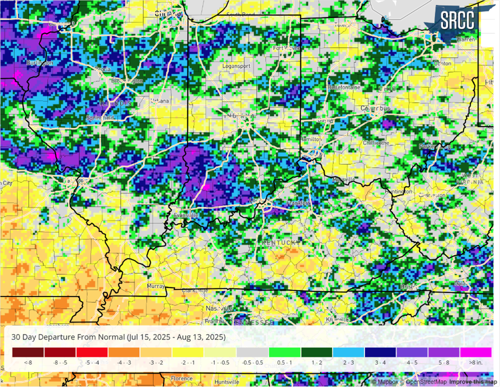
Precipitation over the last 30 days has been very spotty, the usual narrative when dealing with summertime convection.
Precipitation over the last 30 days has been very spotty, the usual narrative when dealing with summertime convection.
This article was originally posted on the Ag Climate Dashboard, located at https://ag.purdue.edu/news/2025/08/new-ag-climate-dashboard-makes-climate-resources-more-accessible-for-midwest-farmers.html WEST LAFAYETTE, Ind. — The Midwestern Regional Climate Center (MRCC), with support from the United Soybean Board, has launched the Ag Climate Dashboard — a centralized digital hub offering streamlined access to integrated climate and agricultural data and decision-support tools for producers, advisors and researchers in the Midwest. Designed to support on-farm decision-making, the Ag Climate Dashboard offers up-to-date weather data, National Weather Service forecasts, Climate Prediction Center outlooks, historical records and interactive tools for monitoring crop growth, pest threats, climate anomalies and extreme weather events. The dashboard also connects users to regional ag climate products and a variety of state-specific resources. State-specific pages, such as Indiana’s, link to tools and resources like the Purdue Mesonet and the Indiana State Climate Office. “We want to provide as much clear, well-organized information to producers and advisors as possible[Read More…]
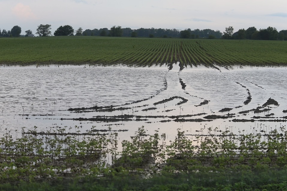
Hot, muggy days in Indiana can get old, quickly! With all the rain lately, and higher humidity, it has been a challenge to get any nighttime relief.
The heat and humidity have returned to the state, as heat indices soared above 100°F on Wednesday and Thursday (July 23-24) this week.
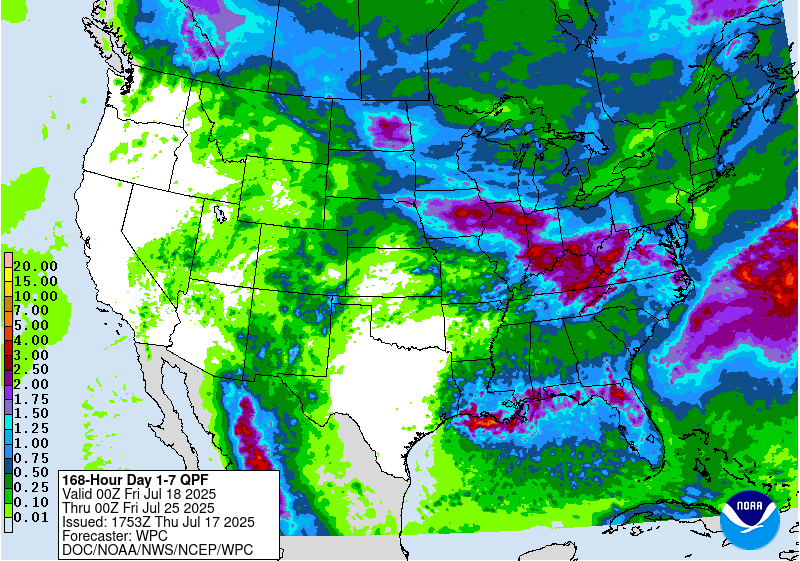
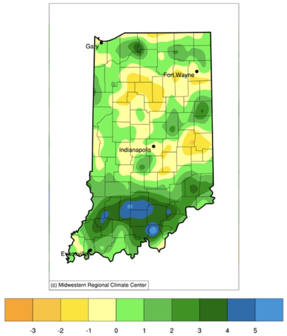
Precipitation forecasts for Indiana over the next 7 days (through late Thursday, July 24) are calling for close to 3 inches (Figure 1).

One heat wave down, more to come.
One heat wave down, more to come. It is summer, though, so aside from expecting plenty of hot days, the things to be more concerned about is reference (or potential) evapotranspiration (ET) significantly exceeding precipitation that would ultimately cause drought-related impacts. The National Weather Service provides a 7-day forecasted reference ET product as well as a 7-day forecast for total precipitation amounts. From these resources, it looks like across Indiana, approximately 1.5” of water is expected to be lost over the next 7 days and anywhere from 0.10” to up to 1.5” of precipitation will be received (Figure 1). This implies a water deficit for most areas – which is not unusual throughout Indiana summers. The concern comes when that deficit becomes much greater than normal. Concerning drought, the U.S. Drought Monitor continues to place northwestern Indiana in the Abnormally Dry (D0) category with two isolated areas within that zone[Read More…]

I couldn’t think of a better title this week, thanks to the hot weather we’ve been experiencing and the song by Arrow.

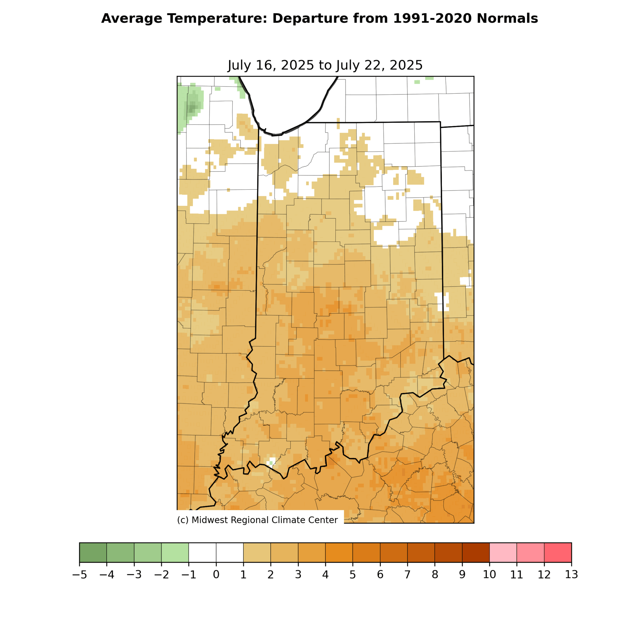
June 20, 2025, marks the summer solstice in the northern hemisphere. This is more an astronomical (i.e., planetary and orbital, not necessarily huge) event rather than meteorological. This is the date when the north pole is leaning most directly toward the sun due to its tilt relative to earth’s solar orbit throughout the year. Because of this, the length of daylight within a 24-hour period is greatest on this day for all locations north of the equator. More daily daylight means more solar exposure and therefore greater surface heating and temperatures. Of course, we’ve been working up to this moment for a while (since December 21, 2024) and we’ve already been experiencing warmer temperatures. Mother Nature is going to really show off her solstice spirit, however, with extreme high temperatures expected by the end of this weekend into next week. Over the last 30 days or so, average temperatures across[Read More…]

We’ve made it! Meteorological summer started on June 1, but the official start of summer isn’t until June 20.
© 2026 Purdue University | An equal access/equal opportunity university | Copyright Complaints | Maintained by Pest&Crop newsletter
If you have trouble accessing this page because of a disability, please contact Pest&Crop newsletter at luck@purdue.edu.
