

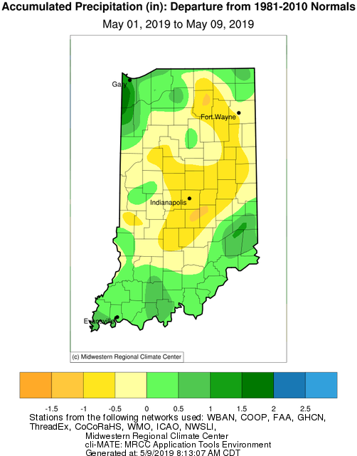
The biggest topic seems to be how wet it is and how much more rain Indiana can expect. So far, May has experienced near-normal precipitation throughout the central part of the state with 0.5”-2” in southern and northern regions (Figure 1).
The biggest topic seems to be how wet it is and how much more rain Indiana can expect. So far, May has experienced near-normal precipitation throughout the central part of the state with 0.5”-2” in southern and northern regions (Figure 1).
No reason exists to expect drought anytime soon in Indiana, with much of the state remaining rather wet after last weekend’s showers. One good new development exists.
Last week, spring-like temperatures teased most of the Hoosier State with temperatures 5°F-8°F above normal (see Figure). While this encouraged more folks to get outside and enjoy the warmer weather, the week ended with a return to colder, windier conditions.
An El Niño develops when sea surface temperatures are warmer than average in the equatorial Pacific for an extended time. This is important to North America because El Niño can impact our weather patterns, especially in the winter.
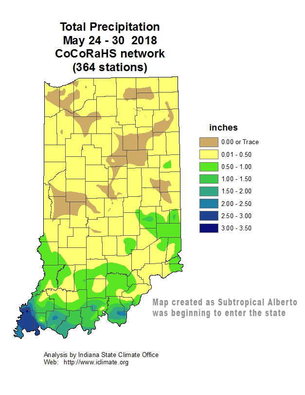
Total Precipitation May 24-30, 2018
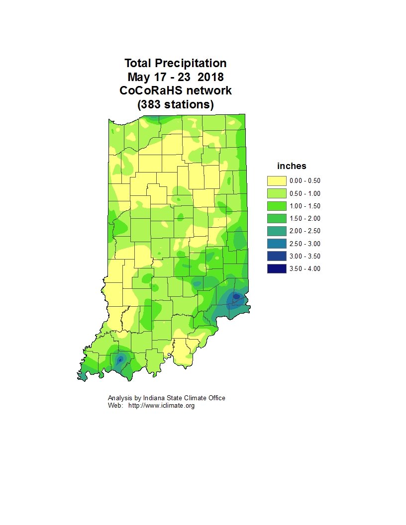
Total Precipitation May 17-23, 2018
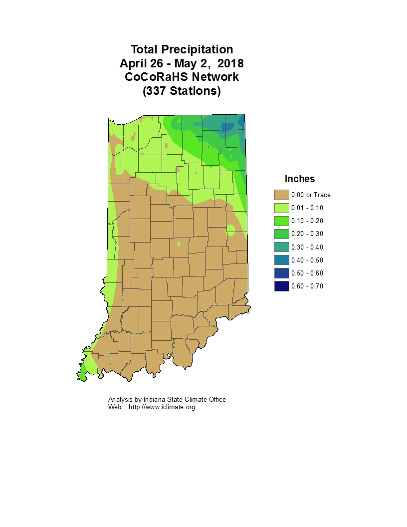
Total Precipitation April 26-May 2, 2018
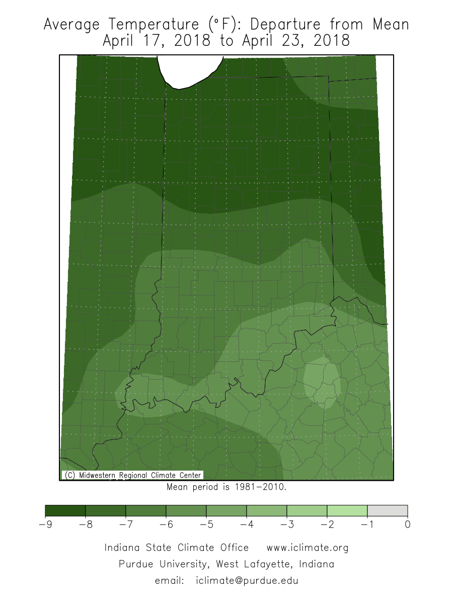
Average Temperature Departure from Mean April 17-23, 2018
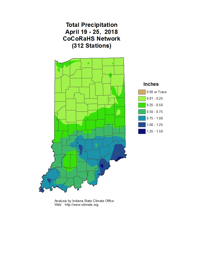
Total Precipitation April 19-25, 2018
With a promising extended forecast, we may finally get a lot of field work done around the state. With planting and spray season upon us, we decided it was a good time to test some of the weather prediction tools that have been advertised throughout the winter.
© 2026 Purdue University | An equal access/equal opportunity university | Copyright Complaints | Maintained by Pest&Crop newsletter
If you have trouble accessing this page because of a disability, please contact Pest&Crop newsletter at luck@purdue.edu.
