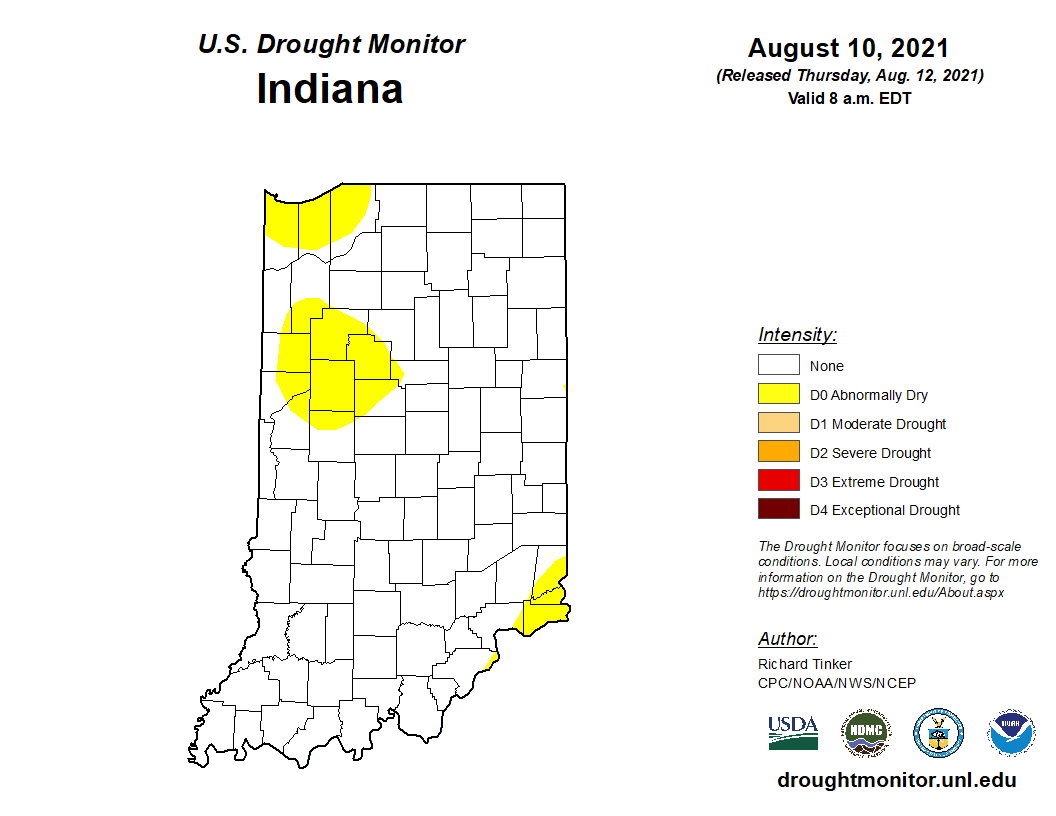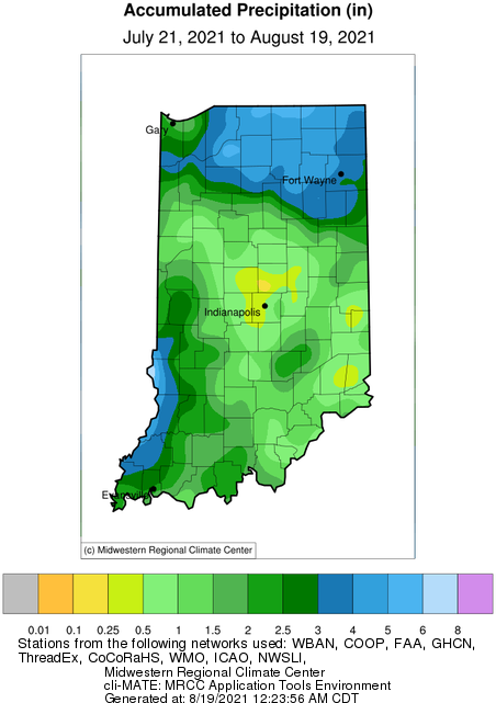
Precipitation and storm tracks this year seem to be stagnating in patterns that have caused some parts of Indiana to feel as if they are drowning and other parts to feel like they are in a drought. Indiana is not a particularly large state, so it is impressive to see the extremes across such a short area. Sometimes, these extremes can be explained from just one or two storm events that pass through, but recently it seems to be a series of events that set up this polarized pattern of precipitation winners and losers. Figure 1 shows the 30-day accumulated precipitation presented as the percent of mean climatology for Indiana from July 21 to August 19. Central Indiana has been experiencing dry conditions with some locations only have received 25%-50% of what they would normally receive during that time period. In contrast, northeastern and southwestern Indiana have experienced a surplus[Read More…]