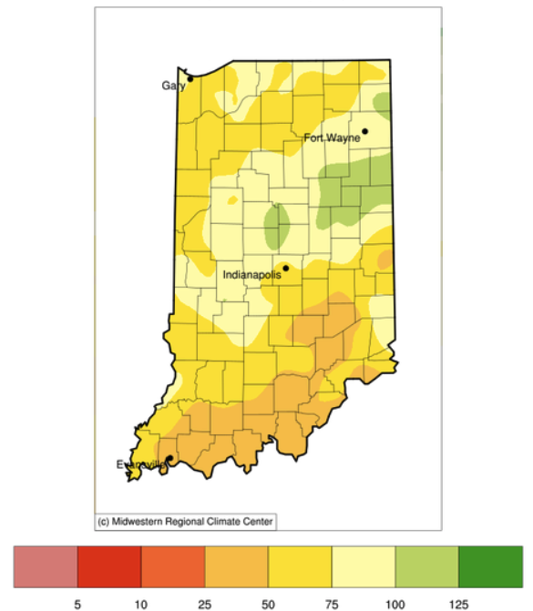
Indiana has been receiving less precipitation than normal, particularly over the last 30 days (Figure 1). In fact, southern Indiana has only received 25%-50% of the precipitation amounts it normally sees during this period. One would think this would mean “Abnormally Dry (D0)” if not “Moderate Drought (D1)” classifications for the U.S. Drought Monitor. However, as mentioned in previous articles, drought is not caused by just a lack of precipitation. This week, drought leadership teams from Indiana, Ohio, and Kentucky discussed this dilemma where precipitation data is suggesting the introduction of Abnormally Dry status for the tri-state area. Interestingly, other indicators such as soil moisture, stream flow, and local observations from residents in the area are indicating normal, if not wet, conditions are still prevailing. While the amount of precipitation has not recently kept up with what is normal for this time of year, there have been a lot of wet days. For example, Evansville, IN has had 10 wet days over the past 30 days (33% wet days), Indianapolis, IN has had 16 wet days (53%), and Fort Wayne, IN has had 13 wet days (43%). This has managed to keep conditions wet or near normal, even though total precipitation has been low.

Figure 1. Accumulated precipitation presented as the percentage of the 1991-2020 normal amounts for April 19 – May 18, 2022.
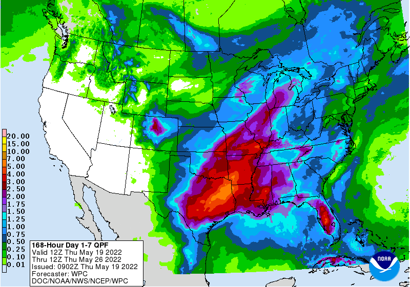
Looking ahead, this pattern of rain every few days continues with predicted rain amounts ranging from 1-3 inches across Indiana for May 19-23, 2022.

Figure 2. Quantitative precipitation forecast (in inches) for May 19 – May 26, 2022. Source: National Weather Service.
If this forecast come true, this would be more precipitation that what is normal for that period. Both the 6-10- and 8-14-day climate outlooks are favoring above-normal precipitation across the state, so expect this wet pattern to continue for a while. The 1-month (June) and 3-month (June-July-August) climate outlooks were just released on 19 May 2022 from the national Climate Prediction Center. For both periods, climate models are favoring above-normal temperatures, but were equally favoring below-normal, normal, and above-normal precipitation amounts. This suggests too much uncertainty regarding precipitation to know if this wetter period will continue, how many wet days to anticipate, and how much precipitation will be received.
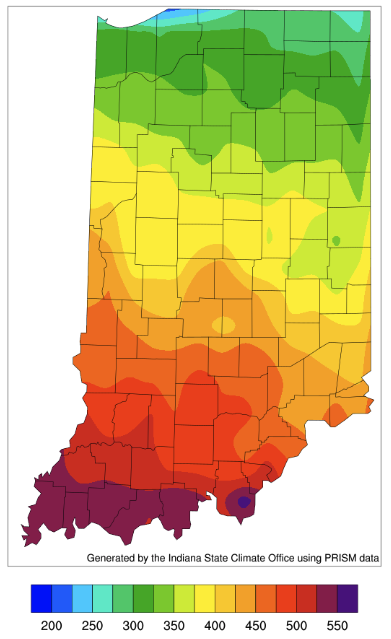
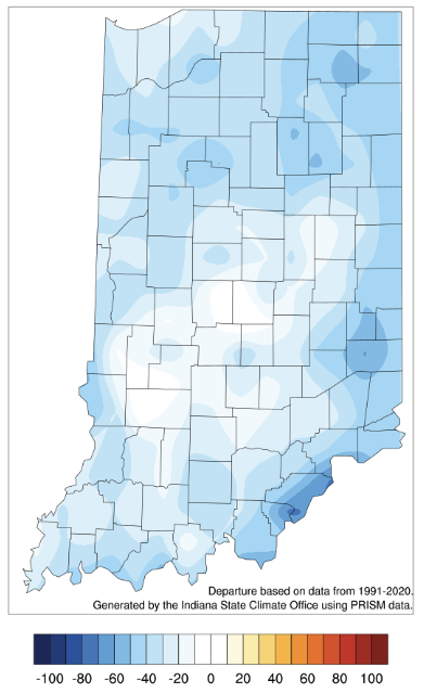
Warm temperatures last week helped catch this year’s accumulated modified growing degree day value up to near normal. Figures 3 and 4 show the accumulation total and departure from normal for April 1 – May 18, 2022.


