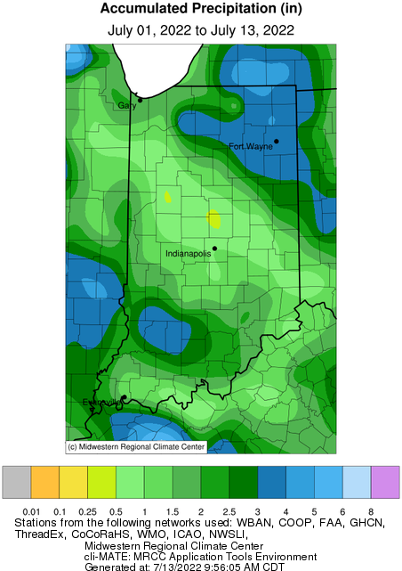
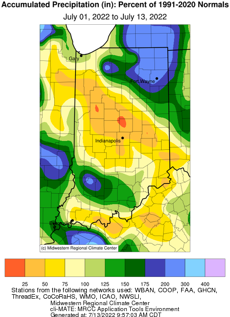
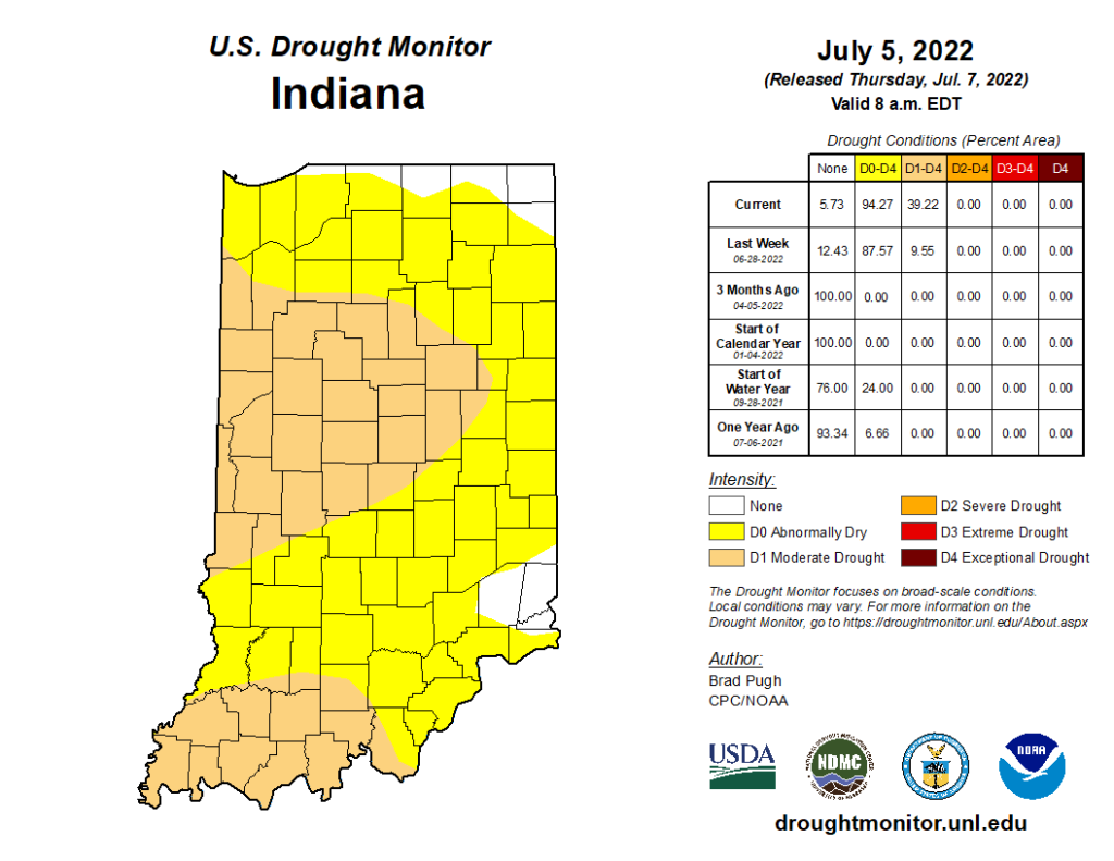
The June 2022 state average precipitation was 2.42 inches below the 1991-2020 normal, which ended up being the 14th driest on record. High heat and reduced precipitation led to the rapid intensification of abnormally dry and moderate drought conditions in the state. As of July 13, July precipitation had continued to be very isolated (Figure 1). Northeastern Indiana experienced rainfall totals ranging from 2-4 inches, which was 150-300 percent of the 1991-2020 normal (Figure 2). Reports of flash flooding at the Fort Wayne Children’s Zoo occurred on Tuesday, July 5. Heavy rainfall also fell in southwestern Indiana, where 2-4 inches was recorded. Parts of Sullivan, Greene, Davies, Martin and Lawrence counties received 3-4 inches of rain. As for everyone else, lighter precipitation totals (0.5-1.5 inches) were not enough to reduce drought stress. Much of central Indiana received less than 75 percent of the 1991-2020 normal precipitation and isolated locations received less than 25 percent of normal. The US Drought Monitor map released on July 7 reflects conditions through July 5, and therefore, excludes the most recent rainfall (Figure 3). Over 94 percent of the state was experiencing either abnormally dry (D0) or moderate drought (D1) conditions in this release. A new Drought Monitor map will be released on Thursday, July 14 at 8:00 am Eastern Daylight Time.
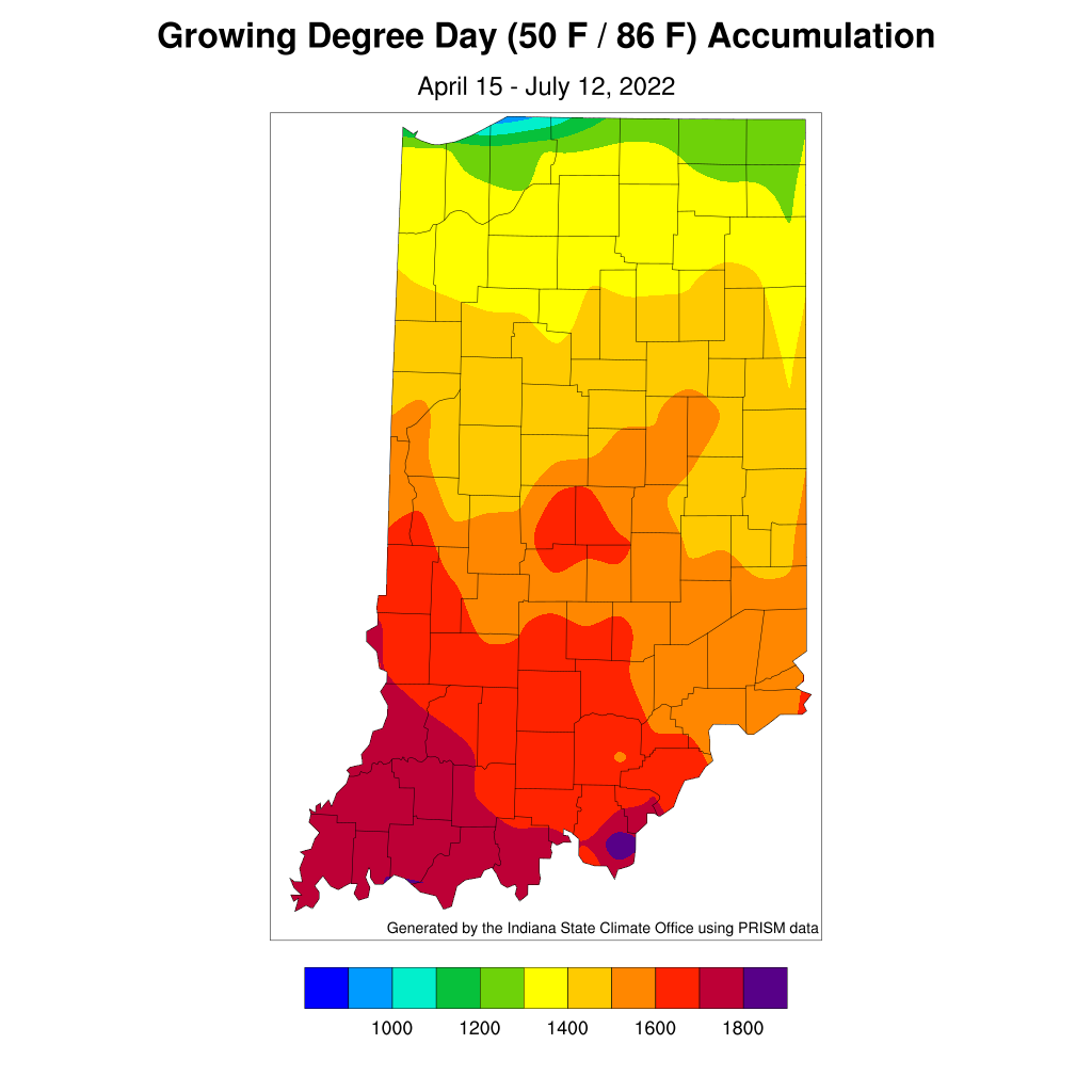
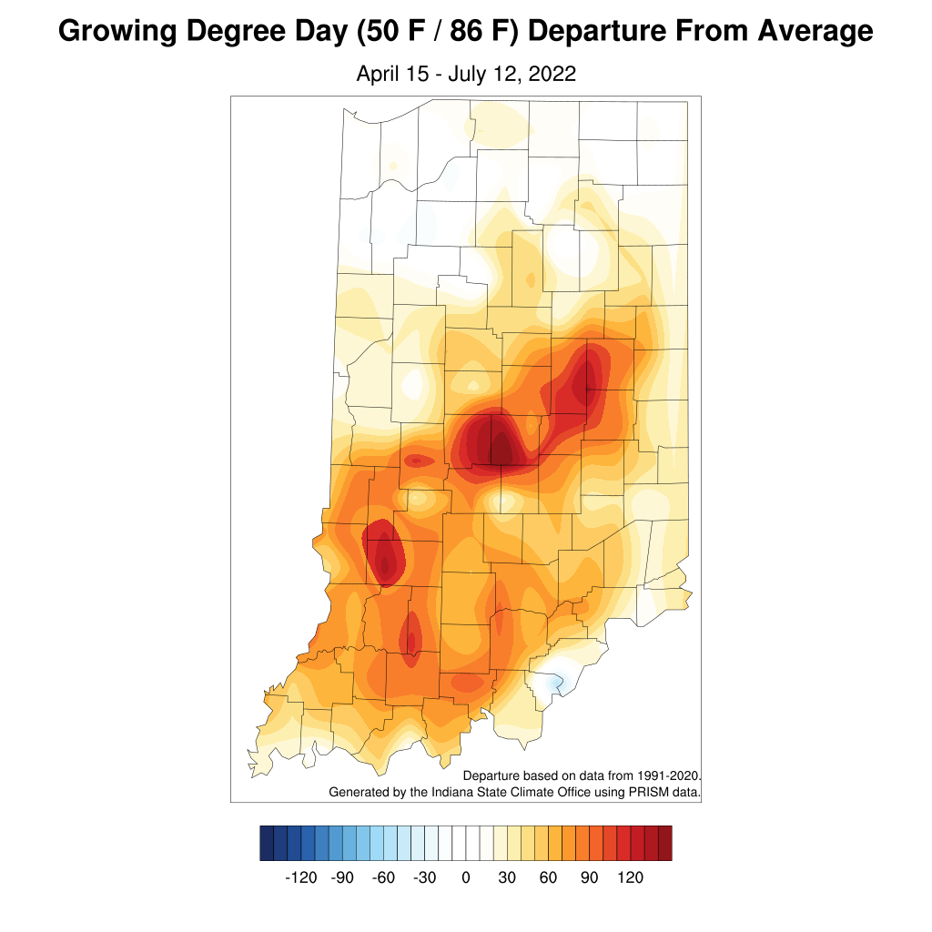
Eleven Indiana weather stations recorded over 100◦F temperatures during the first week of. Patoka Lake, located in Dubois County, recorded a maximum temperature of 104◦F on July 6. On July 7, the oppressive temperatures retreated south, leaving behind more seasonable conditions in the northern part of the state. As of July 13, month-to-date temperatures still averaged 1-3◦F above normal for much of central and southern Indiana. Isolated locations in central and southern Indiana were in excess of 3◦F above normal. Modified Growing Degree Day (MGDD) accumulations since April 15 (Figure 4) were above the 1991-2020 normal, which was directly tied to the above normal temperatures. The highest departures were observed in central Indiana, where many locations were over 100 MGDDs ahead of normal (Figure 5).
Limited rain chances are in the forecast through the next week and appear to be very isolated in nature. The Climate Prediction Center’s 6-10-day and 8-14-day forecasts are in agreement with elevated chances of above normal temperatures and below normal precipitation. Continued drought stress is expected and Indiana will likely see a continued deterioration of conditions. The Indiana State Climate Office recently added drought resources to their website, which include a National Weather Service Drought Dashboard, Midwestern Regional Climate Center Midwest Climate Watch, the National Integrated Drought Information System resource page for Indiana, the U.S. Drought Monitor, Purdue Extension’s ‘The Kernel’, and the IN-PREPared drought page. Should you have any questions or input on local conditions, please email the Indiana State Climate Office (in-sco@purdue.edu).


