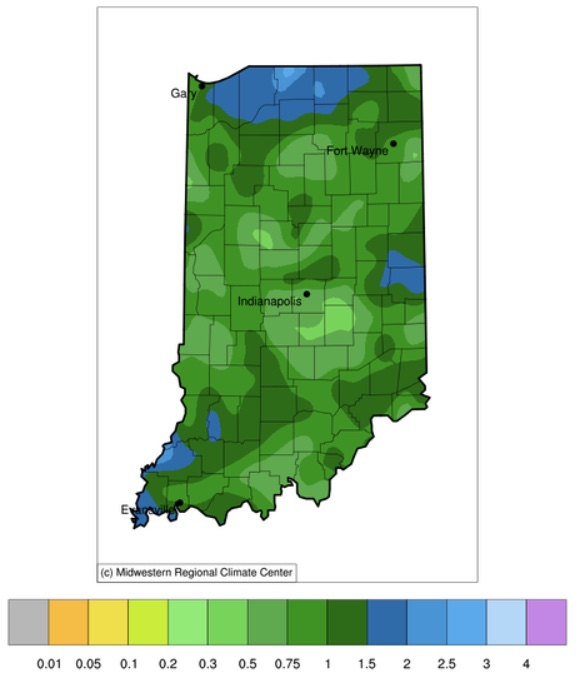
From September 19th through 25th, Indiana was fortunate to receive between a quarter inch to almost three inches of precipitation (Figure 1). This seemed to be a sight for many a sore eye since it had been weeks since any appreciable rain had fallen. But was this enough for us to get out of drought and return to “normal”? Not exactly. Figures 2 and 3 show how these recent events impacted the recent 30-day percent of normal precipitation and the departure from normal amounts across the state. In other words, most of the state is still in a moisture deficit with some locations having receive almost three inches less precipitation over the past 30-day period that what normally has occurred in that same period, historically. As a result, the U.S. Drought Monitor continues to show all of Indiana at least Abnormally Dry (D0) with a growing percentage of Moderate (D1), Severe (D2), and even a small area of Extreme (D2) drought areas (Figure 4).

Figure 2. Precipitation from August 27 through September 25, 2024, represented as a percentage of the normal amount from that 30-day period from 1991-2020).

Figure 3. Precipitation from August 27 through September 25, 2024, represented as a departure from the normal amount (in inches) from that 30-day period from 1991-2020).
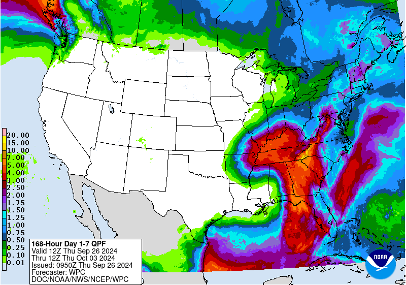
Hurricane Helene is expected to move heavy rain northward toward Indiana, but there is still some uncertainty how far north into the state the impacts will occur. At this point, there is moderate confidence that southern Indiana should benefit some from this storm, but central and northern Indiana may not see significant amounts. The seven-day precipitation forecast is favoring amounts over three inches for counties along the Ohio River with amounts rapidly decreasing northward (Figure 5).
The 6-to-14-day (October 1-9) climate outlooks are currently favoring a return to warmer-than-normal and drier-than-normal conditions across Indiana. Therefore, it would be great if we can somehow maximize as much rain as possible over the next few days to at least keep water supplies strong.


