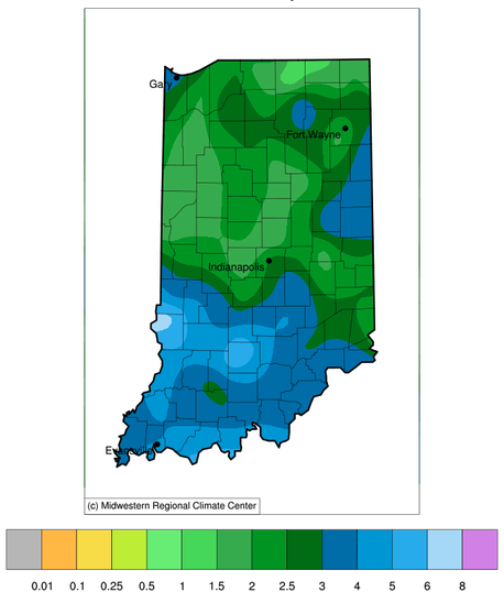
For the past seven weeks, abnormally dry conditions gradually spread and intensified across Indiana to eventually cover over 98% of the state. Conditions were looking dire, those with late-planted crops may have started getting worried, and water supply managers may have started expressing quiet concerns for those reliant upon groundwater. Then the rain came. Over the past two weeks, most of Indiana has received at least 1.5 inches of rain with southern and eastern counties receiving over three inches. In fact, some counties have received over five inches (Figure 1)! Does this mean our drought is over?
Once again, the answer depends upon where in Indiana one is located. For those in southern and eastern Indiana, conditions are looking good. Comparing that same 2-week period to climatology indicates that the rain that fell over this period was above normal with several counties getting over twice the amount of rain that is typical (Figure 2). Unfortunately, most counties in central, western, and northern Indiana are still struggling to not only receive normal amounts of rain but catch up from the serious deficits that have been accumulating.
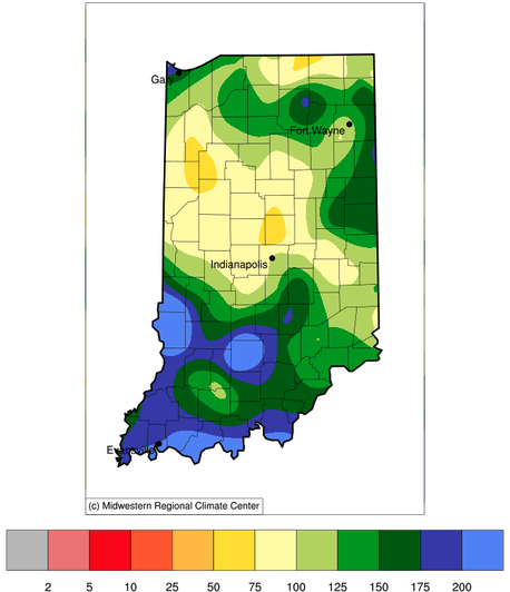
Figure 2. Percentage of the total precipitation amount received from June 22 through July 05, 2023, compared to what normally has fallen during that same period from 1991-2020. A value of 100% would equal the climatological normal amount.
Figure 3 presents the latest release of the U.S. Drought Monitor (USDM) for Indiana based upon data through July 4, 2023. It is important to realize that the USDM incorporates a variety of both quantitative and qualitative information when determining changes each week and reflects the fact that drought rarely go away quickly. One or two weeks of above-normal precipitation will likely provide short-term improvements, but a more sustained pattern of normal precipitation would be needed to eliminate drought completely.
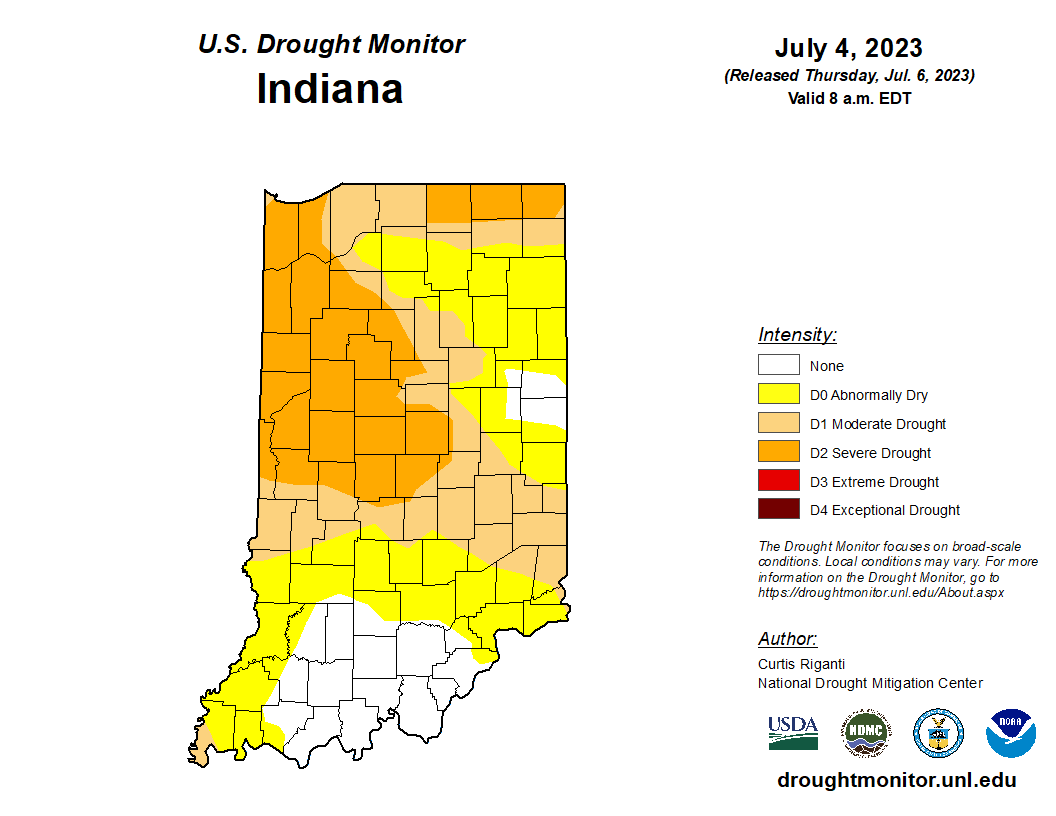
Figure 3. U.S. Drought Monitor for Indiana as of July 4, 2023. Source: https://droughtmonitor.unl.edu/CurrentMap/StateDroughtMonitor.aspx?IN
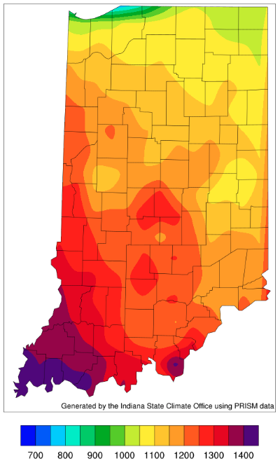
Another factor that will be slowing the rate of drought improvement is the increase in temperature likely to continue over the next several months. This will increase the rate of evapotranspiration further offsetting what precipitation may fall. Over the past two weeks, temperatures have been near normal. However, while short-term (1 to 2 weeks) climate outlooks are favoring below-normal temperatures, it is the warmer time of the year. We have certainly been feeling the heat the last several days! Accumulated modified growing degree days since April 15 (Figure 4) are still at least 60 units below normal with southern counties lagging by almost 200 units (Figure 5).
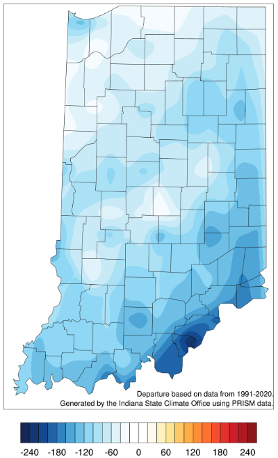
Figure 5. Modified growing degree day (50°F / 86°F) accumulation from April 15-July 4, 2023, represented as the departure from the 1991-2020 climatological average.
The good news for those still wanting more rain is that the climate outlooks for the next two weeks as well as the month of July are favoring above-normal precipitation. It is still too early to know if this will fall evenly over time or as heavy downpours with potential severe weather involved. Regardless, the additional rainfall will be welcomed and hopefully will continue to improve drought conditions for the entire state!


