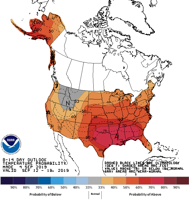
Welcome to September! Are we in the home stretch for the growing season? Precipitation has been falling intermittently throughout the state, but nothing compared to what Hurricane Dorian is sharing. Expect increased possibilities of above normal precipitation through the mid-September, particular in northern regions of the state. Above-normal temperatures should continue throughout most of the month (Figure 1). Drought conditions continue to hang around the southeastern and northwest parts of Indiana but there are no strong indications these abnormally dry regions will worsen.
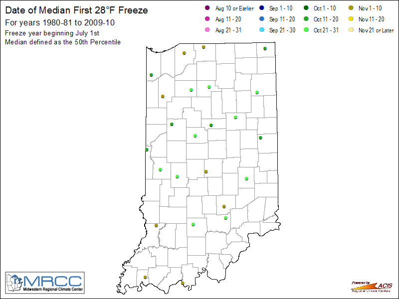
As we start thinking about the risk for an early fall freeze, early September is still too soon to predict. From a climatological perspective, the median first 28°F freeze (1980/1981 – 2009/2010 climate period) in Indiana occurred between mid-October to early November (Figure 2). Over this 30-year period, these dates indicate that half the years had the first 28°F freeze occur before the date shown on the map; half the years had the first 28°F occur after the date shown. To see the climatological probability of the first freeze occurring before or after a particular date for your local area, log into the Midwestern Regional Climate Center’s online data and tools portal, cli-MATE. Once logged in, you can find your nearby station of interest (near the top of the web page click the “Select Daily Station” button). The freeze probabilities can be found along the left-hand navigation list under “Charts and Graphs” > “Freeze Probability Graphs”.


