

Temperatures dipped below freezing earlier this week as spring perennials started forcing their way out of their winter slumber. Forecasts over the next few weeks are suggesting temperatures should be above normal. Does this mean no more snow is likely for the season? Can we start putting away our snowplows and make space for our lawnmowers? The Midwestern Regional Climate Center (MRCC) has a fun tool called the Snowfall Climatology Toolbox to explore this answer from a climatological perspective. For many cities across the U.S., one can discover historical snowfall statistics such as annual and monthly snowfall totals, number of snowfall days defined by various depth thresholds, historical dates of the first and last snow event defined by various depth thresholds, and the record 1-day snowfall amounts. The average date of the last snow event that measured at least 0.1” ranges from late February in southern Indiana to early April in northern Indiana (Figure 1). Therefore, based on climate averages, we should have seen our last snow event. However, when considering the extremes, the latest date of the last snow event (going back almost 100 years in many cases) range from mid-April in southern locations to mid-May up north!
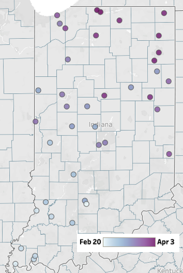
Figure 1. Average date of the last 0.1” or greater snowfall day for stations with at least 30 years of data.
With all the rain we’ve had over the past few weeks (Figure 2), drought conditions continue to improve across Indiana (Figure 3). The hydrological indicators such as streamflow discharge and groundwater levels are improving, but it will take much more rain to get them back to normal!
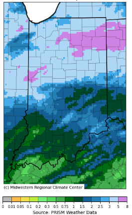
Figure 2. Total precipitation accumulation for March 26 – April 8, 2026.
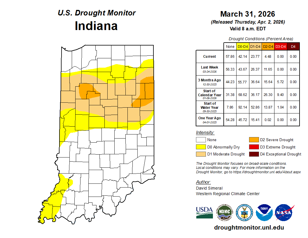
Figure 3. U.S. Drought Monitor status as of March 31, 2026.v
The 7-day forecasted precipitation totals for April 9 to 16 are predicting around an inch more is expected with higher amounts to the northwest and lower amounts to the southeast and east. Climate outlooks for precipitation through April 22 are slightly favoring above-normal precipitation. April is typically a wetter month across the year for Indiana, so expect even more than usual!
