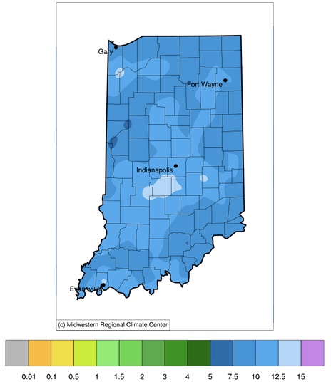
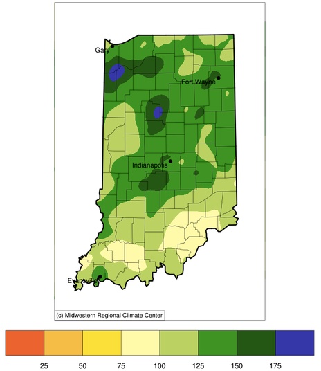
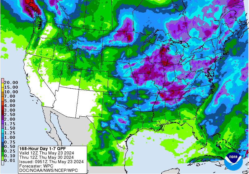
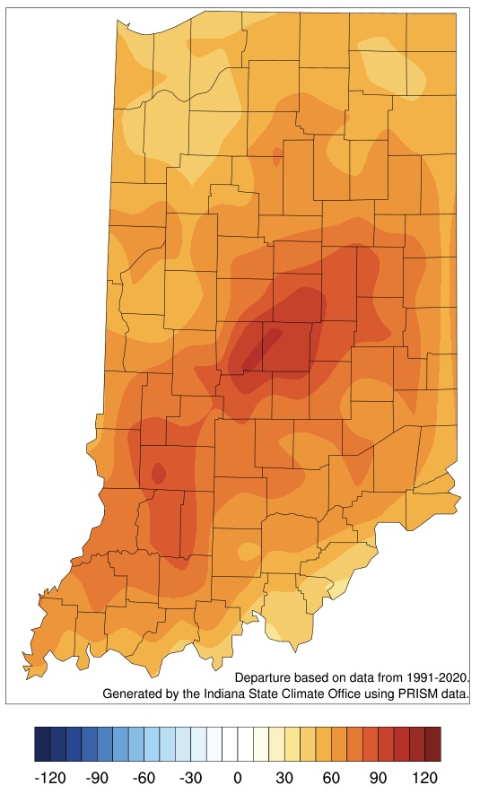
I have been seeing a lot of reports around the state about overly wet conditions with impacts such as running field tiles, high-leveled lakes and streams, field ponding, and difficulty getting into the fields for planting. It certainly feels likes it has been raining a lot around the West Lafayette area. Figure 1 shows how much rain has fallen since April 1st and indeed amounts over 10 inches seem high! To put this into climatological perspective, Figures 2 and 3 compare these amounts to the 1991-2020 period where most of the state has received 2 to 5 more inches of rain (125%-175% of normal) than what is typical for this time of year! The good news is this has kept Indiana clear of any drought or abnormally dry areas for several weeks, but a bit of drying out would be nice. Unfortunately, the 7-day precipitation forecast is predicting a more rain to come our way – particularly early next week (Figure 4). However, according to the national Climate Prediction Center, the climate outlook beyond that (for May 28 – June 5) is favoring near normal to possibly below-normal precipitation. I am hoping things return to “normal”, since our climate patterns over the past few decades seem defy “normal” and instead swing wildly from too much rain to too little in a relatively short period of time. We certainly do not want to see another rapid intensification of drought (i.e., “flash drought”) developing this summer!
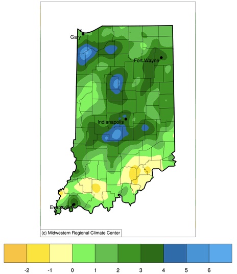
Figure 2. Precipitation departure from normal (1991-2020 period) in inches for April 1 through May 22, 2024.
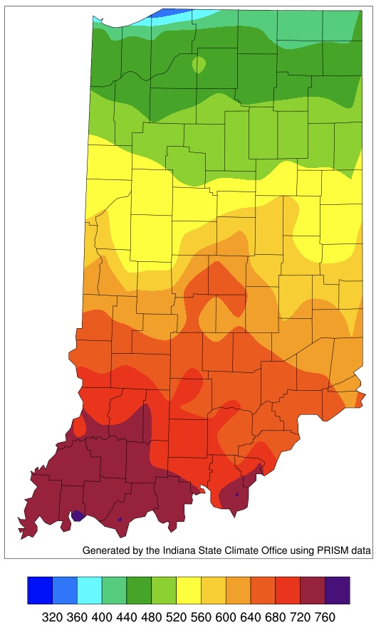
Regarding temperatures, it is likely no surprise that conditions have been warmer than normal. Figure 5 illustrates how the average daily temperatures in May have been 4 to 7 degrees Fahrenheit above normal across much of the state (May 1 – 22). This has been well reflected in the accumulated modified growing degree-day maps since April 1st (Figures 6 and 7).
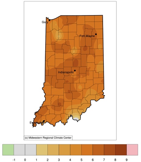
Figure 5. Average daily temperature departure (degrees Fahrenheit) from normal (1991-2020 period) for May 1-22, 2024.


