Through the first 18 days of April, temperatures ran 5.5◦F above normal statewide (Figure 1). The largest deviations occurred in central and northern Indiana. Despite the wet start to the month, wind, abundant sun, low humidity and reduced precipitation accounted for drying conditions across the state. Statewide, precipitation averaged 69 percent of normal. Surprisingly, tillage, fertilizer and herbicide applications, and planting kicked up a lot of dust and goes to show that it does not take a lot to dry out the upper soil profile. Through April 16, the USDA NASS reported 3 percent of corn and 2 percent of soybeans were planted statewide. Modified Growing Degree Days (MGDDs) continued to run above normal statewide (Figure 2) as a result of the warm temperatures.
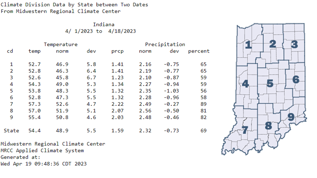
Figure 1: Indiana climate division and state temperature, normal temperature, temperature departure from normal, precipitation, normal precipitation, precipitation departure from normal, and percent of mean precipitation for April 1-18, 2023.
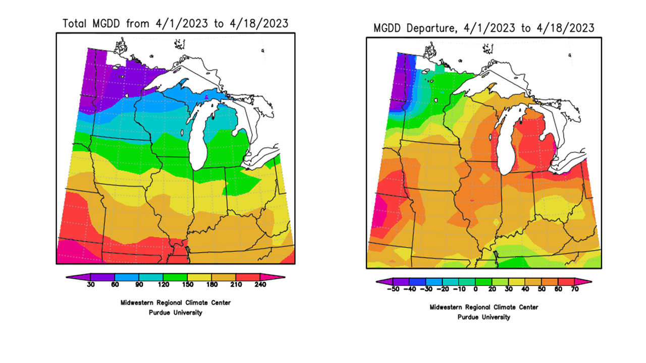
Figure 2: Total Accumulated Midwest Modified Growing Degree Days (MGDDs) April 1-18, 2023 (left) and Total Accumulated MGDDs represented as the departure from the 1991-2020 climatological normal (right).
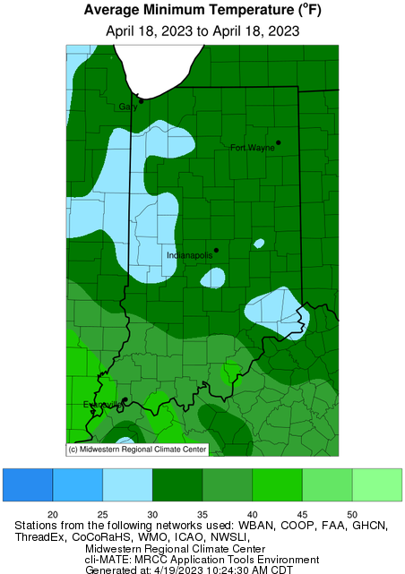
Much of Indiana has been subjected to frost/freeze advisories over the last few days as well. Temperatures fell below freezing in many spots and can confirm that we had patchy frost on multiple occasions. All Indiana vegetation is now susceptible to freeze damage, which has triggered National Weather Service frost/freeze alerts this last week. Most plants are okay for light frosts, but damage can result from prolonged exposure to 28◦F or colder temperatures. Parke and Tippecanoe Counties recorded 26◦F and 27◦F, respectively, on April 18; many other locations experienced lower than 30◦F (Figure 3). Rush County recorded a minimum temperature of 27◦F on the morning of April 19. Warm temperatures resurged during the afternoon on April 19, but are not expected to last long as cooler temperatures are forecasted to return by the weekend.
Seven-day precipitation forecasts, as of April 19th (Figure 4), blanket the entire state with at least 0.5 inches of precipitation with heaviest amounts in southern Indiana (1.25-2.50 inches). The Climate Prediction Center has high confidence in below-normal temperatures and near-normal precipitation through the end of April. What could this mean for frost/freeze risk? The Climate Prediction Center has already issued a slight risk of much below normal temperatures from April 26-May 2, 2023 (Figure 5), which is indicative of increased freeze risk over. Purdue Extension has a helpful article titled “Effects of Cold Weather on Horticultural Plants in Indiana” that discusses impact of freeze events on these crops.
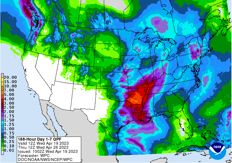
Figure 4: NWS Weather Prediction Center 7-day quantitative precipitation forecasts for the continental United States.
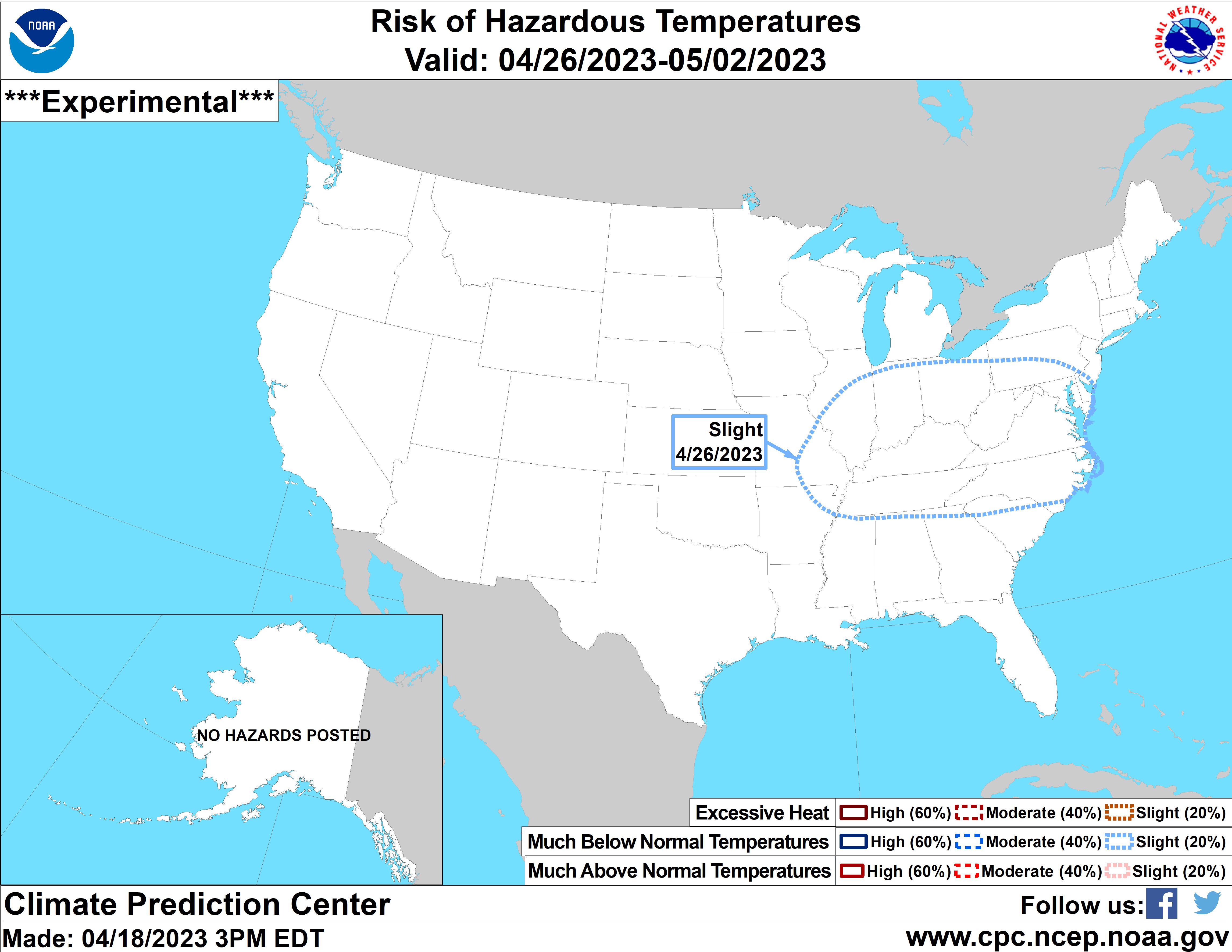
Figure 5: Climate Prediction Center’s 8–14-day hazard map depicting a slight risk for much below normal temperatures on April 26, 2023.


