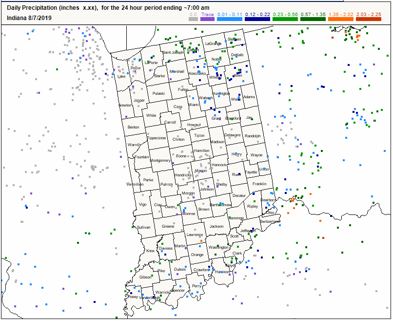
Another period of rain passed through the state earlier this week, providing limited rain to the northeast and southern counties (Figure 1). Note the map showing the measurements taken by volunteers for the Community Collaborative Rain, Hail, and Snow (CoCoRaHS) program. If you’re a weather enthusiast and would like to participate in this program, please let me know (bethhall@purdue.edu) or go to www.cocorahs.org! The National Weather Service, climate centers, and private business use and depend on this data to improve forecast models and better understand the moisture available in the ground and atmosphere.
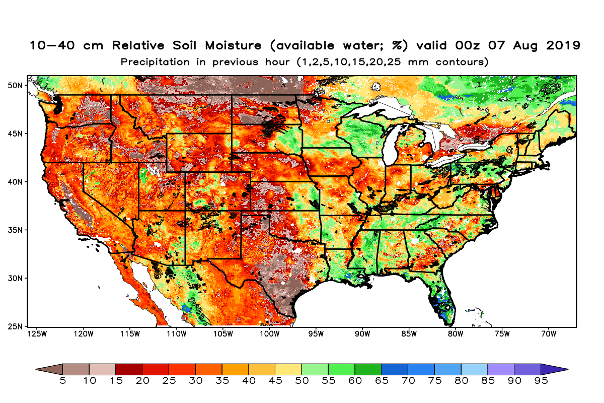
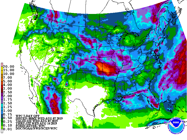
Regardless of the rain, drought is continuing to spread across the state with anticipated expansion this week. The National Aeronautical and Space Administration (NASA) produces maps that combine satellite information, ground observations, and modeled output shows how Indiana and surrounding states are experiencing reduced shallow soil moisture. The August 7th map for 10-40cm relative soil moisture (available water; %) shows the increasing dryness for northwest and southeast Indiana (Figure 2). Fortunately, the 7-day precipitation forecast is suggesting some more rain (1.5”-2.5” in the central and southern counties) could be on the way, however this is not likely until the middle of next week (Figure 3).
Temperatures have remained rather mild for this time of year (0°F to 3°F below normal over the past week), which has reduced the rate of modified growing degree-day accumulations. Climate outlooks for August 14-20 suggest insufficient confidence about whether temperatures and precipitation will be above or below normal. Could Indiana experience an earlier-than-normal “first freeze” this year? It is simply too early to know and while climate prediction outlooks can provide some guidance on whether or not temperatures are likely to be above or below normal, they are unable to predict the date of the first freeze event.


