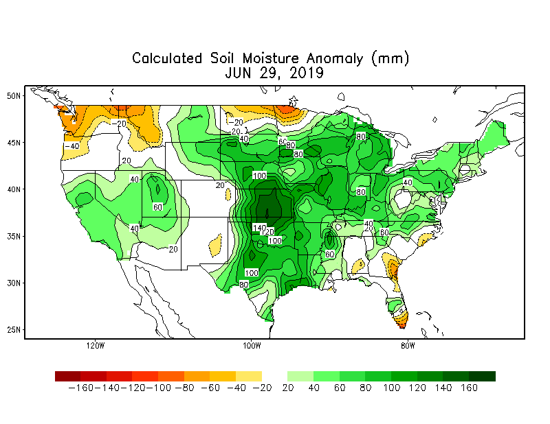
When I was very young, I remember my father talking about “knee high by the Fourth of July”. As I got older I thought that expression was so strange for it seemed the corn was usually “man high” by the Fourth of July. Obviously, the excessive rains and cooler temperatures have had an impact this year! While the above-normal precipitation from April and May may have tempered in June, Indiana is still getting “normal” amounts of rain on relatively saturated soils (Figure 1). In fact, preliminary data from June suggests that most of Indiana was near normal for precipitation with the southern third well above normal. Average temperatures in June were also near normal to a few degrees below normal.
How will July end up? If it matches the climatological “normal” July, then average daily temperatures would be 70oF-75oF across the northern part of the state and above 75oF in the southern part. The national Climate Prediction Center’s July outlook is showing confidence that temperatures will overall be below normal across northern Indiana with no confidence in either above- or below-normal temperatures for the southern counties. Precipitation amounts are expected to be above normal.
The 2-week outlook is showing confidence of above normal precipitation from July 8-14 and the 7-day precipitation forecast is predicting 0.75”-1.25” through July 8th. In a nutshell, expect more rain and fewer oppressively hot days over the next few weeks.


