After three consecutive weeks of Indiana being drought free according to the US Drought Monitor, it looks like next month is favored to be drier than normal and cooler than normal. That does not necessarily imply drought is expected to return since rain events may still occur. However, the predicted amounts of rain are low, so there could be some drying. However, with below-normal temperatures in those climate outlooks, several benefits may come. First, the rate of evaporation of any moisture across the state could be lower, and second, conditions should feel more pleasant when outside. However, a drier atmosphere will also encourage evaporation, so this may offset any reduced impact from the lower temperatures and Indiana may see some impacts from the drier atmosphere. The good news is the second week in August is favored to near-normal precipitation along with above-normal temperature. Therefore, enjoy next week outside as much as you can since the warm and muggy conditions so common this time of year are expected to return.
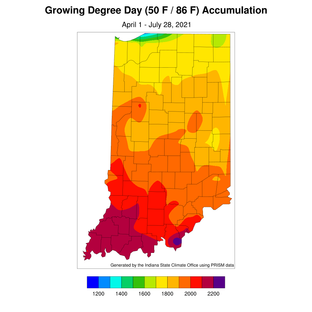
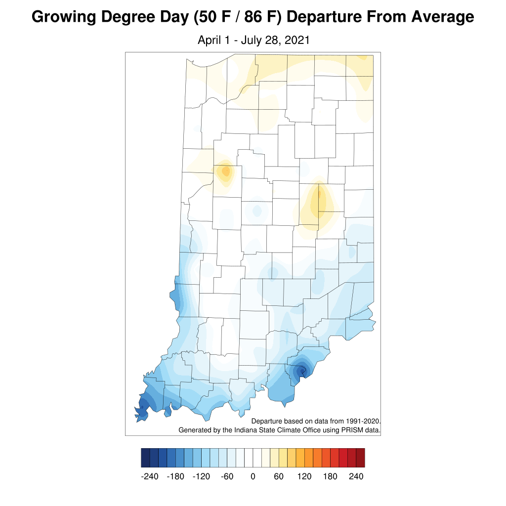
Modified growing degree-day accumulations range from 1600 units in northern Indiana to nearly 2200 units in southern Indiana (Figure 1). The southern part of the state is still slightly behind the climatological average with the northern counties slightly ahead (Figure 2). The bullseyes of above-normal MGDD departures in northern Tippecanoe county and between Madison and Delaware counties may be due to erroneous data. Further investigations are needed.


