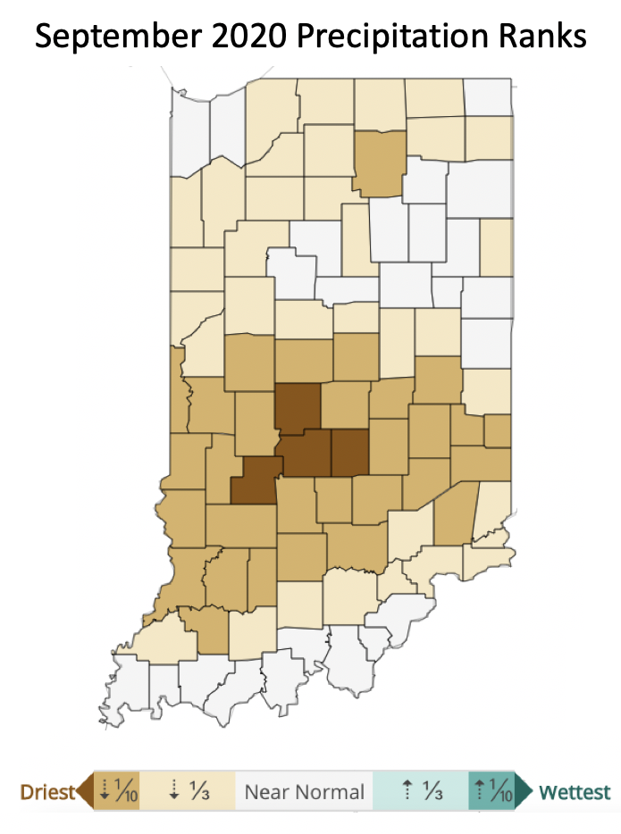
September was dry across Indiana with some counties being the driest on record since 1895 (Figure 1). Four counties – Owen, Morgan, Johnson, and Hendricks – experienced the driest September on record, with over 30 counties experiencing a September that was in the driest ten percent of years. Unfortunately, aside from a few southern and southeastern counties that may receive some rain this weekend from the remnants of Hurricane Delta, there is very little indication that the rest of Indiana will receive above-normal precipitation throughout the rest of October.

Figure 1. County ranks for September precipitation over the 1895 through 2020 period. Source: NOAA Climate At-A-Glance
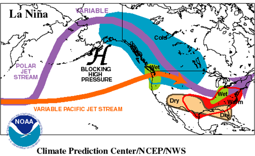
The likelihood of a La Niña strengthening has been increasing in recent weeks. Historically, what this has meant for Indiana is a wetter winter (Figure 2). There is a bit of uncertainty with this prediction, however. First, while winters have been categorized as either El Niño, Neutral, or La Niña (phases of the El Niño – Southern Oscillation (ENSO) climate pattern) since the early 1950s, the number of those years that have fallen into those categories is relatively small. In other words, if this represents approximately 70 years of data, and one assumes a third of these years was either an El Niño, Neutral, or a La Niña winter, that leaves only about 23 years per category. Furthermore, those phases are labeled by their strength (e.g., weak, moderate, or strong). If we assume that among those 23 years per phase, a third was either weak, moderate, or strong in its strength, then we are now only looking at about 8 years to draw a climatological conclusion on what a similar La Niña winter will look like in Indiana. Sadly, the climatological uncertainty does not stop there. Our climate has been changing significantly since the late 1970s. Therefore, the number of past years to use as guidance for this upcoming winter is even smaller. What can we glean from all of this? Climate scientists tend to agree that this coming winter is likely to be warmer than average (which has been a safe prediction most of the recent, past winters), and if it is going to be wetter, Indiana is likely to experience this closer to the end of the winter season, if not early spring – February and March. Will that increased wetness fall as rain or snow? Will it fall in fewer, heavier events or be spread evenly over those weeks? We’ll leave those answers up to the weather forecasters who will be predicting three-to-seven days out!
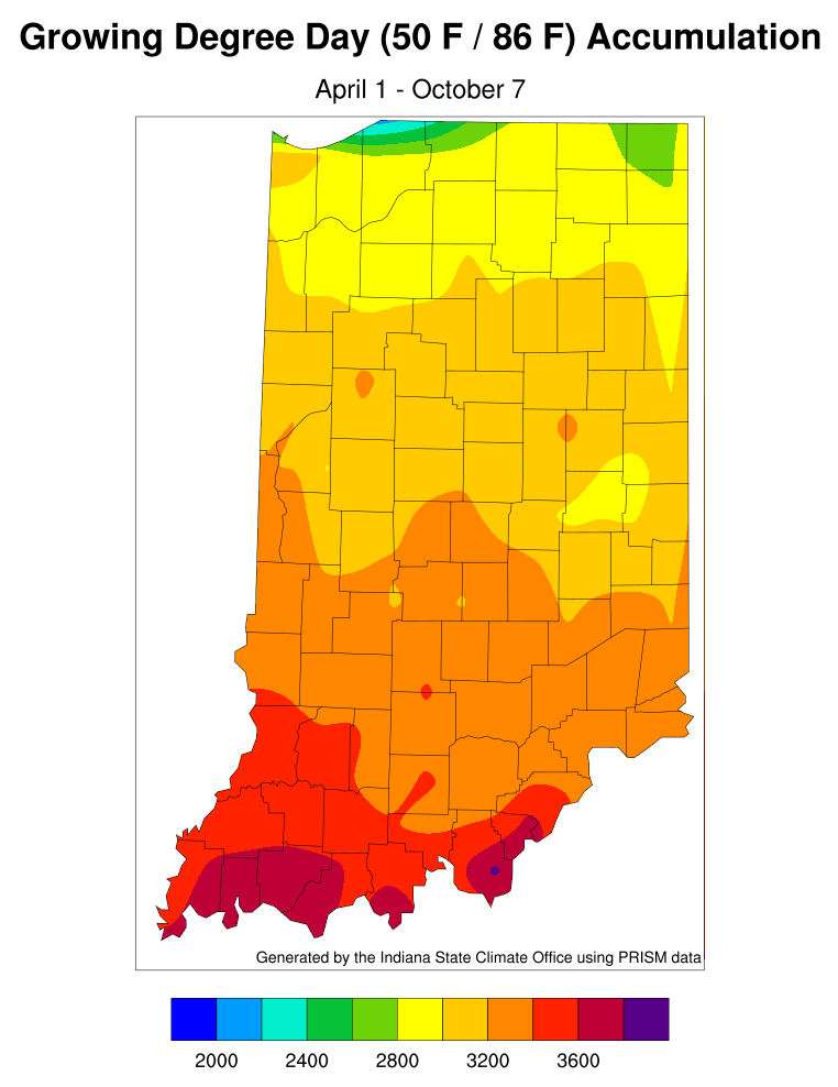
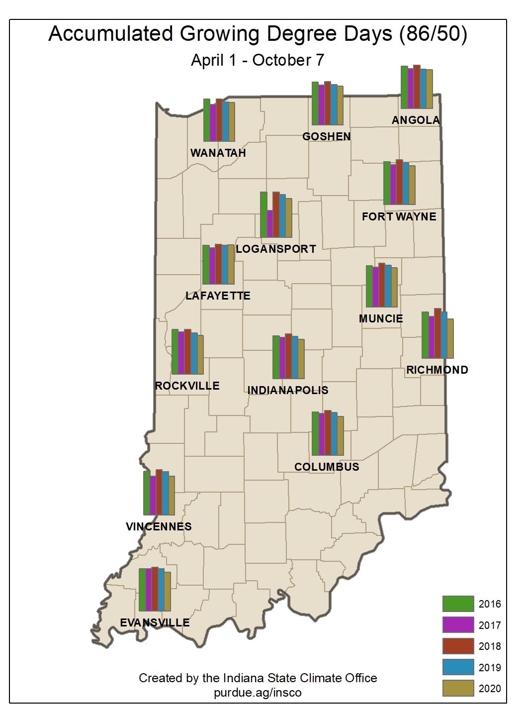
Finally, as our major growing season comes to a close, Figures 3 and 4 provide the latest maps of accumulated modified growing degree days (mGDD). As of October 7, 2020, mGDDs in Indiana were slightly behind most of the past 5 years.


