Abnormally Dry (“D0” in the U.S. Drought Monitor [USDM]) conditions were starting to develop in several areas across northern Indiana by the end of July. However, intermittent, spotty rain events as July transitioned to August seemed to occur in many of those places suggesting conditions were returning to normal. Therefore, the only area of the state that is still considered Abnormally Dry is in the northeastern counties (Figure 1). Periods of dryness are not uncommon, particular over the summer when warmer temperatures can accelerate evapotranspiration. The challenge becomes assessing whether the drier periods are normal or abnormal. For now, most of Indiana seems to be more normal. Will this last?
The rain forecast over the next 7 days (through August 14th) is predicting a chance of rain every day. Those chances may range from 10% to over 80%. This is often tricky to interpret. If it does not rain in your area, was the forecast wrong? Technically, no. If it does rain, then why couldn’t the forecast have said a 100% chance? If only things were that easy. Think of those probabilities of precipitation (PoPs) as indicating a measure of risk measure or a level of confidence that rain may occur. Additionally, those PoPs are applying to a larger area than just where you are standing. Most precipitation forecasts are considering areas approximately 4km by 4km (~6 square miles). Sure, your favorite app may be telling you it is providing far better accuracy, but that is physically unlikely. Anyhow, 6 square miles is about 576 city blocks (by Midwest standards). If it never rained where you were, but you think it likely rained somewhere in the surrounding 575 city blocks, then the forecast did a good job predicting the rain event. Going back to our 7-day accumulated precipitation forecast (Figure 2), most of Indiana is predicted to get from 1” to over 4” of rain. However, spread over 7 days with PoPs often ranging from 30% to 70% confidence suggests these events are likely to be very localized with a high variability of precipitation amounts.
Looking beyond next week, temperature outlooks for August 12-20 are favoring warmer than normal conditions for southern Indiana, near normal temperatures across central Indiana, and below normal conditions for northern Indiana. Over that same period, precipitation is slightly favored to be above normal.
Modified growing degree day accumulations since April 15th (Figure 3) are general above normal (Figure 4). These departures are not significantly large, implying that MGDDs are likely only a few days ahead of schedule. If the climate outlooks verify, then northern Indiana’s MGDD accumulations may return to more normal levels while southern Indiana may continue to stay several days ahead of average years.
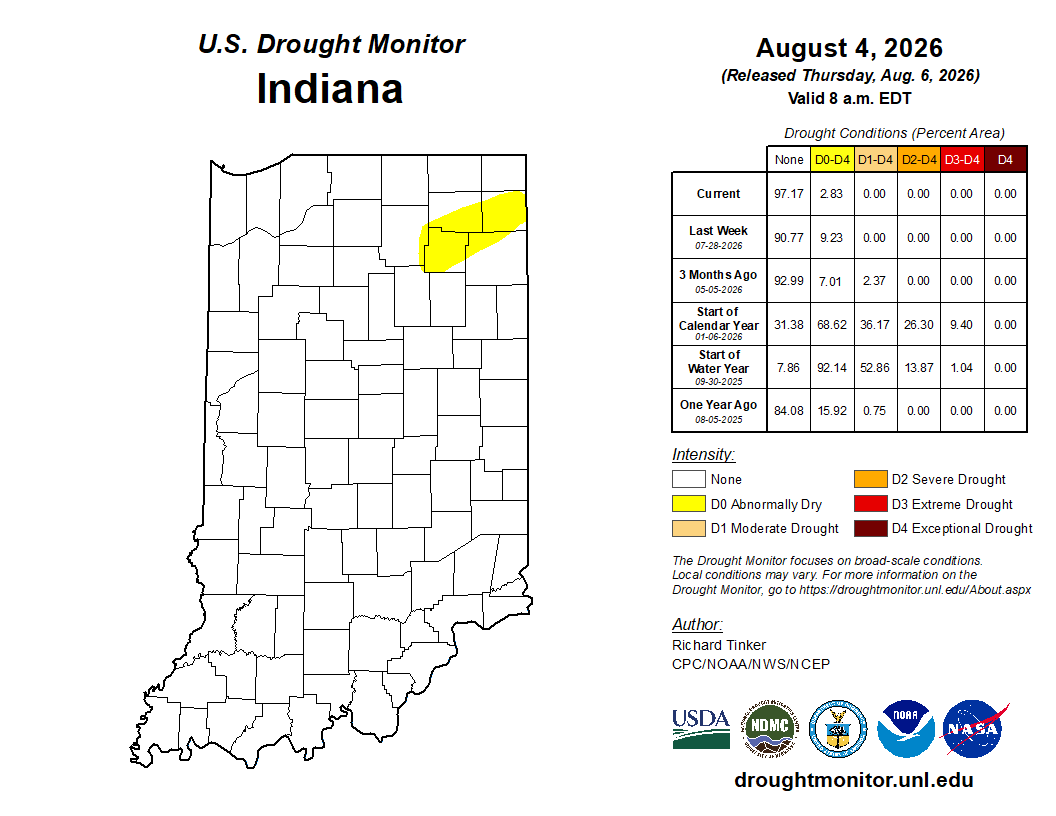
Figure 1. US Drought Monitor status for conditions through August 6, 2026.
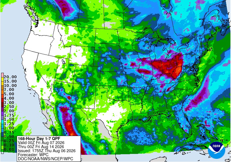
Figure 2. Accumulated precipitation amounts (in inches) for August 7-14, 2026.
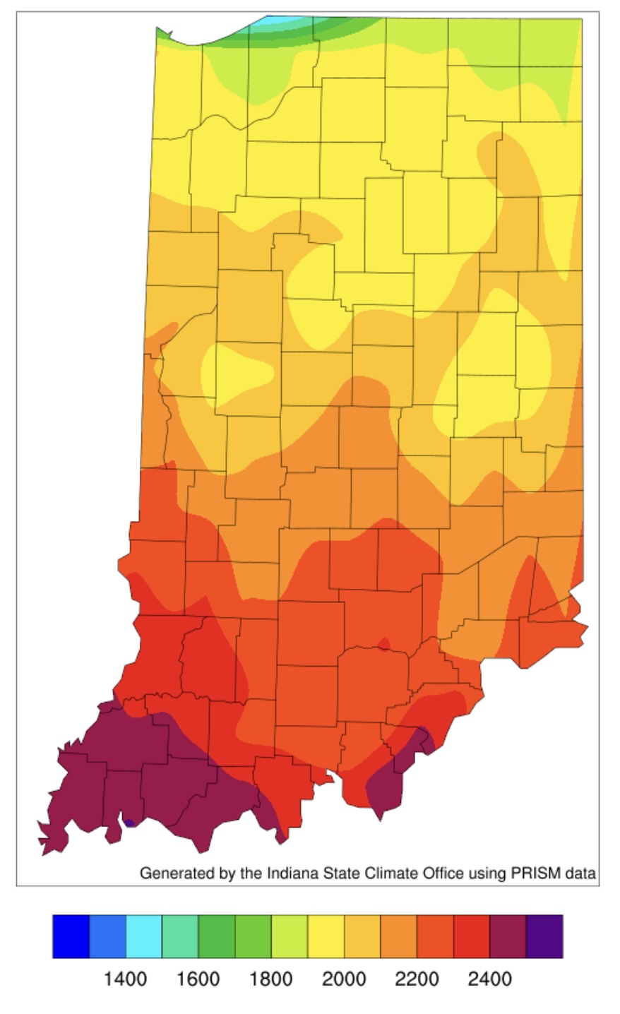
Figure 3. Accumulated modified growing degree days (50°F / 86°F) from April 15 through August 5, 2026.
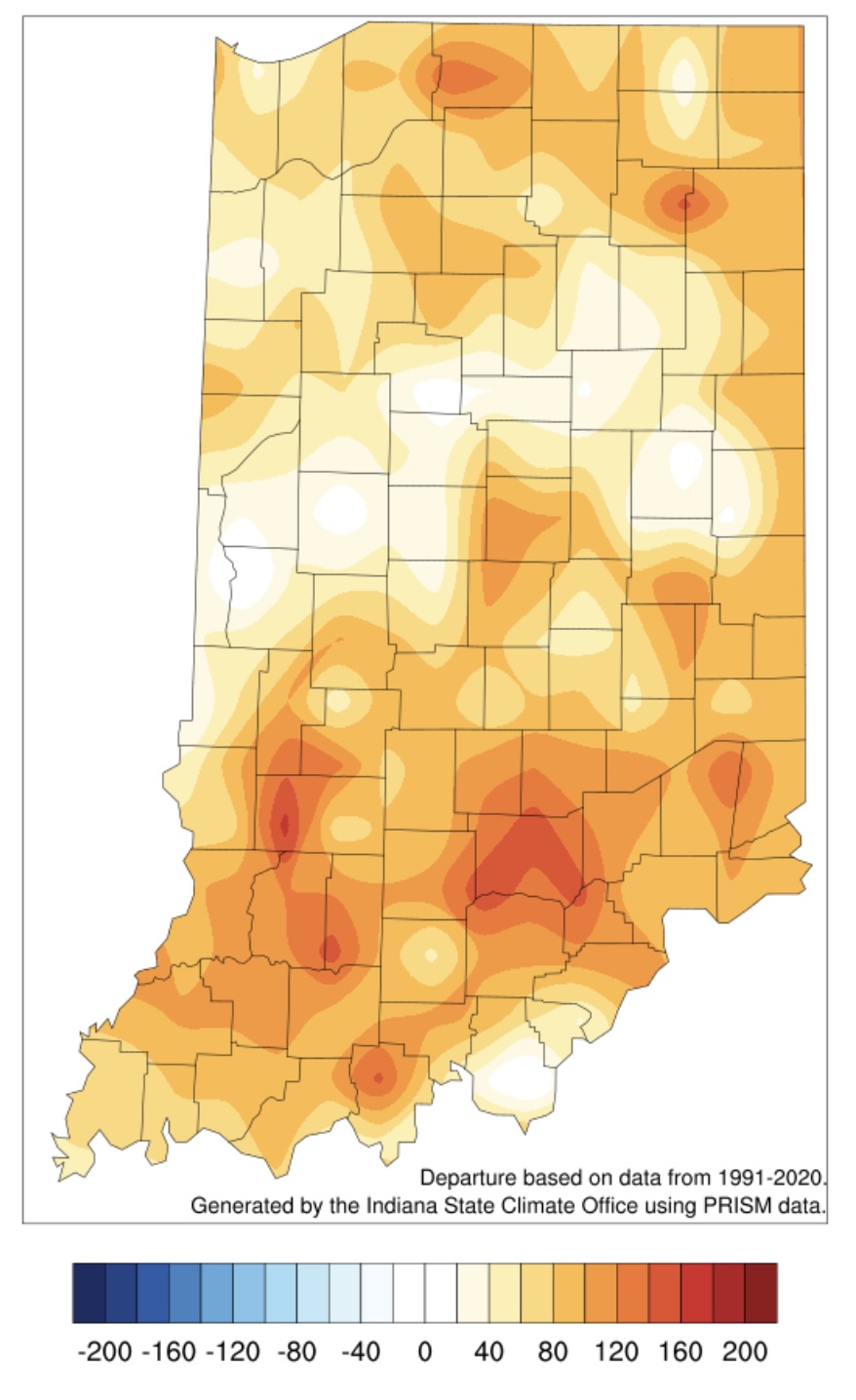
Figure 4. Accumulated modified growing degree days (50°F / 86°F) from April 15 through August 5, 2026 presented as the departure from the 1991-2020 average.