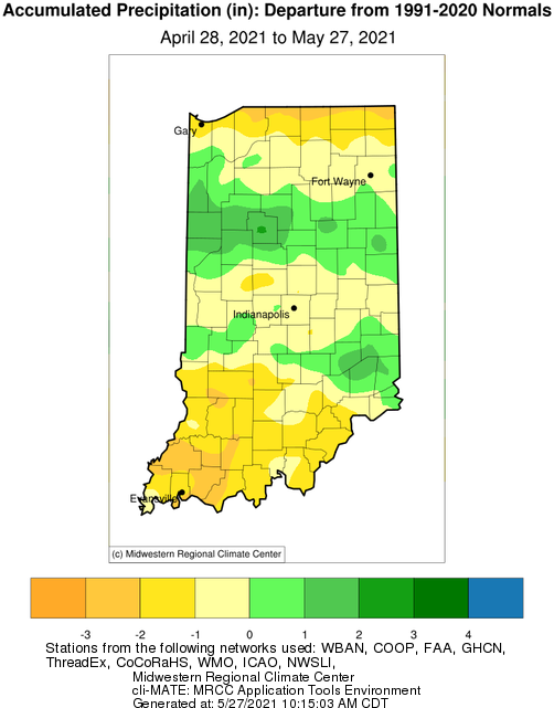
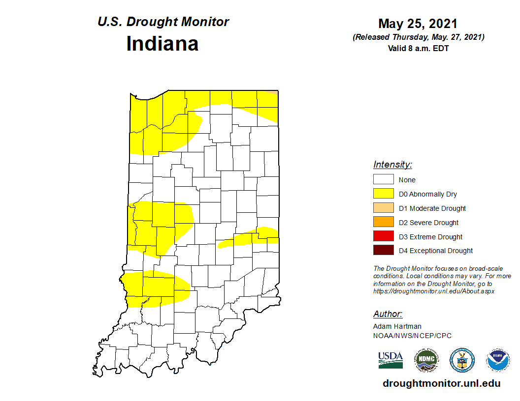
Abnormally dry conditions are continuing to linger across Indiana as temperatures, and therefore evapotranspiration, increase (Figure 1). There have been and will continue to be intermittent storms passing through our area, but ongoing concerns focus on whether the precipitation can keep up with the evaporative demand. Additionally, the state has not fully recovered from the moisture deficits over the last few months. Figure 2 shows the precipitation differences from the 30-year average from just the last 30 days. There are areas with deficits of 1-2-inch as well as places with 1-2-inch surpluses. However, at this time of the year, the evaporative demand across the state can range from 1.0-1.5 inches. This means that to keep conditions stable, the same amount that is evaporating should be falling as precipitation. Any differences between these two factors can quickly lead to undesirable deficits or surpluses.

Figure 2. Precipitation departure (inches) from April 28 through May 27, 2021 compared to the 1991-2020 climate normals.
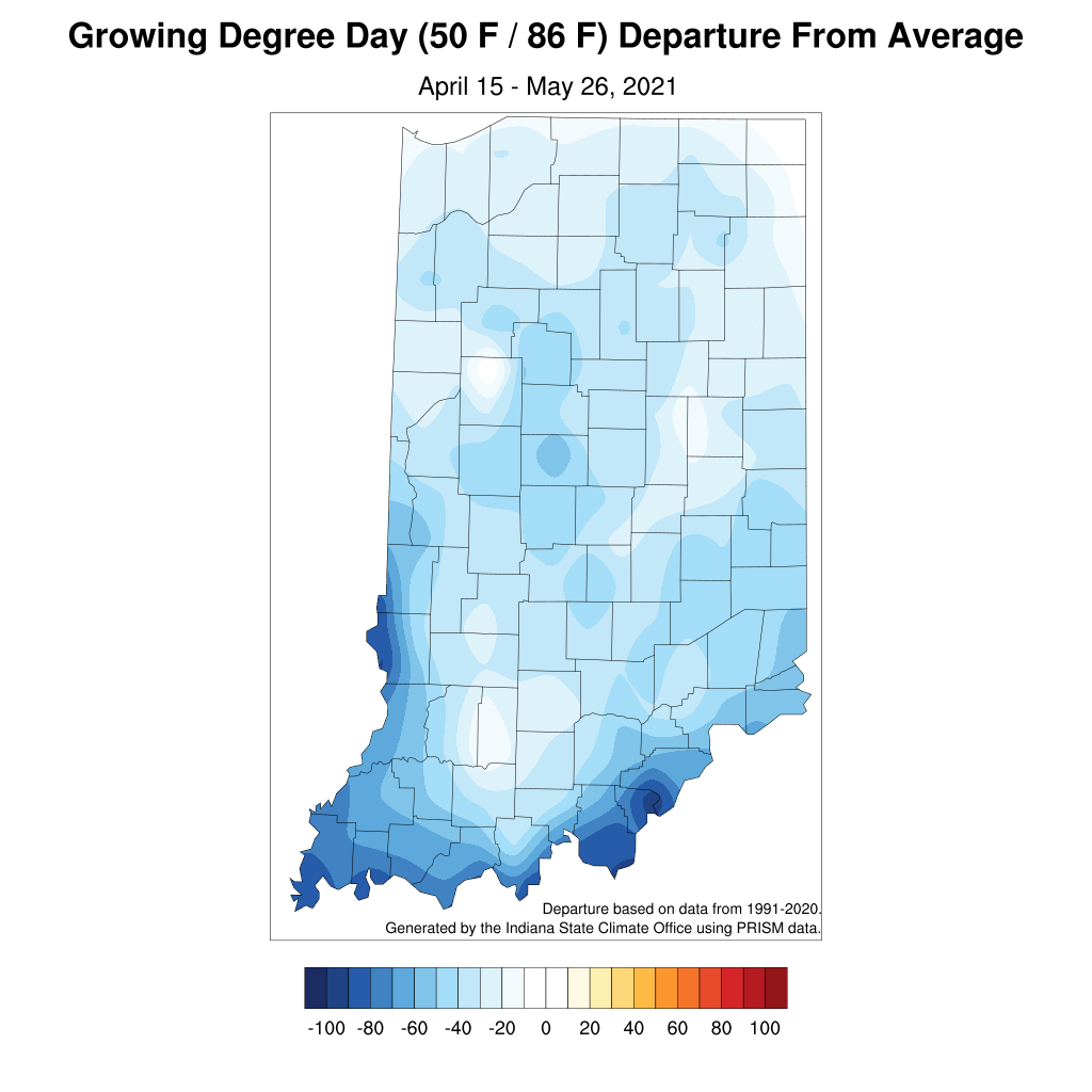
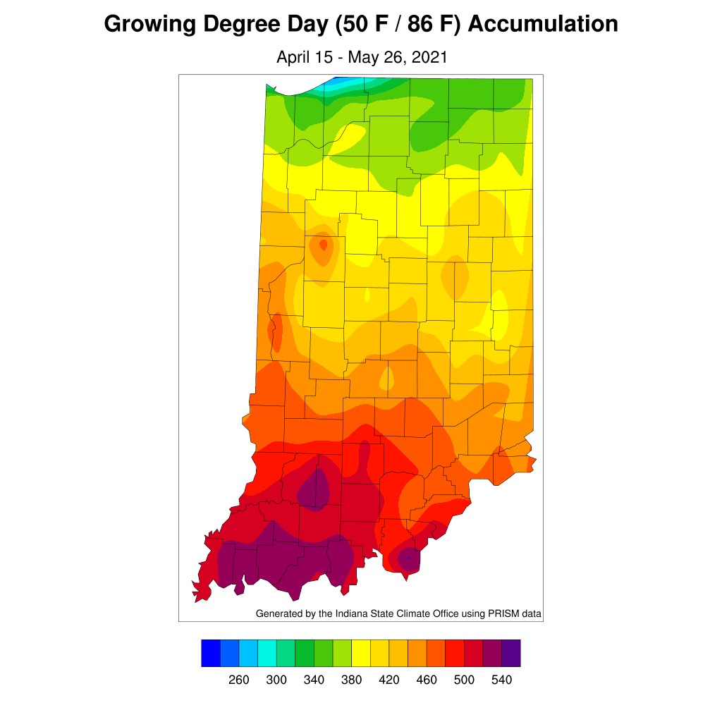
Warmer, muggier temperatures have been experienced the last few weeks. This has allowed modified growing degree days to accumulate at a strong pace (Figure 3). However, earlier cooler periods have caused accumulations this year to be slightly behind the most recent 30-year average. Figure 4 illustrates the MGDD departures for accumulations since April 15th. While southern counties are most behind the 30-year average, these negative departures are occurring across the entire state.

Figure 4. Modified growing degree day departures for the period April 15 – May 26, 2021 compared to the 1991-2020 climatological period.
Over the next two weeks, climate outlooks from the national Climate Prediction Center are favoring normal conditions for both temperature and precipitation. This would suggest seasonal temperatures along with periodic rainfall events. If this outlook holds true, the good news would be that drought conditions should not worsen rapidly. However, without above-normal precipitation in some key areas across the state, drought may intensify due to the longer-term precipitation deficits.


