

Precipitation over the last 30 days has been very spotty, the usual narrative when dealing with summertime convection. Thunderstorms in northwestern Indiana provided relief from ongoing drought conditions in certain areas, with some locations receiving over 2 inches of rainfall above the 30-day (July 15-August 13) normal (Figure 1). Just south and east of this region, precipitation was up to 2 inches below normal for the same period. Additionally, central Indiana also shows increasing departures, with deficits reaching as much as 3 inches below normal in some places. Recently, many parts of Indiana have experienced less than 25 percent of their typical rainfall since July 31 (Figure 2), which is leading to drier conditions being reported. The bonus – I am back to mowing my yard every other week!
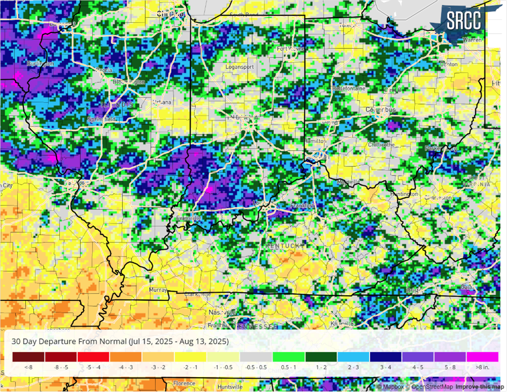
Figure 1: July 15 – August 13, 2025, accumulated precipitation departure from normal.

Figure 2: July 31 – August 13, 2025, accumulated precipitation departure from normal.
The US Drought Monitor observed some improvements in northwestern Indiana over recent weeks. Still, the persistent hot and dry conditions are beginning to shift areas in central and northern Indiana back toward drier conditions (Figure 3). The August 12 US Drought Monitor indicated that about 20 percent of the state was in either abnormally dry (D0) or moderate drought (D1) conditions, up just shy of 5 percent from last week. Areas of the state in D1 were up nearly 2 percent compared to the previous week.

Figure 3: The August 12, 2025, US Drought Monitor Map.
How long will the dryness persist? The 7-day forecast for precipitation from August 14-21 suggests limited improvement, as most of the state expects less than 0.5 inches of rain (Figure 4). Some parts of northeast Indiana might receive up to an inch, however. Additionally, the Climate Prediction Center projects near-normal to below-normal rainfall across the entire state through the end of August, indicating that drying conditions could continue in the coming weeks. The good news is that temperatures will be close to normal or below average through the end of the month.

Figure 4: August 14-21, 2025, quantitative precipitation forecast.
