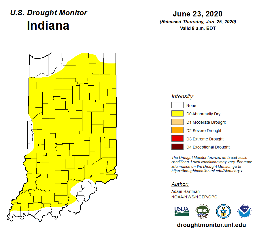
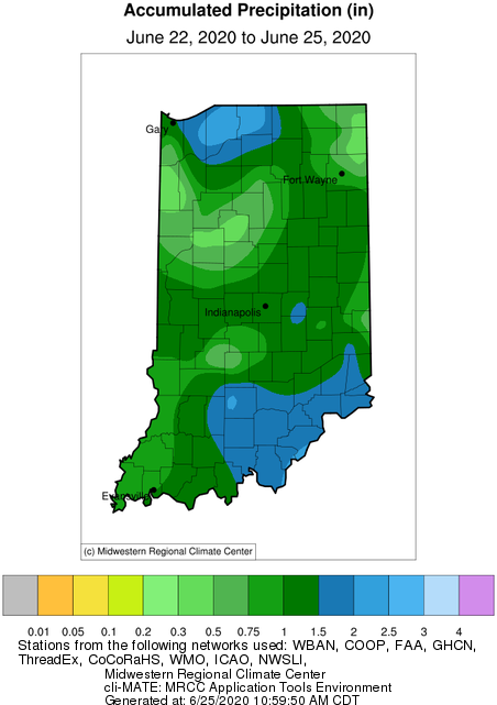
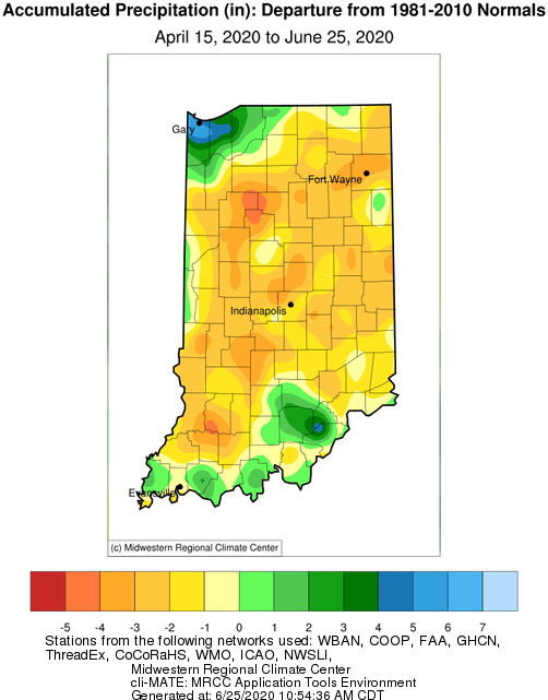
Prior to this week, there was growing concern of developing drought across Indiana. The U.S. Drought Monitor (Figure 1) has expanded the coverage of the D0 (Abnormally Dry) category across the state. From June 22 through June 25, however, there has been a wide range of rainfall across the state (Figure 2). Was it enough to fully recover the state from its deficit? Figure 3 shows the precipitation departure for Indiana from April 15th through June 25th compared to the 1981-2010 climatology. This map illustrates how much of the state is still a few inches behind, so Indiana could certainly benefit from more precipitation over the next few weeks. Climate outlooks are indicating increased probability that precipitation will be above normal for the southern half of the state through the first week of July. Northern counties are not showing any significant confidence for either above- or below-normal precipitation over this time period.
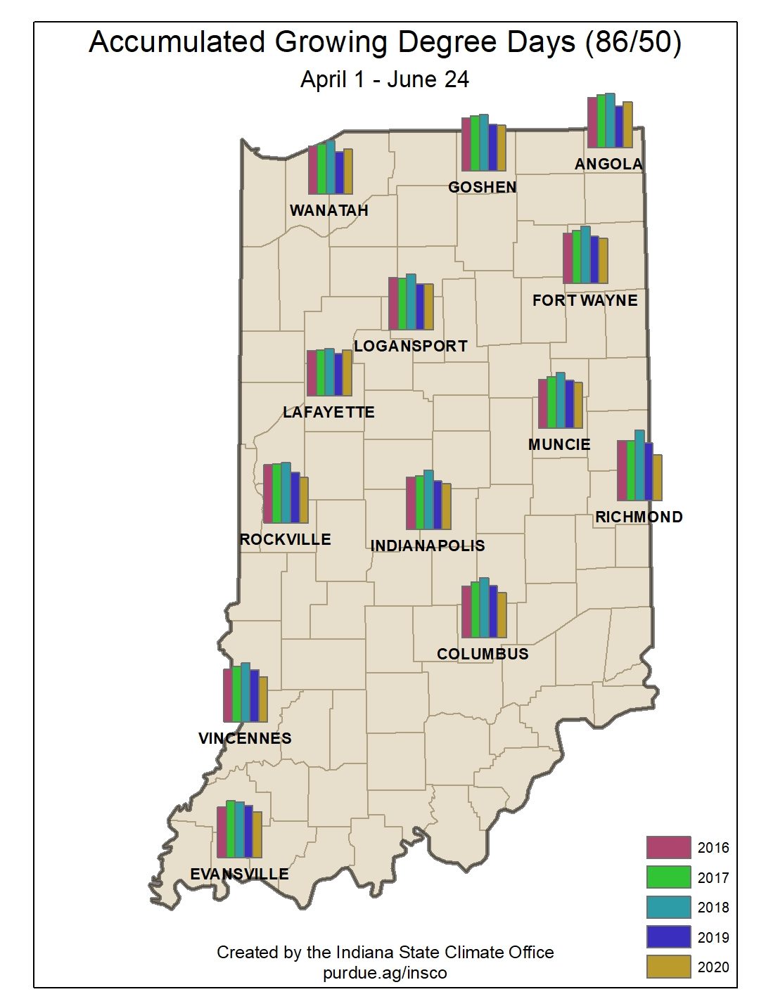
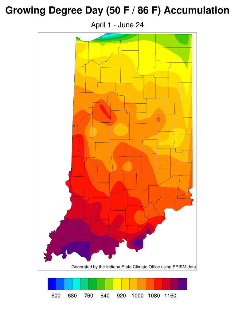
Growing degree-day accumulations in the northern half of Indiana are catching up to levels seen in recent years (Figure 4). However, the southern half of the state is still lagging behind. Figure 5 illustrates the accumulated modified growing degree-day units from April 1 through June 24.


