

It happens every year. A warm wave moves into the area, and I immediately get the urge to run to the nursery and start planting for the spring. Of course, there is another little voice inside my head warning me to not fall for it. There are plenty of other things I can do outside to start prepping for spring. Perhaps I’m just anxious to liven things up a bit; break out of the winter hibernation. This past week was certainly one of those weeks. Are we passed the point of having any more freeze events? When does the last freeze event typically occur for my area? For curious readers, the Midwestern Regional Climate Center has a tool – the Freeze Date Tool (https://mrcc.purdue.edu/freeze/freezedatetool) – that can help answer this question (Figure 1). Utilizing historical observation data that has been gridded to the county level, users can select their temperature of interest (e.g., 28°F) and which historical statistic (e.g., latest date on record) for either the last “freeze” event of the cold season or the first “freeze” event. For example, the earliest last 28°F event of the season in Tippecanoe County occurred March 22, 1967, whereas the latest last 28°F event occurred May 9, 2020. Given there’s several more days until March 22nd this year, I think I’ll wait before buying a bunch of flowers.
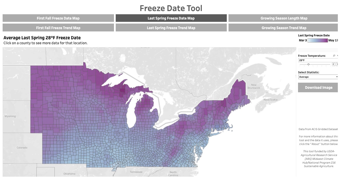
Figure 1. Screenshot of the Freeze Date Tool home page for the average date of the last 28°F freeze of the cold season.
High temperatures over the last 30 days (February 10 – March 11, 2025) have been either near or below normal across Indiana. Remember that cold spell just a few weeks ago? Southern Indiana had the greatest departures from normal with temperatures over the period ranging from 1 to 3 degrees (F) below normal. Over that same period, southern and northwestern counties have received up to an inch above normal precipitation whereas counties across central Indiana were 1 to 2 inches below normal. In fact, the latest U.S. Drought Monitor has those counties in Moderate Drought (D1) with surrounding counties categorized as Abnormally Dry (D0) (Figure 2).
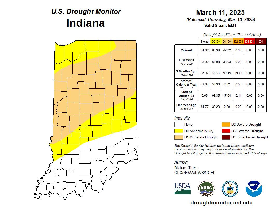
Figure 2. U.S. Drought Monitor status for conditions as of Tuesday, March 11, 2025.
Climate outlooks over the next two weeks (through March 26) are favoring above-normal temperatures and above-normal precipitation. There is still a La Niña pattern in the tropical Pacific Ocean which tends to favor above normal precipitation over the Michigan-Indiana region. However, the La Niña is expected to weaken soon, in which case that precipitation pattern is likely to go away. It is still too soon to be able to strongly predict weather conditions for this upcoming planting season. Stay tuned!
